by Jo Foden, Cefas, UK
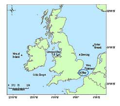
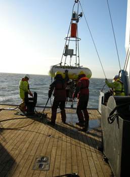
Scientists from the UK’s Centre for Environment, Fisheries & Aquaculture Science (Cefas) have just returned from a short survey on the RV Cefas Endeavour, during which they serviced a Cefas SmartBuoy (http://www.cefas.defra.gov.uk/our-services/monitoring-and-mapping/autonomous-monitoring/smartbuoys.aspx) at the Warp Anchorage site in the Thames. SmartBuoys are autonomous, ‘intelligent’, automated, multi-parameter recording platforms used to collect marine environmental data. This particular recovery was of the 100th deployment at this site, which has been active since November 2000.
The Cefas team deploys buoys at key sites allaround the UK coast. This particular buoy has been out for just over a month, which is normal for the season. In winter, SmartBuoys may be deployed for 10–12 weeks as the bio-fouling of optical sensors occurs more slowly during the winter months.
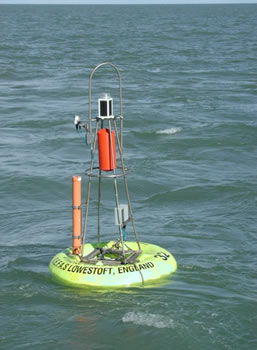
The instruments and sensors mounted below the waterline on the Warp SmartBuoy measure most of the parameters required for plankton growth, with light and nutrients being the most important. Complementary measurements of suspended solids and oxygen are made simultaneously. Above the waterline a navigation light, satellite and GPS aerials, radar reflector and a secondary satellite tracking unit are visible (Fig. 1).
SmartBuoys are moored in five key locations in the coastal waters of England and Wales, as part of work undertaken on behalf of Defra. The data are used in national and international assessments of water quality. Every two hours the most recent data from all of these buoys are sent back to Cefas by satellite telemetry. They may subsequently be viewed online athttp://cefasmaps.defra.gov.uk/smartbuoyweb/StaticMapPage.asp. Data are also used in satellite imagery validation and are sent to the EMECO observatory site (www.emecodata.net) where they are used to carry out assessments of marine environment for key policies, such as European Directives and international protocols (e.g. OSPAR).
References:
http://cefasmaps.defra.gov.uk/smartbuoyweb/StaticMapPage.asp
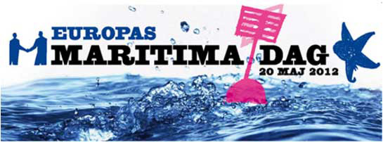
 A large conference for stakeholders is organized every year, and in 2012 this honour is given to Sweden – where the event will be held in the former shipyard area of Gothenburg. It will be split over three days with public events happening on the actual day, and then conferences and workshops on the 21st and 22nd. Interventions by politicians, industrialists and researchers will give a holistic panorama of the issues facing our seas today, and provide also space for people to air their views.

 The EU believes that research and innovation are key instruments in promoting sustainable economic growth and job creation. The Southern Mediterranean region called for innovative and ambitious responses from the European Union. The European Commission has established all Mediterranean countries as priority. The EC has also developed a new strategy which is found in two joint Communications of the European Commission and the High Representative of the Union for Foreign Affairs and Security Policy. Hence the EU has developed the strategy named CKIS (Common Knowledge and Innovation Space) which is linked to Smart Growth and the EU’s innovation agenda.