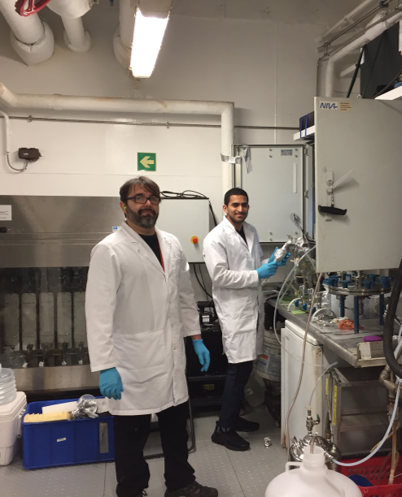
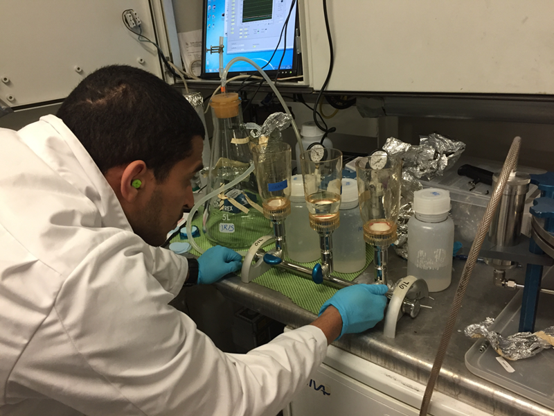
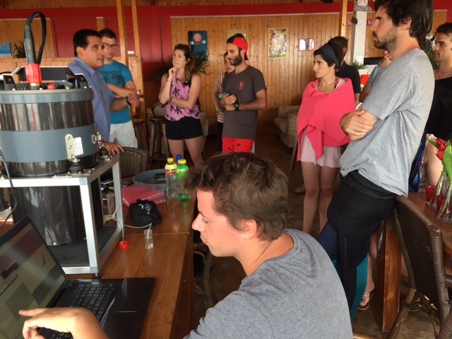
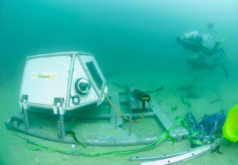
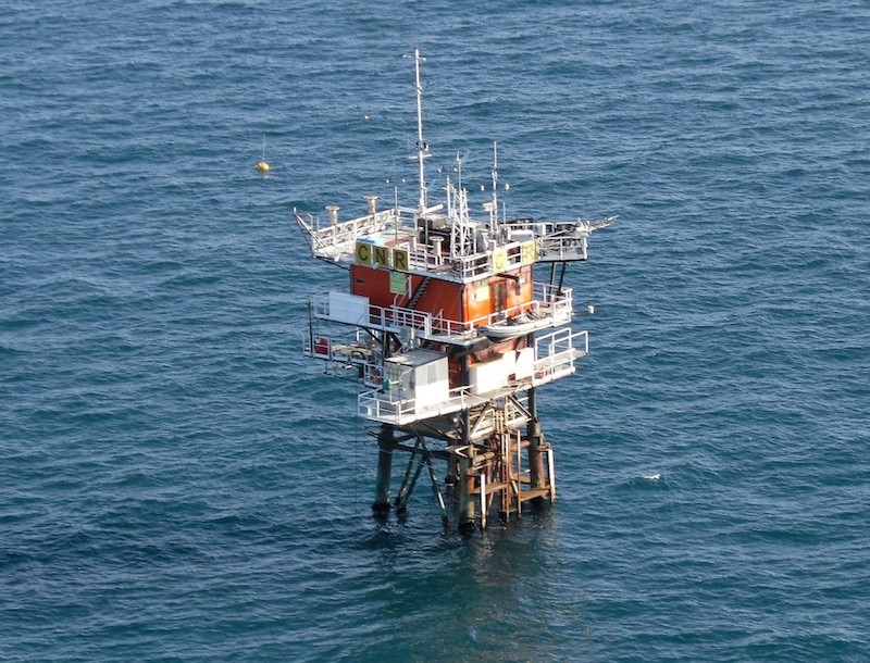
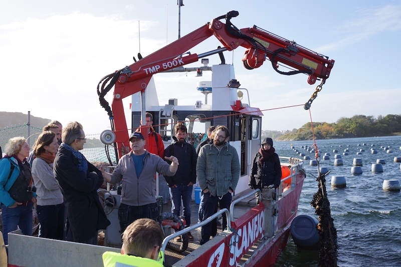
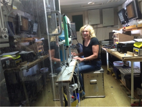
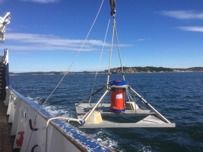
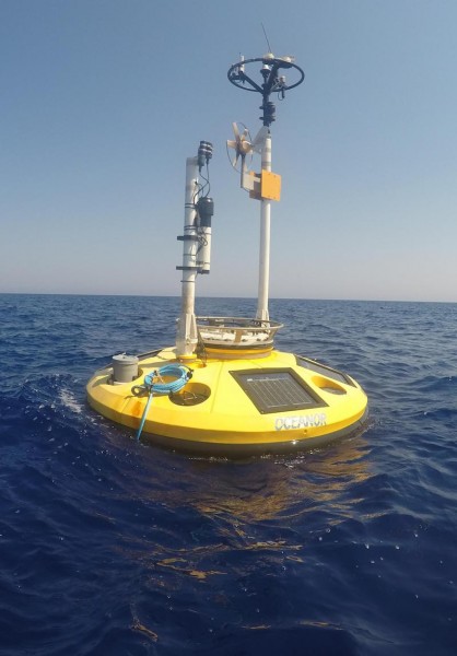
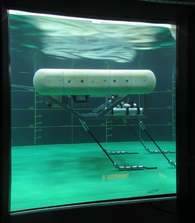
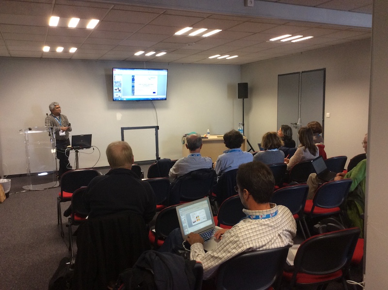
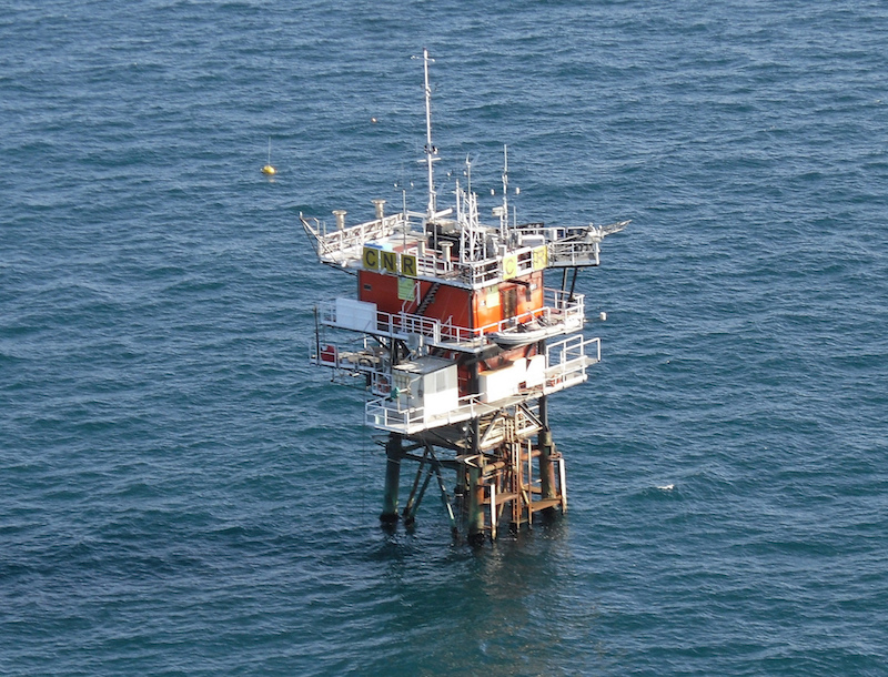
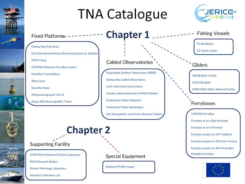
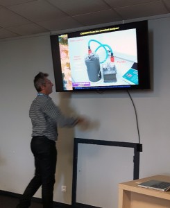
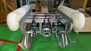
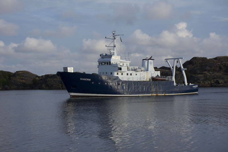
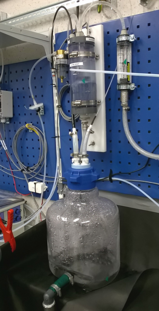
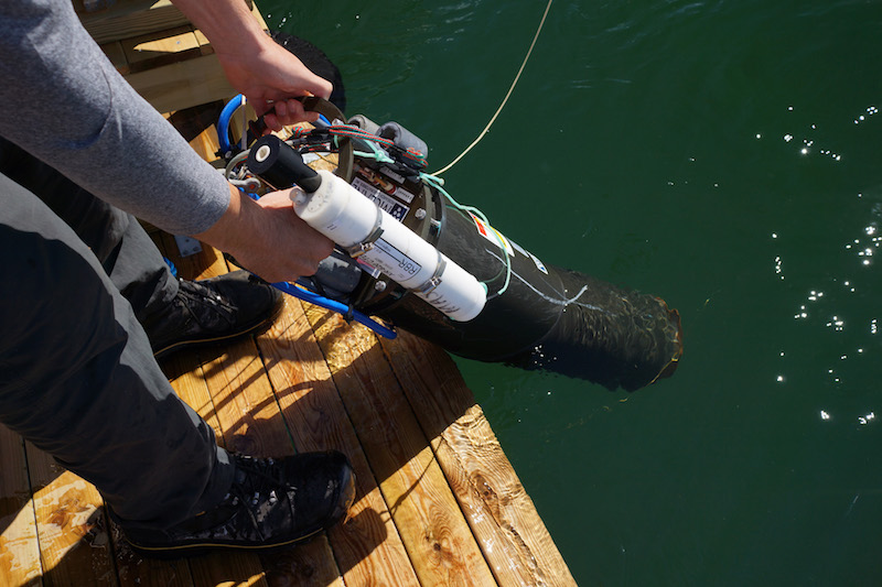
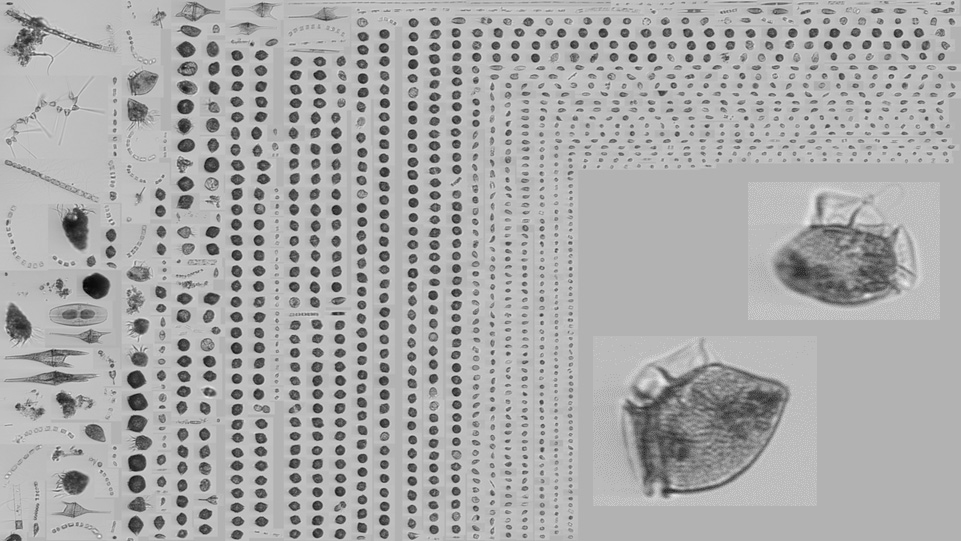
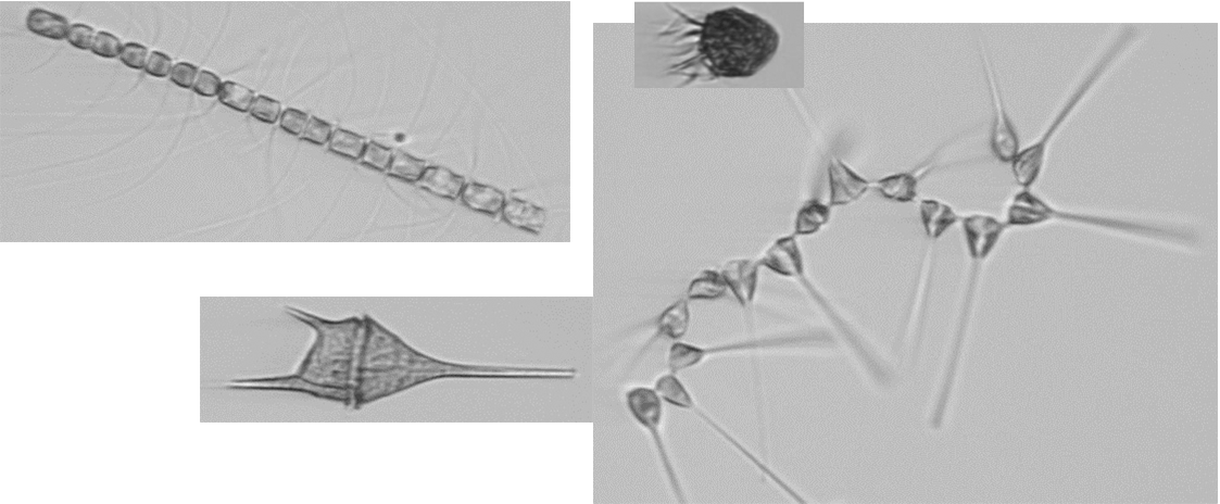
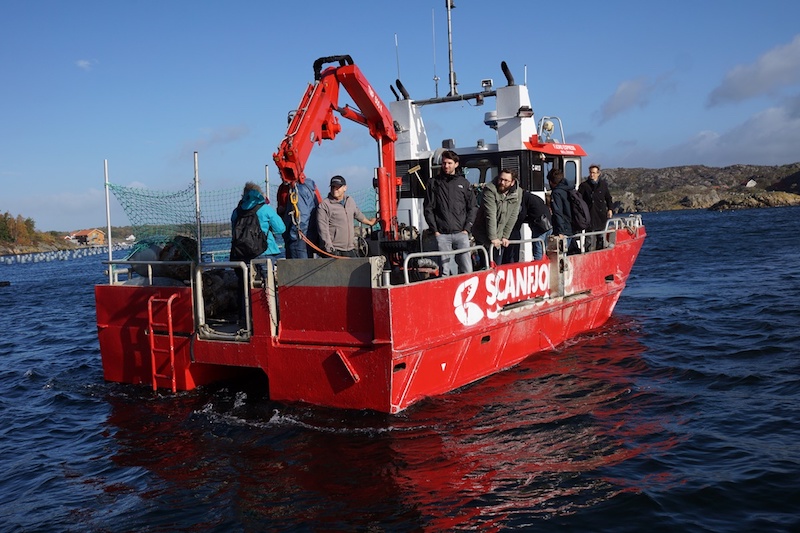
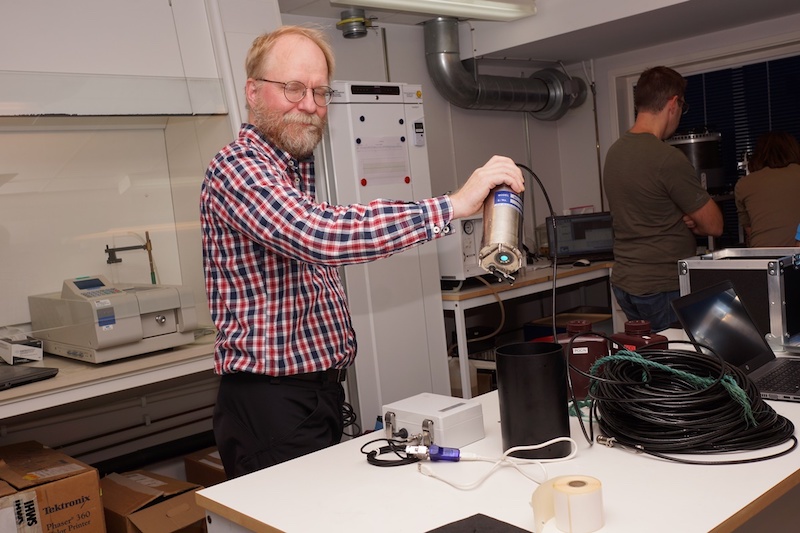
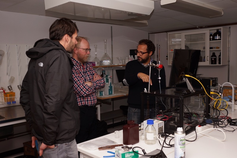
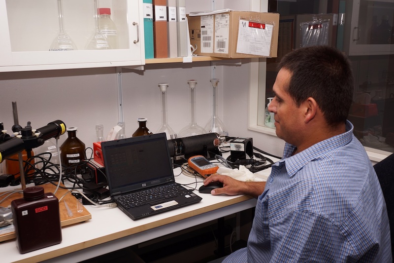
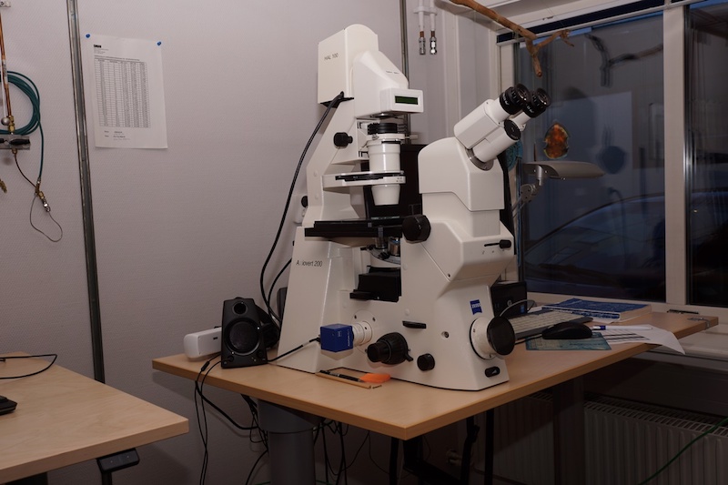
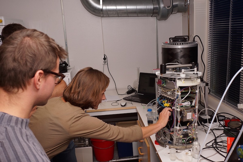
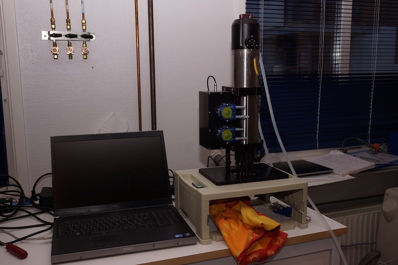
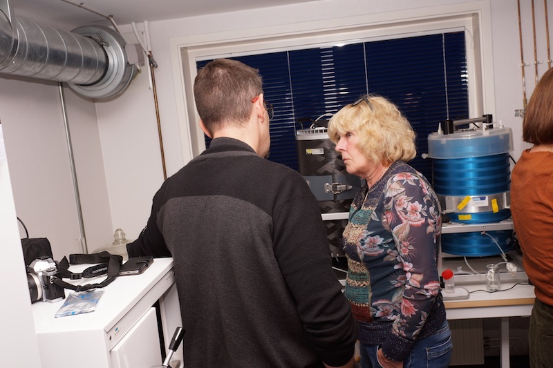
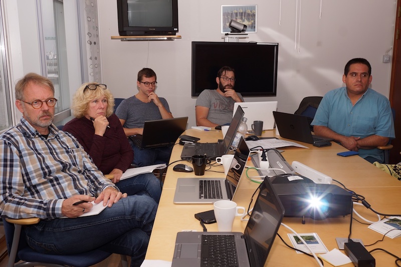
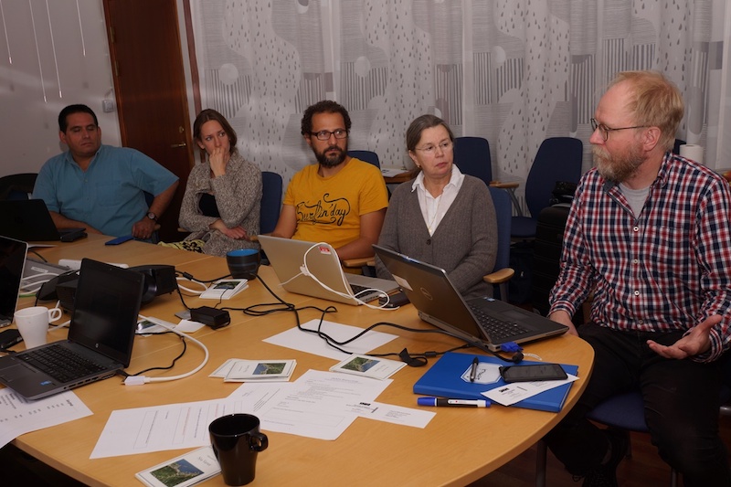
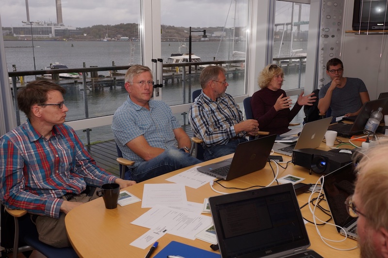
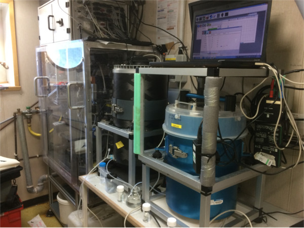
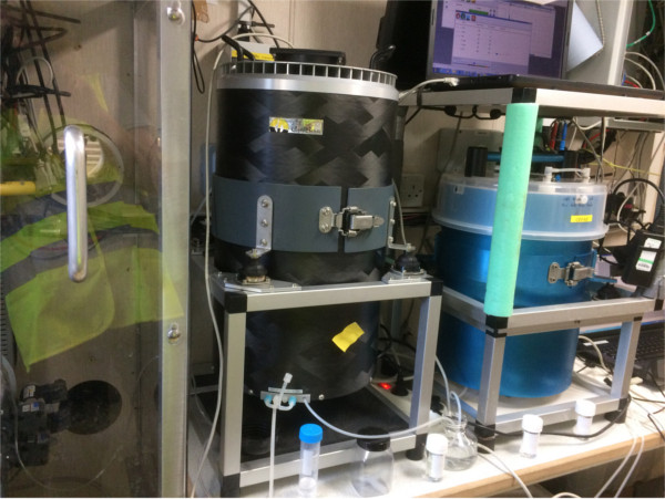
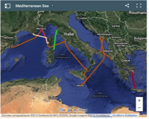
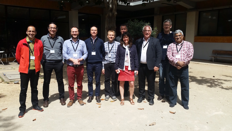
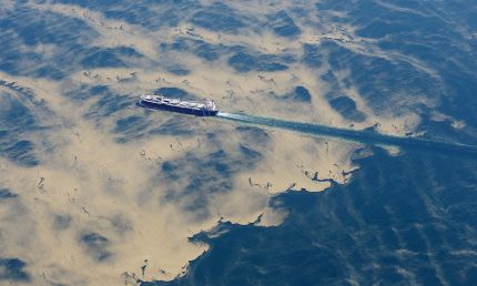
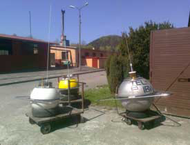
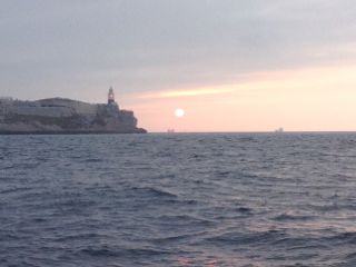
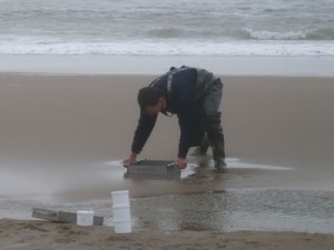
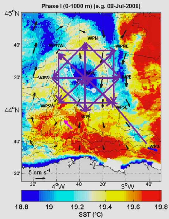
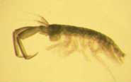
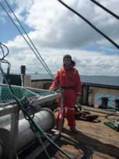
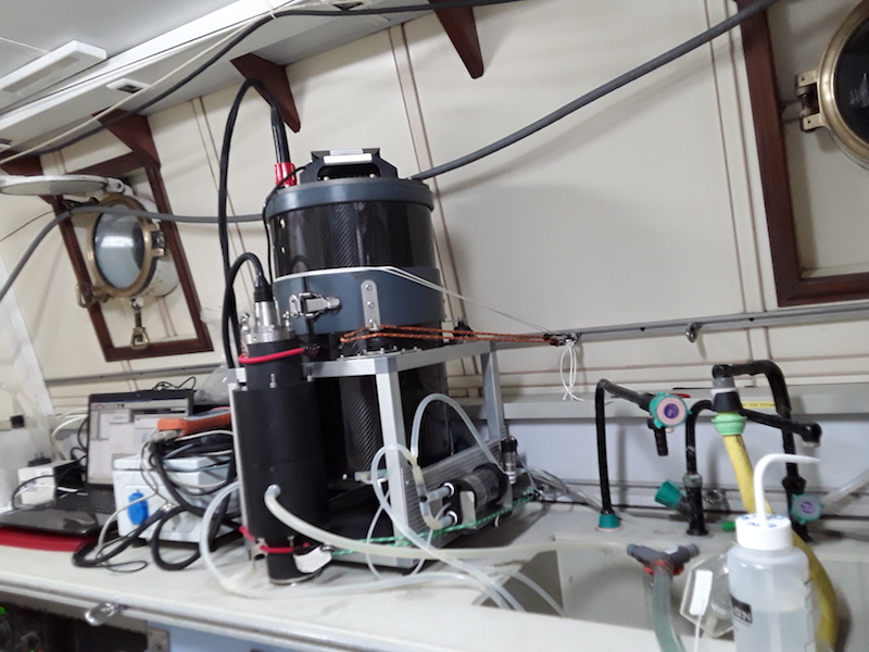
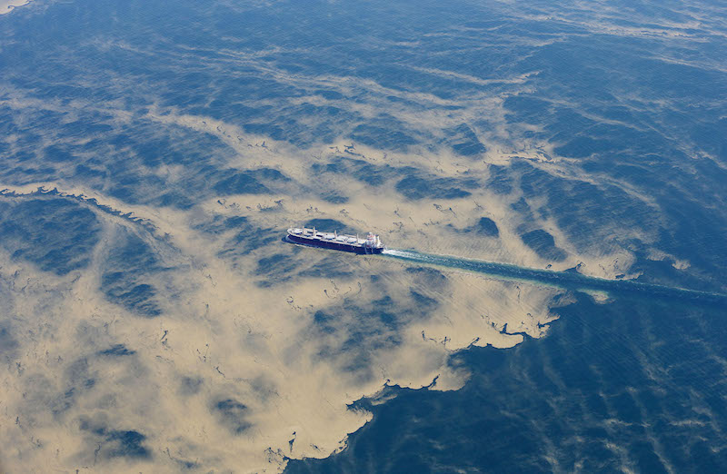
Since Monday, a team of JERICO-NEXT has been investigating the hydrodynamics and related transport of phytoplankton and microplastics in the southeastern part of Bay of Biscay. Thanks to the collaboration between the LOPS lab of Ifremer, the Shom, the university of Littoral and Cote d’Opal (ULCO) and AZTI we are already able to see the strong variability of the hydrology with the MVP profiler trawled behind the ship and some phytoplankton species are identified in real time with the flow cytometry (see photo). More news to follow…
Author: admin
Transnational Access – The French Glider National Facility (GNF)
The French Glider National Facility (GNF)
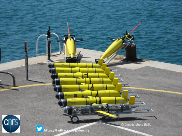
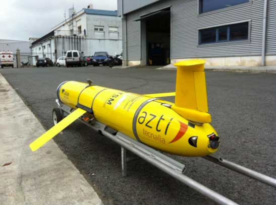
The French Glider National Facility (GNF) provides glider missions for the Transnational Access (TNA) of JERICO-NEXT. During 2017, GNF is involved in two projects, GliderSouth with the University of Malta and FinisGlider with the Spanish Institute of Oceanography. The French team prepared, deployed and piloted two Slocum gliders, Campe and Bonpland.
Project GliderSouth for the University of Malta
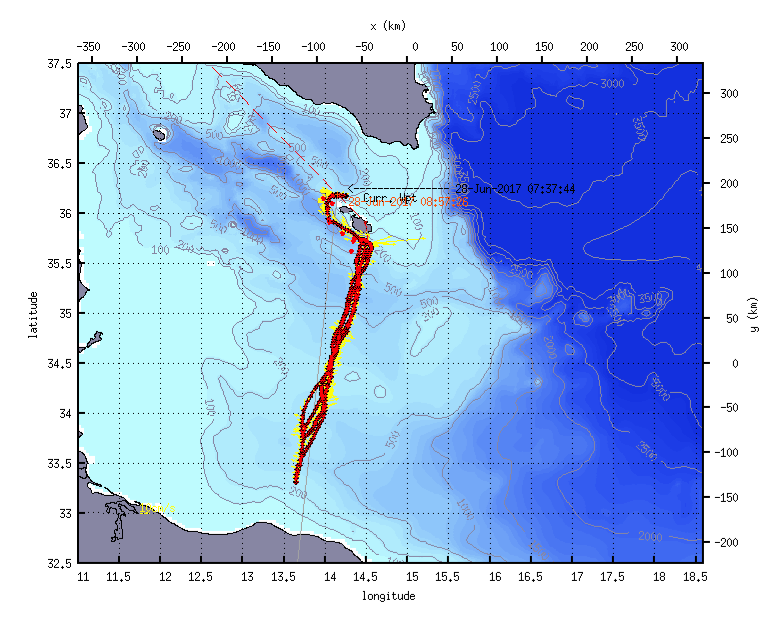
The main objective of GliderSouth Project was to sample intensively the area of the Sicily Channel. The area between Malta and Libya is practically an unexplored area of the Mediterranean Sea. The data collected by Campe will be useful to validate the models elaborated for this poorely sampled area.
Campe has been deployed on April 23th by a member of the GNF with the help of the Maltese team. After a successful mission of 65 days, the glider had been recovered in the north of the Maltese Islands.
More info (including plots): https://gfcpdsi.ego-network.org/plot/plot_deployment.php?glider=Campe&deployment=GliderSouth
Media Coverage:
https://www.um.edu.mt/newspoint/news/features/2017/06/presentingtheseagliderexperienceinmalta
Project FinisGlider for the Spanish Institute of Oceanography
The objectives of FinisGlider are part of a long-term monitoring program from the Spanish Institute of Oceanography to monitor the ocean hydrography and biogeochemistry at the Western Iberian Margin. The FinisGlider project will provide the first glider mission of the section, partially overlapping with a ship cruise.
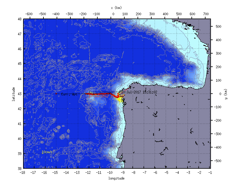
The 27th of June, a member of GNF with the Spanish team and the crew of the LURA deployed the glider off Finistère. Bonpland is currently performing the section and will be recovered in mid-August.
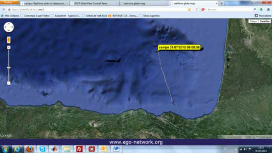
More info (follow the ongoing mission, including plots): https://gfcpdsi.ego-network.org/plot/plot_deployment.php?glider=bonpland&deployment=FinisGlider&posti=0&postj=position_zoom0&pposti=4&ppostj=position_zooml2_lastweek&hchk=&defsct=default_scatter
Case study on marine contaminants – artificial sweeteners
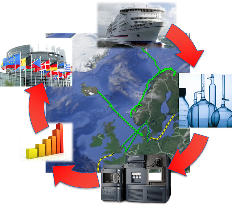
The ubiquitous presence of artificial sweeteners in North European and Arctic coastal waters was discovered in the framework of the JRAP3 activities led by NIVA (Norway) thanks to the JERICO-NEXT project. JRAP3 deals with the assessment of distribution of man-made chemical pollutant in European coastal water and the biological responses they can induce. Through the FerryBox platforms included in the JERICO-RI infrastructure we have conducted an extensive monitoring campaign covering over 3000 miles of coast line in the North Sea, Norwegian Seas and the Barents sea. Artificial sweeteners are synthetic substances that add sweetness to food, drinks or even pharmaceuticals. By combining the unique sampling facilities and logistic offered by JERICO-RI with the power of state of the art mass spectrometers, we could identify some of these substances as possibly the most abundant micropollutant of emerging concern so far identified in marine waters.
Mastodon 2D – low cost measurements in shallow water along the water column
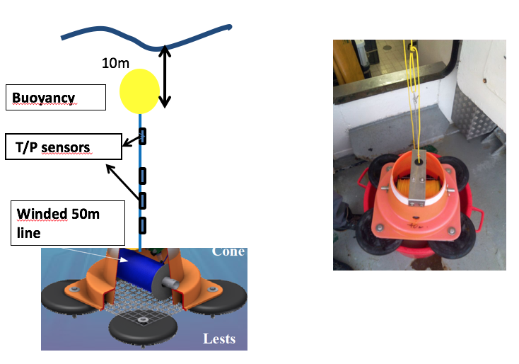
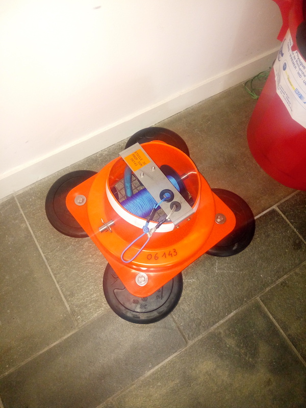
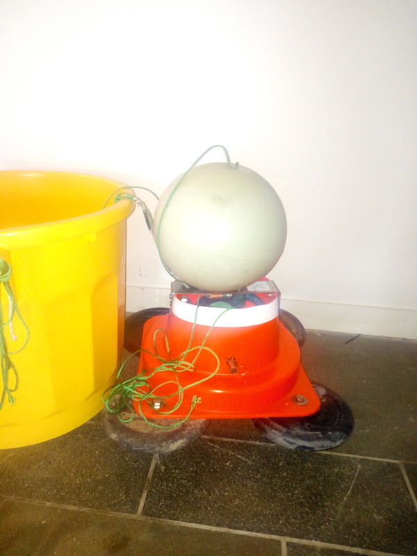
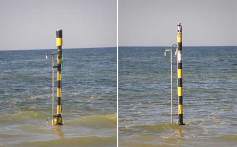
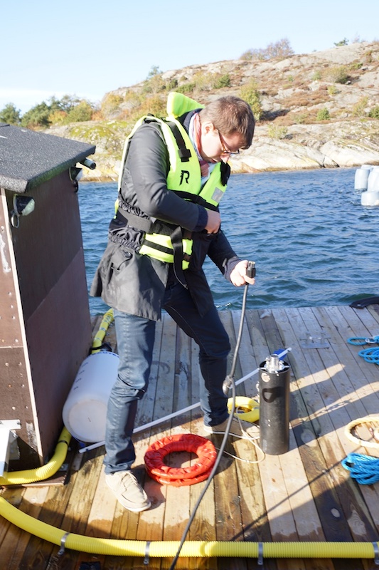
Nine low-cost Mastodon 2D moorings will deployed in the Bay of Biscay for a duration of two weeks to study fast changes in temperature. This has been organised thanks to the Etoile cruise in the JERICO-NEXT project.
The bin below the mooring contains the buoy for the travelling and boarding.
Objective : to measure temperature in the column of shallow water
ABACUS 3 project information
ABACUS 3 OBJECTIVES:
The project aims at assessing the importance of a new monitoring line across the Algerian Basin between Palma de Mallorca and the Algerian Coast.
The main objectives of the ABACUS 3 project are:
- To continue the time series of oceanographic data collected in the Algerian Basin along the endurance line between Mallorca and Algeri;
- To identify the physical and biological properties of the surface and intermediate water masses between Balearic Islands and Algerian Coast;
- To intercept any mesoscale eddy identified during the mission;
- To understand the sub-basins dynamics and the complex interactions due to eddies;
- To assess the ocean description capabilities of several satellite products when approaching coastal areas, also comparing them to glider high resolution in situ data;
- To validate the new along-track (L3) and gridded interpolated maps (L4) altimetry products provided by the Sentinel-3 altimetry mission and the other satellites for the western Mediterranean Sea.
Through its activities, ABACUS-3 project contributed to data collection in the Southern European Seas, one of the main EU maritime policy objectives, as outlined in the Marine Strategy Framework Directive (MSFD).
The ABACUS glider mission was first realized in 2014 through application to the 3rd JERICO TNA call. Since then two more mission have been realized.
The new glider mission realized in November-December 2016 allowed to extend the dataset previously collected in the area (Autumn 2014 and 2015) in order to enrich the data useful for an interannual comparison.
Last mission main achievements can be summarized through some technical data:
- 49 days in water
- 1127.90 Km (609 Nm) navigated
- About 1800 triplet-profiles (CTD, Oxygen, Fluorescence)
- 2 SENTINEL-3 overflights
- 4 SENTINEL-3 swath-segments
The scientific and technical team of ABACUS is composed by scientists from University of Naples “Parthenope” (Italy), Sistema d’observació i predicció costaner de les Illes Balears – ICTS SOCIB (Spain) and from Instituto Mediterráneo de Estudios Avanzados: IMEDEA (Spain). At least one meeting a year has been realized at the glider facility to analyse data collected through the glider missions and discuss the scientific results achieved. Up to now ABACUS results have been presented in 2 scientific papers and 7 international conferences.
More details on the ABACUS Project can be found in “Glider and satellite high resolution monitoring of a mesoscale eddy in the algerian basin: Effects on the mixed layer depth and biochemistry”, by Y Cotroneo, G Aulicino, S Ruiz, A Pascual, G Budillon, G Fusco, J Tintoré. Journal of Marine Systems, 162, 2016, pages 73-88.
The activity described in this report has received funding from European Commission’s H2020 Framework Programme under JERICO-NEXT project, grant agreement No. 654410.
ABACUS 3 PROJECT INFORMATION
GENERAL INFORMATION:
Proposal reference number | JN-CALL 1_2 |
Project Acronym (ID) | ABACUS-3 |
Title of the project | Third Algerian BAsin Circulation Unmanned Survey |
Host Research Infrastructure | SOCIB glider facility (SOCIB-GF) |
Project Starting date – End date | November 2016 – April 2017 |
Glider Mission Starting date –End date | 4Nov 2016 – 23 Dec 2016 |
Name of Principal Investigator | Prof. Giorgio Budillon |
Home Laboratory Address |
Università degli Studi di Napoli “Parthenope” Centro Direzionale Isola C4 – Napoli, Italy |
E-mail address | giorgio.budillon@uniparthenope.it |
Telephone | +39 081 5476584 |
AlterEco PDRA position (31 months, start date: 1 October 2017)
Position available: PDRA for the NERC project “AlterEco: An Alternative Framework to Assess Marine Ecosystem Functioning in Shelf Seas”. The SRA will participate in the design and delivery of ocean glider campaigns in the North Sea, calibrate and analyse the resulting observations, derive relationships between them, calculate rates of relevant biogeochemical processes and disseminate the work to academic audiences, stakeholders and policymakers.
To apply, please navigate to:
JERICO-NEXT summer school 2017
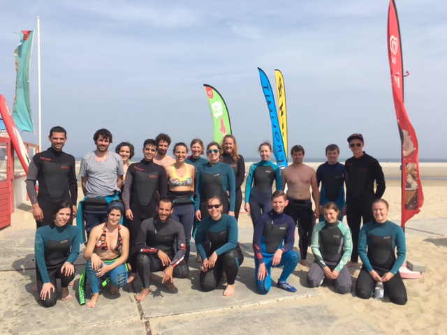
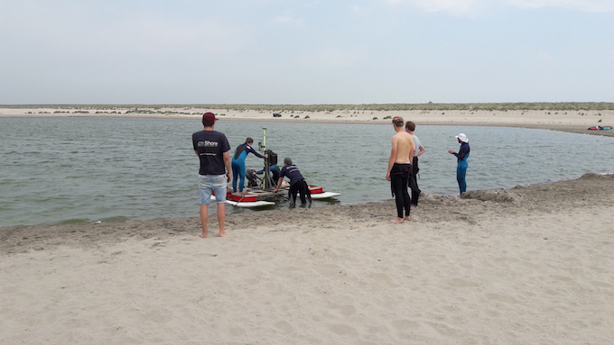
From 19 – 23 June the first JERICO-NEXT summer school was held near The Hague (the Netherlands). Twenty-one early career scientists from various disciplines learned about multi-disciplinary monitoring and data analysis. The nearby Sand Motor pilot project area was used as an illustration of the multi-disciplinary approach during the field work and hands-on exercises. Lectures addressed the JERICO-NEXT research infrastructure for coastal waters, monitoring methods, data management and the application of multi-disciplinary data for MSFD and research projects. Several multi-disciplinary research projects were presented in more detail: NatureCoast (on coastal defense), Seacams (on tidal renewable energy) and JMP-EUNOSAT (on MSFD eutrophication descriptor). All-in-all, the students spent an inspiring and pleasant week together by the sea.
2nd JERICO-NEXT Newsletter
Winter 2016
Welcome to the JERICO-Next Newsletter
2nd ISSUE – JERICO-Next, Joint European Research Infrastructure network for Coastal Observatory – Novel European eXpertise for coastal observaTories
Find out more information on the Web, Twitter & Facebook
We are very pleased to send you the latest updates on coastal observatories and JERICO-Next activities. Last few months efforts were focused on the 1st call of Trans-National Access, the establishment of an User Engagement Panel, the Science strategy & Governance strategy and on the valorisation through applied joint research activities. |
|
Focus on User Engagement Panel
The User Panel is intended to create a dynamic communication channel with key users representing the public and policy makers as well as operational communities that focus on research, education and from within the industry sector. The main target of the Panel is to establish an effective mechanism linking the project to beneficiaries and
|
ensuring that the JERICO-RI products to be defined will fit the needs of users and stakeholders. The members, individually and collectively, participate directly and have a pro-active role in the derivation of knowledge and applications from the JERICO-NEXT products, including provision of feedback and assessments to enhance the relevance of the project scopes.
|
We wish you a pleasant and fruitful reading! Adam Gauci and Patrick Farcy |
JERICO-Next main achievements
JERICO-Next Trans-National Access: from the first to the second call
The first Trans-National Access (TNA) call, launched by JERICO-Next last May, ended with the Selection Panel meeting which was held in Bordeaux, France, on September 7, 2016. Six out of twelve submitted TNA projects were selected and will be supported by JERICO-Next.
The second call will be launched in February 2017 (instead of May 2017).
|
Science strategy & Governance strategy workshops: Two key meetings with the Scientific and Technical Advisory Committee (STAC) of JERICO-Next were organized in Bordeaux (France) on September 7th & 8th. The Governance strategy meeting took place on Tuesday 7th focused on exchanging experience with research infrastructures similar to JERICO-RI, in the USA and Australia. The meeting was led by Ingrid Puillat (Scientific coordinator of JERICO-Next) with the support of key-contributors to JERICO-Next strategy work package (WP1) and the Joint Research Activity Projects leaders (WP4 – JRAPs).
The Science strategy meeting was held the next day, with focus on the integration of the progresses achieved in the JRAPs into the elaboration of a science strategy for the JERICO-RI, with the support from the STAC.
|
JERICO-Next Workshop on Automated Plankton Observation
The second JERICO-Next plankton workshop was arranged in Gothenburg, Sweden, on 27-30 September 2016. Eighteen participants took part in the workshop. more info
|
|
In the framework of the SEA TECH WEEK international event, JERICO-Next has organized two WP2 workshops. On Monday 10th October, Dave Sivyer from CEFAS (UK) has presented a meeting on “Harmonizing new network sensors” which is the task 2.4 of the project (more info). On Tuesday 11th and Wednesday 12th October, a workshop on “Calibration and Assessment” was leading by Florence Salvetat from Ifremer. She also organized a visit of Ifremer facilities with 40 persons (more info). |
JERICO-Next ongoing progress
Advances on JERICO-Next valorisation through applied joint research
North Sea cruise on the CEFAS Endeavour (UK) 21-28 June 2016
In the framework of WP3 and WP4 (JRAP#1), Machteld Rijkeboer from Rijkswaterstaat (NL) took part in a North Sea cruise on the Cefas Endeavour (UK) between 21st and 28th of June 2016. The aim of the work was to determine the diversity of the phytoplankton with a semi-automatic system including two Cytosense flow cytometers connected to a ferrybox. more info
Multi-disciplinary algal bloom study in the Skagerrak (JRAP#1)
Novel instrumentation for observing the phytoplankton diversity or algal blooms are used in work packages 3 and 4. There are activities in the Baltic Sea, the Kattegat-Skagerrak, the North Sea-English channel and in the western Mediterranean Sea. In the Skagerrak area East of the North Sea a survey of algal blooms to study the diversity of phytoplankton has been carried out from August to October 2016. more info |
Main advances in the study of Coastal carbon fluxes and biogeochemical cycling (JRAP#5)
JRAP#5 is preparing a campaign for an intensive period starting in March 2017. The observation plan will be detailed in December 2016 – January 2017. At FMI & SYKE, new instruments have been tested for continuous pH and pCO2 measurements. In addition, methods for analyzing DIC and alkalinity from discrete water samples have been taken into use. more info |
|
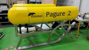
Pagure II device was tried out in the Bay of Brest
From 16 till 20 October 2016, the submarine imaging Pagure II device was tried out in the bay of Brest during a dedicated campaign aboard the Thalia (Fishery Research Vessel). Developed within the framework of JERICO-Next and FFP GALION programs, the Pagure II will allow to facilitate the observation of sea bed and associated biodiversity. more info |
Upcoming JERICO-Next events
12th-13th December 2016, Issy-les-Moulineaux (France): On December, the Steering Committee will meet for the second time this year in Issy-les-Moulineaux. This meeting will be hosted by Ifremer at its headquarters.
13th-14th December 2016, Issy-les-Moulineaux (France): The WP2 key-contributors are organizing a two-day workshop dedicated to the task 2.4 which focus on “Harmonizing new network sensors”. This event will start right after the Steering Committee meeting at the same place. For more information see here is the agenda.
20th February 2017: Opening of the second call for access to the JERICO-Next Coastal Observatories and Supporting Facilities (Trans-National Access).
13th-17th March 2017, Helsinki (Finland): The 1st General Assembly week of JERICO-Next will be held in Helsinki, hosted by the Finnish Meteorological Institute (FMI) from Monday 13th to Thursday 16th of March 2017.
EOOS – An open stakeholder consultation on the European Ocean Observing System is now open
You are invited take part in an open online consultation to help design a new framework for an integrated and sustained European Ocean Observing System, or EOOS.
The consultation will collect views from the European ocean observing community and wider stakeholders on what EOOS should look like and how it should be run. Your responses will be used to inform any decision-making about a future EOOS.
The simple survey takes just 10 minutes to complete. You are welcome to provide additional detail in the free text boxes provided. Further background information on EOOS is available on the dedicated EOOS website and in the Consultation Document which has been prepared to support the questionnaire.
The consultation is open from 12 December 2016 until 20 January 2017. Thank you for taking the time to contribute to the EOOS process.
JERICO-Next First Workshop of Task 2.4: HARMONIZING NEW NETWORK SENSORS
In the framework of the work package 2 (Harmonization of technologies and methodologies – technical strategy) will be organized the first workshop of Task 2.4 “Harmonizing new network sensors” in Issy-les-Moulineaux (France) on December 13th & 14th, 2016.
Aim of the workshop:
The JERICO-Next network is implementing a variety of sensors for a number of bio-geochemical measurements. Furthermore, systems for coastal profiling can help to integrate indispensable information on water column characteristics in coastal areas.
Task 2.4 deals with the harmonization of these sensors and systems, including their underlying technologies. In this first workshop the status of sensors used for measuring biology related optical properties, variables of the marine carbonate system, and systems for coastal profiling within the JERICO-Next network will be presented and discussed. The main objectives are the following:
– Discuss and report on the present level of implementation of such sensors and systems within the JERICO–Next network from the perspectives of:
- the state-of-the-art and use
- current modes of deployment
- capabilities and limitations
- data quality concerns
– Discuss and agree on the structure and contents of Deliverable D2.2: “Report on the status of sensors used for measuring nutrients, biology-related optical properties, variables of the marine carbonate system, and for coastal profiling, within the JERICO network and, more generally, in the European context” (D2.2, MS18 – February 2017).
– Agree on the respective responsibilities of the involved partners in relation to the preparation of D2.2.
For more information you can read the agenda.
Venue
Headquarters of Ifremer
155, rue Jean-Jacques Rousseau
92138 Issy-les-Moulineaux
Tel. +33 (0) 1 46 48 21 00
JERICO-Next WP2 workshop on Calibration and Assessment
In the framework of the Sea tech Week 2016, Ifremer organized on Tuesday 11th and Wednesday 12th October, a meeting focused on Calibration and Assessment led by Florence Salvetat, leader of the concerned task (2.5).
This meeting was the first workshop of Task 2.5 of Work Package 2 of the EU H2020 JERICO-NEXT (“Joint European Research Infrastructure network for Coastal Observatory – Novel European eXpertise for coastal observaTories”) project. The task, entitled “Calibration and Assessment”, consists of a series of activities aimed at optimizing the overall reliability of the project’s observing component, the JERICO coastal observatory network, particularly in relation to the metrological consistency, comparability and quality of data and data products. The meeting served to present, describe and discuss the actions planned within this task, including their links with the other tasks and work packages (especially those relating to sensors and systems) of the project. It also provided the first occasion for the participants in the task to meet and interact with each other directly since the start of JERICO-NEXT. The meeting also reviewed the outcomes of similar actions that were undertaken during the EU FP7 JERICO (“Towards a Joint European Research Infrastructure network for Coastal Observatories”) project, which ended in 2015 and was the forerunner of JERICO-NEXT, to try and draw useful lessons and parallels.
The main comments raised by the audience were:
- The necessity to keep on working toward the sharing of experiences and harmonization of practices.
- The agreement on the protocol proposed for the salinity exercise.
- The need to survey Jerico Next partners on their equipment, practices and needs before defining the next pH and O2 interlaboratory comparison.
- The necessity to have more partners involved in this “Calibration and Assessment” task: are there any needs that are not currently investigated by the task?
Florence Salvetat (Ifremer) also presented this key meeting in a short video
JERICO-Next Trans-National Access: from the first to the second Call
The first Call for Transnational Access (TNA) of JERICO NEXT ended with the meeting of the Selection Panel which was held in Bordeaux, France, on September 7, 2016. The meeting was kindly hosted by the University of Bordeaux at the Campus Talence Pessac Gradignan.
Six out of twelve submitted TNA projects were selected and will be supported by JERICO NEXT. The six projects are listed in Table 1, with the facilities they will have access to. The signature of TNA agreements is in progress, and the projects will start before the end of this year.
The next TNA task is the preparation and opening of the second call, which will be anticipated compared to the original program to 20 February 2017.
More information will follow in the JERICO NEXT website at http://www.jerico-ri.eu/tna/.
Acronym and title |
User group’s P.I. |
Hosting infrastructure |
ABACUS-3: Third Algerian BAsin Circulation Unmanned Survey |
Giorgio Budillon, Università degli Studi di Napoli “Parthenope”, Italy |
SOCIB glider facility, Spain |
ANTEIA: Directional wave measuring sensor validation |
Ibone Rodriguez de Pablo, ZUNIBAL, SL, Spain |
SBI Galway Bay Data Buoy, Ireland |
CarbonAS: Seasonal variability in carbonate chemistry in the southern Aegean Sea |
Andrew King, Norwegian Institute for Water Research (NIVA), Norway |
HCMR Poseidon Ferrybox, Greece |
FinisGlider: Pilot experience to incorporate Glider technology to the Finisterre repeated hydrographic section. |
César M. González-Pola Muñiz, Spanish Institute of Oceanography, Spain |
CNRS-INSU Glider National Facility, France |
GLIDER-SOUTH: GLIDER missions in the SOUTHern Sicilian Channel |
Aldo Drago, Physical Oceanography Research Group, Dept. of Geosciences, University of Malta, Malta |
CNRS-INSU Glider National Facility, France |
MAICA: Mediterranean Aerosol In Coastal Areas |
Jacques Piazzola, University of Toulon – Mediterranean Institute of Oceanography (MIO), France |
CNR Acqua Alta Oceanographic Tower, Italy |
TNA projects approved after the first Call.
JERICO-Next workshop on Nutrient Sensors – Brest, 10 October 2016
In framework of the Sea Tech Week 2016, the CEFAS organized a meeting focused on the task “Harmonizing new network sensors” led by Dave Sivyer (CEFAS) and Rajesh Nair (OGS). This workshop on nutrient sensors and the current use and status in the marine community was attended by representatives from several institutions around Europe. The first speaker was Wilhelm Petersen (HZG) who briefly introduced the workshop in the context of JERICO-Next and work package 2.4. Next, Dave Sivyer presented the responses to an online questionnaire which had previously asked participants in WP 2.4 to answer. This presentation included an outline of all nutrient sensors currently in use, their operational status, what they measure, calibration and quality assurance, ease of use and many other aspects that will be fully reported elsewhere (Deliverable 2.2). A general discussions followed around the room including a useful insight to the ISUS nitrate sensor from Rajesh Nair and an over view of the development, range of measured parameters and current application of the CHEMENI analyzers from Laurent Delauney (Ifremer).
The main users of nutrient sensors would be responsible for contribution of each section of the report required for the milestone of the work package. A template for the report was compiled, including all the questions from the on-line questionnaire, but further expanded to take account of the group discussion. This will be circulated amongst the participants for final approval.
Those responsible for the workshop would like to thank the local support, especially Anne Schmidt, for her great patience and help in the organization of the event.
Pagure II device was tried out in the Bay of Brest
From 16 till 20 October 2016, the submarine imaging Pagure II device was tried out in the bay of Brest during a dedicated campaign aboard the Thalia. Developed within the framework of JERICO-NEXT and FFP GALION programs, the Pagure II will allow to facilitate the observation of sea bed and associated biodiversity.
Designed in September 2013 within the framework of the European projects PANACHE and BENTHIS, Pagure is a sled video towed capable of observing seabed until 500 meters deep and potentially deployable on the whole continental shelf. It was developed to answer an increasing need for characterization of benthic environments and biodiversity monitoring, in particular within the networks of protected marine areas.
Improved regards to its first version, the Pagure II technology was tested from 16 till 20 October in the bay of Brest during the campaign Pagure Next, piloted by Antoine Carlier (DYNECO, Laboratory of Benthic Coastal Ecology). The objective was to validate trials realized in the basin of Boulogne sur Mer and to test the imaging equipment installed on the prototype (HD-video cameras, camera and laser).
Thanks to the plentiful uses of Pagure I, deployed at sea since July 2013 (campaigns IBTS, CGFS, CAMANOC, EVOHE, FEBBE, SPOKEN ILL, etc.), several improvement were identified such as the resistance of the device under pressure, its stability and its impact on the bottom or still its hydrodynamic behavior when this machine is towed by a ship. As the first version, Pagure II can be used in mode “sledge on the bottom thanks to 2 skates. The main innovation is its system of buoyancy, through which the device can also “overfly” the bottom at approximately 50 cm to one meter of height.
This new way of functioning will allow to increase the fields of shots, to explore more irregular seabed and to reduce its ecological imprint on benthic habitats. Pagure II will therefore be able to explore a largest diversity of seabed, including fragile environments, without damaging them.
Mainly developed within the framework of the European project JERICO-NEXT, this Pagure new generation is also equipped with more successful lightings and with a more reliable system of regulation of its slanted camera.
Designed and tested in the basin of Boulogne-sur-Mer, Pagure II was already deployed at sea on the occasion of CGFS (September 23rd-October 14th, 2016), campaign of evaluation of the halieutic stocks in the eastern English Channel. The Pagure II will be an additional tool for the monitoring methods implemented, in particular in the framework of ecosystem approach to fisheries or Marine Strategy Framework Directive (MSFD). It can be operational in various depth conditions, various seabed compositions, various currents and meteorological conditions. Thanks to its ease of use, it may be deployed without recurring to a specialized staff. The device will so generate quantitative information on benthic communities and will allow to measure with precision the size and the abundance of the species found.
Multi-disciplinary algal bloom study in the Skagerrak (JRAP#1)
IN JERICO-Next novel instrumentation of observing phytoplankton diversity, algal blooms etc. are used in work packages three and four (WP3&WP4). There are activities in the Baltic Sea, the Kattegat-Skagerrak, and the North Sea-English channel and in the western Mediterranean Sea. In the Skagerrak area east of the North Sea a study of algal blooms and the diversity of phytoplankton have been carried out August to October 2016. One goal of the study is to increase the understanding on how algal blooms develop and how weather and ocean currents influence bloom development. The study was carried out near a mussel farm by SMHI and several other JERICO partners. Also scientists from the University of Gothenburg, Sweden, and Alfred Wegener Institute in Germany took part in the study. Automated instruments and samplers were deployed in situ for continuous measurements and manual water sampling was made weekly.
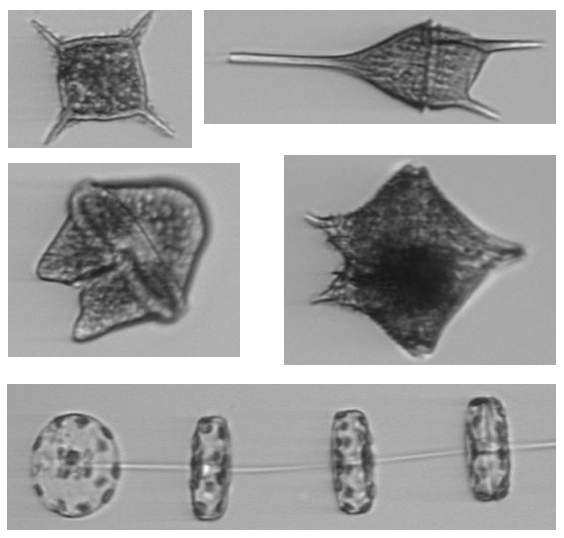
Fig. 1. The Imaging FlowCytobot (IFCB), a type of automated underwater microscope, was used to enumerate and identify plankton. The instrument collects and analyses samples every 25 minutes. It was deployed in situ in a depth profiling mode. Images from the IFCB on the right show a silico-flagellate (top left), dinoflagellates and a diatom chain (bottom). Photo by Bengt Karlson.
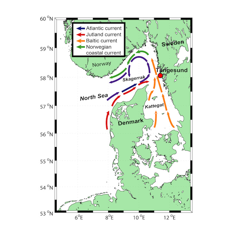
Fig. 2. Left: Study area, top right: an ADCP current meter and bottom right the R/V Skagerak. Photos by Lars Arneborg and Bengt Karlson.
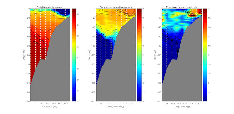
In addition to the biological data collected sea currents and the water column stratification was investigated. CTD-casts from the research vessel were made to measure salinity, temperature and chlorophyll fluorescence. Current meters (ADCP) and salinity and temperature sensors were deployed for about three months. The data collected will be used together with modelling to describe bloom development.
Fig. 3. Left: The water column structure along an east-west transect along 58° from the Swedish coast (right) towards the North Sea (left). During this cruise on September 6th southerly and westerly winds had pushed the surface water towards the Swedish coast. The separate graphs are left: salinity, middle: temperature and right: chlorophyll fluorescence.
Main advances in the study of coastal carbon fluxes and biogeochemical cycling (JRAP#5)
Jrap#5 has been preparing for intensive period starting March 2017. The observation plan will be detailed in December 2016 – January 2017.
At FMI/SYKE, new instruments have been tested for continuous pH and pCO2 measurements. In addition, methods for analyzing DIC and alkalinity from discrete water samples have been taken into use.
Figure: development of new showerhead pCO2-equilibrator at Utö, Finland.
Figure: observation platform on the Cretan Sea
In the Cretan Sea (Eastern Mediterranean), a pH sensor (sensorlab) was deployed by HCMR in collaboration with IOCAG (M. González Dávila) in July 2016, at the location of the POSEIDON E1-M3A buoy, allowing continuous pH measurements transmitted every 3 hours. In addition, discrete water samples have been taken at monthly frequency next to the pH sensor, for analyzing DIC and alkalinity.
The intercomparison of the different instruments used by Jerico-next partners is planned to take place in 2018, after the completion of the intensive period.
First GENERAL ASSEMBLY of JERICO-NEXT
During these four days many workshops dedicated to the Work Packages (WP) will be organized including an User Panel meeting, here is the agenda.
This event will be the opportunity to exchange with all the partners, to get informed on the work carried out during the first 18 months and to consider the next steps and the strategy of the project.
This will also be the occasion to take decisions and to find a common agreement on some items.
If you would like to participate to the 1st General Assembly of JERICO-Next please contact the supervisor of your organization for his approval and send an email at jerico@ifremer.fr.
JERICO plankton workshop in Gothenburg
The second JERICO plankton workshop was arranged in Gothenburg, Sweden 27-30 September 2016. Altogether eighteen participants took part in the workshop.
The aims of the workshop include:
- To improve the understanding of plankton diversity, spatial and temporal distribution and the development of algal blooms in the sea. Harmful algae will be in focus.
- To exchange experiences of using devices aimed at automated observations of phytoplankton including harmful algae. Instruments include automated imaging flow cytometers, multispectral fluorometers and spectrophotometers and a Fast repetition Rate Fluorometer (FRRF).
- To compare the performance of different instruments on common natural and culture samples.
- To promote cooperation and to plan future work in WP3.1 and 4.1.
The workshop was held at the Oceanographic unit of SMHI (Swedish Meteorological and Hydrological Institute). A visit to the SMHI Tångesund observatory in Mollösund, on the Swedish Skagerrak coast made it possible to learn about the Imaging Flow Cytobot (a type of underwater microscope) and other in situ instruments used there. In addition participants were able to use in situ instrumentation on site and sea water was collected for further analysed in the laboratory in Gothenburg.
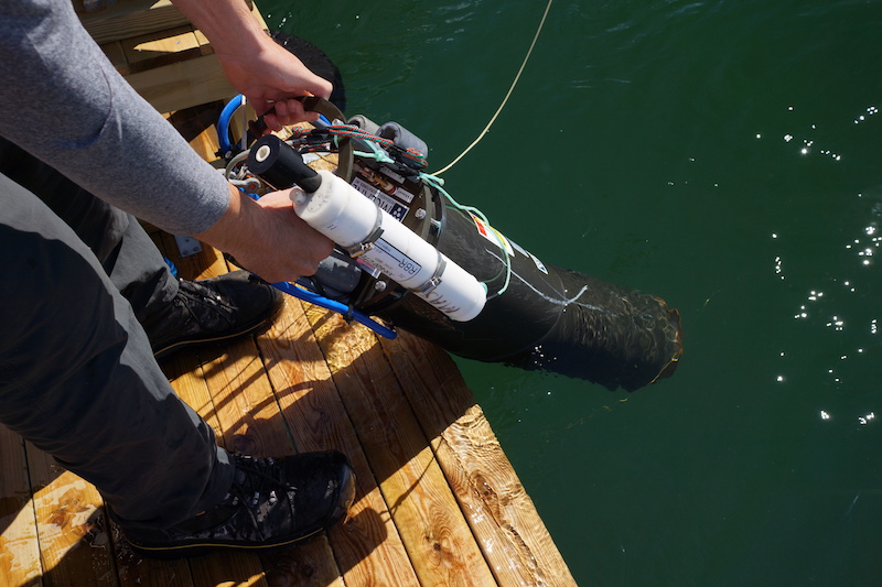
Fig. 1. The Imaging Flow Cytobot, a type of automated underwater microscope, is deployed at the Tångesund observatory. The white instrument is a CTD for measuring depth, temperature and salinity. Photo by Bengt Karlson.
Fig. 2. Images of phytoplankton from the Imaging Flow Cytobot are collected every hour providing near real time data on phytoplankton biodiversity and harmful algae.
Fig. 3. The workshop included a visit to a mussel farm in Tångesund on the Swedish Skagerrak coast. Photo by Bengt Karlson.
Fig. 4 Field work using a bio-optical instrument. Photo by Bengt Karlson.
Fig 5. Water collected at Tångesund was analysed using a number of different instruments. Photos by Bengt Karlson.
Fig. 6. The workshop included discussions and reporting of results. Photos by Bengt Karlson and Florent Colas.
Monitoring of environmental threats and pressures in Europe
In order to develop the Jerico Next Science Strategy for future monitoring we need to identify environmental threats and gaps in monitoring.
To accomplish this, we have created a questionnaire to capture information on environmental threats and monitoring programmes in Europe.
The questionnaire has been developed in a format which facilitates database analysis of the information returned. It needs to be completed online, using Google forms, and includes two linked forms/questionnaires.
- The first questionnaire is to identify threats in European Seas, and to assess whether existing monitoring programmes are adequate.
- The second questionnaire is to provide information on current monitoring programmes. This form includes a link to a spreadsheet so that information on monitoring stations can be provided.
When you click ‘submit’, your response will be received online. You can save partially completed forms, as long as the required fields are completed, and go back to an entry and edit it later. To do so: click submit, right click on the link “Edit your response”, and save the link so you can edit the form later (you will only be able to access it with this link so don’t lose it!).
If you have any questions, please contact Suzanne Painting or Kate Collingridge at Cefas.
Deadline: 12th October
North Sea cruise on the Cefas Endeavour (UK) 21-28 June 2016
In the framework of WP3 and WP4 (JRAP#1), Machteld Rijkeboer from Rijkswaterstaat (NL) took part in a North Sea cruise on the Cefas Endeavour (UK) between 21st and 28th of June 2016. The aim of the work was to determine the diversity of the phytoplankton with a semi-automatic system including two Cytosense flow cytometers connected to a ferrybox. The on line analyses were programmed from every 20 minutes to every hour. The results can already be seen on http://fytoplankton.nl/CEFAS/Endeavour/phytoplankton_liveloc.shtml and http://fytoplankton.nl/RWS/Endeavour/phytoplankton_liveloc.shtml. A meeting in August will take place in VLIZ in Oostende (B) to finalise the outputs of the cruise.
Involved institutions: Cefas, Rijkswaterstaat, VLIZ/Ghent University, Thomas Rutten Projects
JERICO-NEXT Newsletter, June 2016
1st ISSUE – JERICO-NEXT, Joint European Research Infrastructure network for Coastal Observatory – Novel European eXpertise for coastal observaTories
It gives us great pleasure to send you the latest updates on coastal observatories and JERICO-NEXT activities through this first newsletter introducing the new project. JERICO-NEXT started in September 2015 and will run for four years, finishing at the end of August 2019. The first year is dedicated to building upon the JERICO FP7 project and to begin JERICO-NEXT activities including new partners.
How to access to the JERICO Research Infrastructure (JERICO-RI)?
Apply for the First Call for Trans-National Access (TNA) on the JERICO-RI!
As part of the Trans-National Access (TNA) activity implemented in WP7, JERICO-NEXT offers opportunities for researchers or research teams from academy and industry to access original coastal infrastructures for measurement campaigns and instrument testing. These opportunities are expected to help build long-term collaborations between users and JERICO-NEXT partners and also to promote innovation and transfer of know-how in the coastal marine sector.
The JERICO-NEXT TNA activity is built on the successful experience of the previous FP7 JERICO project. However, it will involve a greater number of observatories (ferrybox lines, fixed platforms, including cabled observatories, glider fleets, HF Radar and fishing vessels) distributed in coastal and shelf seas all around Europe, including dedicated to biological observation.
The first Call has been open since the 2nd of May and will remain open until the 5th of July 2016, for activities scheduled in the period October 2016 – September 2017. Interested users will find more information on the JERICO-NEXT website,http://www.jerico-ri.eu/tna/call-program/1st-call/.
JERICO-NEXT main achievements
JERICO-NEXT ongoing progress
JRAP#2 on benthic biodiversity
JRAP#3 on chemical contaminant occurrence and related biological responses
JRAP#4 on hydrography and transport
News & Events
Access to the articles from JERICO-NEXT web site.
Upcoming JERICO-NEXT events
Don’t want to receive the JERICO-NEXT newsletter anymore? Send an email to sympa@listes.ifremer.fr with the subject “unsubscribe jerico_newsletter”
Sea Tech Week 2016
Every two years, the International week of marine sciences and technologies gather international experts from different disciplines related to the sea. Sea Tech Week offers conferences, scientific and technological workshops as well as a business part (B2B meetings, trade show…). This year the event will take place at the Quartz Congress Centre in Brest (France) from October 10th to 14th, 2016.
In the framework of this international event JERICO-NEXT’s workshops and B2B meetings will be organized as follows:
- A workshop on nutrient sensors (TASK 2.4.1), organised by Dave Sivyer from CEFAS, will be held on October 10th. The aims of this workshop are to review and evaluate the effective capabilities of the nutrient sensors utilised within the JERICO-NEXT network, describe the current modes of their deployment, and deal with data quality concerns. The goals are to define best practices in the use of similar sensors, and investigate their portability (across systems/platforms), interoperability and performances with a view to provide recommendations regarding these issues to manufacturers and industry.
- A workshop on “Calibration and Assessment” will be held from 11th to 12th October 2016. It constitutes the first workshop of task 2.5 in relation to the metrological consistency, comparability and quality of data and data products. The meeting will serve to present, describe and discuss the actions planned within this task, including their links with the other tasks and work packages (especially those relating to sensors and systems) of the project.
Please find all the information needed:
– agenda and registration at http://forms.ifremer.fr/
brestmetrologie/28-2/ – organisation of the Seatechweek (location, program,…) at http://www.seatechevent.eu/
Home-552-0-0-0.html Contacts
1) Florence Salvetat (Ifremer), florence.salvetat@ifremer.fr;
2) Rajesh Nair (OGS, Italy), rnair@inogs.it.Registration
http://forms.ifremer.fr/
brestmetrologie/28-2/ Deadline for Registration: 28/09/2016.
- On October 11th B2B meetings, to interact with industry end users, will be organised during all the afternoon. This will be another opportunity for the Industry Ocean Observation Forum to engage in technology cluster activities. The objectives of the technology cluster activities at Sea Tech Week are:
- Identify business opportunities for the private sector providing products and services to the academic research community (SLR);
- Case study presentations by companies who successfully engaged with TNA activities (JERICO-NEXT and FixO3);
- Demonstrate ease of access to existing data available from ocean and coastal observatories (EMODnet and FixO3 EarthVO).
For the 10th edition, Sea Tech Week’s main theme will be SEA and DIGITAL TECHNOLOGY, in connection with the national label “French Tech” obtained in 2015. This theme will be defined in a wide range of sub-themes in the various conferences: observation, robotics, biocomputing, sensors, modelling, human-machine interface, data science etc.
JRAP #2: Monitoring changes in macro benthic biodiversity
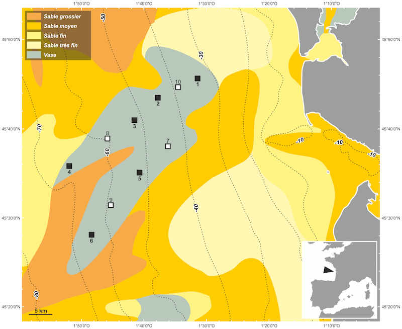
As first steps of two seasonal samplings, two cruises will first be carried out in October 2016 in: (1) the West-Gironde mud patch (SW France) from the 20th to the 31st, and (2) the Cretan Sea. These cruises aim at assessing the relationships between benthic diversity and the functioning of the water-sediment interface (remineralization of settled Particulate Organic Matter). The strategy will coupled the use of both ex-situ and novel in-situ techniques in order to link: (1) bottom water characteristics, (2) biogeochemical characteristics of sediment pore water and organic matter, (3) benthic macro- and micro-fauna diversity, (4) benthic fauna activity and (5) benthic fluxes. In the West-Gironde Mud patch, ten stations will be located along two inshore-offshore transects located in the two main lobes of the mud patch (figure). In the Cretan Sea, 5 stations will be sampled along a predefined gradient, starting from the sewage outfall of the city of Heraklion (close to the shore and at shallow depth) until a control station at 200-meter depth, where no effect of the sewage outfall should be detected.
Involved institutions: EPOC CNRS/UBdx, HCMR
JERICO-NEXT Cabled Observatories Workshop (April 2016)
On the 19th & 20th April, the Cabled Observataries Workshop took place in Vilanova i la Geltrú, Spain, organized by UPC-Obsea.
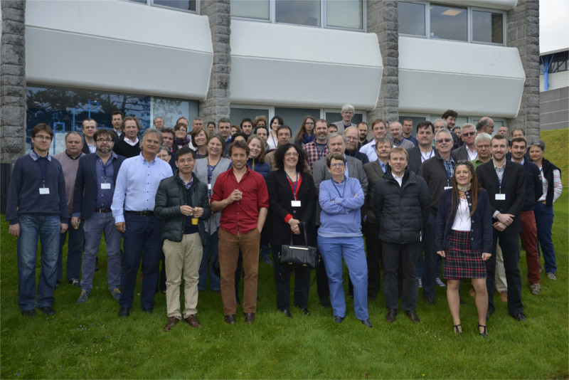
In the framework of WP2, T2.3, the CABLED COASTAL OBSERVATORIES carried out a revision of the current level of development: That took place last 19th-20th April in Vilanova, Barcelona (Spain).
Task 2.3 deals with the harmonization of HF-radar systems and cabled coastal observatories with the JERICO network.
The objective for this workshop was to review the state-of-the-art of these observing systems in terms of technology, procedures, maintenance, data processing, format, quality and management, identification of limitations and difficulties, applications, dissemination, etc, and promulgate Best Practice from the specific perspective of operations in coastal waters.
All the JericoNext cabled observatories infraestructure’s were very well represented:
AWI (UNH, UNS), Phillipp Fischer (Please login or register to view contact information.)
IFREMER (Molene) Nadine Lanteri (Please login or register to view contact information.), Laurant Delauney (Please login or register to view contact information.)
FMI (Utö) Lauri Laakso (Please login or register to view contact information.)
IMR (LoVe) Henning Wehde (Please login or register to view contact information.), Terje Torkelsen (Please login or register to view contact information.)
SBI (CPO in Galway Bay) Rogelio Chumbinho (Please login or register to view contact information.), Diarmaid O’Connor (Please login or register to view contact information.)
UPC (OBSEA) Please login or register to view contact information., Please login or register to view contact information.
JERICO Special Issue
Twelve peer-reviewed articles are published in a special issue of Journal of Marine Systems dedicated to JERICO (FP7) project, volume 162C. The paper version will be available shortly. These articles are already available online. JERICO offers a promotional access free of charge during 6 months.
The Editorial “Progress in marine science supported by European joint coastal observation systems: The JERICO-RI research infrastructure” is available here:
http://www.sciencedirect.com/science/article/pii/S092479631630135X
Below the 12 peer-reviewed articles:
- A comparison of FerryBox data vs. monitoring data from research vessels for near surface waters of the Baltic Sea and the Kattegat
- Optimizing observational networks combining gliders, moored buoys and FerryBox in the Bay of Biscay and English Channel
- South-Eastern Bay of Biscay eddy-induced anomalies and their effect on chlorophyll distribution
- Statistical properties and time-frequency analysis of temperature, salinity and turbidity measured by the MAREL Carnot station in the coastal waters of Boulogne-sur-Mer (France)
- FerryBox-assisted monitoring of mixed layer pH in the Norwegian Coastal Current
- High frequency mesozooplankton monitoring: Can imaging systems and automated sample analysis help us describe and interpret changes in zooplankton community composition and size structure — An example from a coastal site
- Seasonal pH variability in the Saronikos Gulf: A year-study using a new photometric pH sensor
- Development and validation of a video analysis software for marine benthic applications
- Exploring the occurrence and distribution of contaminants of emerging concern through unmanned sampling from ships of opportunity in the North Sea
- Assimilation experiments for the Fishery Observing System in the Adriatic Sea
- Glider and satellite high resolution monitoring of a mesoscale eddy in the algerian basin: Effects on the mixed layer depth and biochemistry
- South Baltic representative coastal field surveys, including monitoring at the Coastal Research Station in Lubiatowo, Poland
JERICO-Next HF Radar Workshop
The first workshop on HF Radar developments in JERICO-NEXT was held in San Sebastian on March 9th to 11th, 2016. This very successful meeting joined the main partners dealing with HF Radars in JERICO-NEXT, with participation of 22 people and 12 different Institutions from 7 European countries.
HF Radars are a remote sensing measurement technique, which provide surface ocean currents measurements, with extended coverage (range of 30-200 km) and high resolution in time (order of 1 hour) and space (order of 1-5 km). HF Radar technology offers a unique opportunity for excellent and innovative scientific research on coastal ocean variability, by providing data at the interface between ocean and atmosphere. Moreover, the real-time data obtained from this technology is being used today for monitoring surface ocean transport with application to different sectors in relation with marine environment, safety and exploitation. There is still work needed to improve the operation of radar, data quality control and harmonization, and to develop their applications. To improve these aspects and to work towards building a European HF Radar networks is one of the aims of the HF Radar component of JERICO-NEXT project.
The two main outcomes of the Workshop were: (i) a joint review of the state-of-the-art of these observing systems (in terms of technology, procedures, maintenance, data processing, format, quality and management, identification of limitations and difficulties, applications, dissemination, etc.), and (ii) the coordinated planning of work in the different tasks related to HF Radars. These tasks involve the following JERICO-NEXT WPs: WP2 on the harmonization of new network systems, WP3 on the developments on current observations from HF Radars, WP1 and 4 on Science strategies towards 4D characterization of trans-boundary hydrography and transport, WP5 on the definition of Quality Control procedures for HF Radar data and WP6 on Virtual Access to the data.
Cruises in the framework of JRAP#3
Task 2: Ferry box based monitoring of emerging marine contaminants:
-
Cruise 1: Bergen-Kierkenes route (Trol Fjord), 15 June 2016, 6 Days, Collection of water samples using Ferrybox automatic sampler. A broad set of emerging contaminants (including: antibiotics, pesticides, pharmaceuticals, personal care products and synthetic food additives) will be analyze. The scope is to discover new contaminants and their spatial distribution at the scope of support Descriptor 8 of the EU MFSD.
-
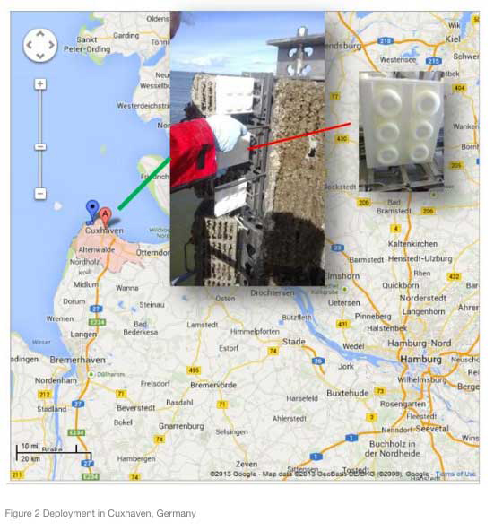
Cruise 2: Moss-Cuxhaven-Immingham-Moss (LysBris), Foreseen 15 June (2016), 6 Days, as above
-
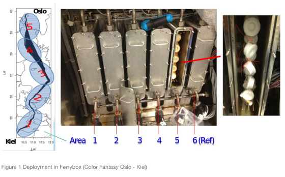
Cruise 3: Oslo-Kiell (Color Fantasy), Foreseen 12 August 2016, 2 Days, as above
Task 3: High resolution integrated monitoring of contaminant distribution and biological responses:
-
Cruise: Oslo Kiell (Color Fantasy), Foreseen 12 August 2016, High resolution monitoring (e.g. hourly) of several contaminants (see list above) including the Polyciclic Aromatic Hydrocarbons (markers of oil pollution) will be carried out simultaneously to the collection of samples for the determination of Biomarkers of bacterias adapted on growing on oil pollution substrate.
New experiments in the framework of JRAP#1
Automated systems for investigating phytoplankton diversity and abundance with a focus on harmful algae are used on research vessels, ferries and at fixed ocean observatories in the Baltic Sea, The Kattegat-Skagerrak, the North Sea-eastern English Channel area and in the Western Mediterranean Sea. Flow cytometry and bio-optical measuments are some of the methods used. A joint WP 2.4.2, WP3.1 and WP4.1 workshop was arranged in Wimereux 31 June – 2 June 2016 and a WP 4.1 Plankton Workshop will be held in 27 – 30 September in Gothenburg, Sweden.
Harmful algal bloom study at the Tångesund observatory
A study of plankton dynamics near a mussel farm at Tångesund on the Swedish Skagerrak coast will be carried out in August-October 2016. An instrumented oceanographic buoy was deployed already in April. One objective of the study is to investigate the coupling between physical processes and harmful algal blooms. The focus organisms are dinoflagellates belonging to the genus Dinophysis. These phytoplankton produce diarrhetic shellfish toxins that may accumulate in shellfish, posing a threat to human health. Other phytoplankton and also bacteria are being studied. The involved JERICO-NEXT partners are SMHI with subcontractors Scanfjord and WHOI (USA), NIVA, IRIS and Ifremer. In addition scientist from the University of Gothenburg, Sweden, and the AWI (Germany) will be involved. In connection with the study at the fixed location three cruises with a research vessel are planned. In addition, data from the Ferrybox system on Color Fantasy covering the route Oslo-Kiel will be used.
Study of phytoplankton in the western Mediterranean Sea
Phytoplankton functional diversity and spatio-temporal distribution at the meso-scale are studied in the frame of the A*MIDEX CHROME (Continuous High Resolution Observation of the Mediterranean, https://en-chrome.mio.univ-amu.fr/?page_id=42) project thanks to the combined installation of a Ferrybox system (belonging to the INSTM, Tunis) and a Cytosense flow cytometer on board the CTN’s ferry “Le Carthage”. The first trial was run end of April 2016 for one week and should run again before the end of 2016. By combining the phytoplankton datasets with oxygen, partial pressure of carbon dioxide and pH, the understanding of the phytoplankton functional diversity on biogeochemical processes at the basin scale will be improved.
Study of phytoplankton in the North Sea – eastern English Channel area
The phytoplankton are being studied using automated systems on research vessels, ferries, instrumented buoys (e.g. SMILE and Smartbuoys) and the MAREL Carnot instrumented Station. In 2016, regular cruises with R/V Endeavour around the Bristish Isles (North Sea and English Channel), R/V Sepia II (English Channel), R/V Simon Stevin and Zirfaea in the North Sea along the Belgian and Dutch coasts will be carried out. The following JERICO partners are involved: Cefas, VLIZ, RWS, CNRS-LOG and CNRS-Borea, Ifremer and Deltares. In addition subcontractors and partners outside JERICO such as University of Gent, NIOZ and ThomasRutten Projects.In parallel, work is still in progress (Ifremer-LER/BL) ) to develop user friendly interfaces (using R) in order to pre-process and process high frequency (HF) data series. At the time being, tools in test allow to merge files from different HF and LF (Low Frequency) data then allow to summarise statistics, to define clusters (based on biotic and/or abiotic parameters) and to make some modelling using Hybrid Markov Model. In collaboration with a partner outside JERICO such as ULCO-LISIC laboratory.
Cruises involving at least two JERICO-Next partners in the North Sea-eastern English Channel:
- Cruises of R/V Zirfaea (RWS):
11-14 April 2016: Phytoplankton study along the Dutch Coast and towards the Dogger Bank. Flowcytometry and FRRF in order to detect, follow and couple the phytoplankton composition and the productivity of the system. This involved the cooperation of RWS-NIOZ-VLIZ-University of Ghent
13-17 June 2016. Phytoplankton study along the Dutch Coast and towards the Dogger Bank. Flowcytometry, FytoPam and continuous Fluoroprobe in order to detect, follow and couple the phytoplankton composition and the productivity of the system. This involved the cooperation of RWS -CNRS -University of Lille
- Cruises of Cefas Endeavour (Cefas):
9-12 May 2016: Phytoplankton study on the East Coast of UK.
The Cytosense Flowcytometer on line with the Ferrybox during a short cruise (3 days) between North of Norfolk and the Tames Estuary chasing a Phaeocystis bloom.
20-29 June 2016: Comparison of outputs from two Flowcytometers from RWS and Cefas.
The two Flowcytometers will be on line with the Ferrybox during the Survey which aims to estimate the density of Nephrops in the North of the North Sea. The data from the two instruments will be compared to estimate their performances and will show that it is possible to combine phytoplankton measurement with other monitoring surveys.
- Cruise of RV Simon Stevin (late May 2016):
End of May 2016. Phytoplankton study in the North Sea (off Belgian coast). Coupling of two automated flow cytometer, FRRF, Fluoroprobe and PhytoPAM in order to follow both phytoplankton abundance, diversity and productivity. This will involve cooperation between Cefas, RWS, NIOZ, CNRS-LOG and U. Gent.
In parallel, work is still in progress (Ifremer-LER/BL, ULCO/LISIC) to develop user friendly interfaces (using R) in order to pre-process and process high frequency (HF) data series. At the time being, tools in test allow to merge files from different HF and LF (Low Frequency) data then allow to summarise statistics, to define clusters (based on biotic and/or abiotic parameters) and to make some modelling using Hybrid Markov Model.
New experiments in the framework of JRAP#4
-
CNR- ISMAR is working on the deployment of a new HF radar system in the region of Cinque Terre (NW Mediterranean).
Duration: 2016- 2018.
Objectives: The NW Med area is characterized by the presence of the Liguro-Provenco-Catalan Current also called Northern Current (NC) that flows westward along the coasts of Italy and France and it is characterized by a complex time variability covering a large spectrum of scales. These new deployments will allow to study the variability of this current and associated transport. -
MIO-CNRS has been working on the deployment of a new HF radar system off Nice (NW Mediterranean) and will be analyzing this new data to study the NC current.
Duration: 2016 – 2018.
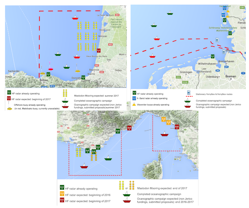
Objectives: The installation of the second HF radar site off the coast of Nice in the Ligurian Sea area extended the observation zone to the full coastal area, from Italian coast to the Gulf of Lion, allowing a much larger coverage of the Northern Current. - IFREMER will be performing two oceanographic campaigns in summer 2017 to deploy MASTODON MOORINGS and retrieve additional information in the NW Mediterranean and the SE Bay of Biscay.
Duration: 2017, one week for the cruise, one month for the moorings.
Objectives: to better describe the true nature of internal waves over the continental shelf in both study areas.
-
IFREMER and AZTI are working to install in 2017 a new HF radar antenna in the French coast of the SE Bay of Biscay to complete the existing system.
Duration: 2017, for one year.
Objectives: To overcome one of the clearest limitations of the present configuration which is the lack of HFR coverage along the Basque Coast, due to the small angle amongst existing radials generated by two antennas in the Basque Coast. The installation of the third antenna will enable the inter comparisons between a Phased Array (PA) and a Broad-Beam (BB) system in the area, make further analysis on observational errors (in the area covered by the three antennas where there will be redundant data) and on wave data retrieval. -
HZG will be performing numerical experiments in the German bight using data from existing HF radar systems and tide gauges.
Duration: 2016 -2018.
Objectives: the potential of the combined use of HFR data and tide gauge measurements in an assimilation procedure will be analyzed. A pre-operational assimilation system for HFR data is already running at HZG in the framework of the COSYNA system. The added value of water level measurements for this system will be assessed with a particular focus on the estimation of 4D transports. This includes the definition of suitable metrics for both Lagrangian trajectories and volume transports through transects.
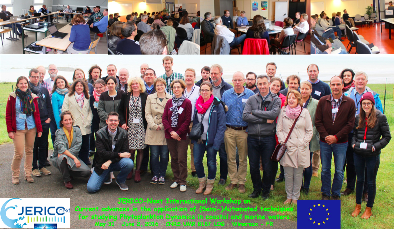
From May 31st to June 2nd in Wimereux has been organized the JERICO-NEXT Workshop on current advances in the application of semi-automated techniques for studying phytoplankton dynamics in coastal and marine waters (WP 2.4.2 – WP3.1 – JRAP1)
The JERICO-NEXT Workshop on current advances in the application of (semi-)automated techniques for studying phytoplankton dynamics in coastal and marine waters, has been organized from May 31st to June 2nd in Wimereux (Northern France).
It gathered together scientists from 15 partners or contracted partners and SMEs of the JERICO-NEXT consortium, as well as external experts for:
– preparing the synthesis of existing approaches and methodologies related to optical sensors for observing phytoplankton (WP 2.4.2)
– presenting the recent past, current and future technical and analytical improvements for building an automated platform for the observation of phytoplankton diversity and related ecosystem services (WP 3.1, in connection with WP3.4 on microbial and molecular sensors and WP5.2 on the integration of high volumes and flow of biological data generated with those sensors)
– preparing the common Practical Inter comparison Workshop that will take place in Gothenburg (Sweden) by late September (WP 3.1 and Wp4.1 – JRAP1)
– preparing the JRAP 1 activities for 2016 and 2017 on the implementation of innovative automated techniques in Pelagic Biodiversity – plankton, Harmful Algal Blooms and eutrophication studies, in connection with JRAP5 on Coastal Carbon fluxes.”
JERICO-NEXT 7th FerryBox Workshop
Examples of FerryBox regional coverages (from http://www.ferrybox.org/)
Aside from the 7th Ferrybox meeting which was held in Heraklion on the 7-8 April 2016, the FerryBox EuroGOOS task team met on the 6th of April 2016. This meeting was made possible with the help of the JERICO-Next project and was led by F. Colijn, HZG and W. Petersen (remotely).
One expected outcome from the JERICO-NEXT project was to “Define the specifications for a European system for handling FerryBox data, including physical, chemical and biological parameters from automated measurements as well as data from water samples”.
Underway data collected with FerryBox is a key component of multi-parameter (eg. Temperature, salinity, turbidity, Oxygen , Chlorophyll-a-concentration, pH/pCO2, Nitrates, …) coastal observations. Consequently, it is obvious that FerryBox observations have an important place in the JERICO-NEXT project.
Prior to the Heraklion meeting, the EuroGOOS task team met in Brussels (november 2014) and then remotely worked. The objective was to agree on a common approach on the FerryBox project and finally to produce a « FerryBox white book » that will clarify the roles of the different partners and that will clearly define the FerryBox infrastructure. This white book will be appliable as an EuroGOOS publication. (to be published in summer 2016).
One expected outcome from the JERICO-NEXT project was to “Define the specifications for a European system for handling FerryBox data, including physical, chemical and biological parameters from automated measurements as well as data from water samples” and it is part on the main issues adressed in the white book.
Initially, the FerryBox project was set up as an EU-FP4 project (2002-2005) and coordinated by GKSS Research Centre, Geesthacht (Germany). After the end of the project, the FerryBox observations have been mostly sustained with national contributions. HGZ has kept the leadership on the FerryBox project during the last 15 years and will continue to be the central focus point.
CABLED COASTAL OBSERVATORIES WORKSHOP: Review of the current level of development (WP2, Task 2.3.2)
The objective for this workshop was to review the state-of-the-art of these observing systems in terms of technology: procedures, maintenance, data processing, format, quality and management, identification of limitations and difficulties, applications, funding, dissemination, etc. The workshop was organized by Universitat Politècnica de Catalunya in Vilanova i la Geltrú (Barcelona, Spain) during 19th-20th April.
All the cabled observatories facilities participating within JERICO-NEXT were very well represented by AWI (UNH, UNS in Germany), IFREMER (Molène in France), FMI (Utö in Finland), IMR-Metas (LoVe in Norway), SmartBay (CPO in Ireland Galway Bay) and UPC (OBSEA in Spain).
The workshop was very well appreciated by each participant with a very active participation during the meeting. It was very fruitful.
Outcomes of this workshop will be public on the deliverable D2.1: Report on the status of Cabled Coastal Observatories for next Sep 2016 lead by UPC.
Next step will be to promulgate best practices from the specific perspective of operations in coastal waters at the end of the JERICO-NEXT project.
Dr. Joaquin del Rio
UPC-OBSEA
JERICO-NEXT: Salinity Exercise, 2016
The present salinity exercise, organized by Ifremer and OGS jointly, is part of the work planned in Task 2.5 of JERICO-NEXT Work package 2 (WP2).
It is a first attempt to evaluate the comparability of salinity measurements across the JERICO observing network.
The exercise will require participating laboratories to analyze unknown samples of certified IAPSO standard seawater that will be delivered to them using their main laboratory reference instrument for salinity.
Please fill in and return the registration form (link below) as soon as possible: we need the information you provide in your form in order to move ahead with the organization of the exercise. Note that the exercise is intended to be completely anonymous: participants will be assigned a code that will be used for all reporting purposes and while referring to analysis results.
Contacts
1) Florence Salvetat (Ifremer), florence.salvetat@ifremer.fr;
2) Rajesh Nair (OGS, Italy), rnair@inogs.it.
Please send your completed registration form to Florence Salvetat at Ifremer (florence.salvetat@ifremer.fr).
Deadline for Registration: 15/06/2016.
JERICO-Next User Engagement Panel – Application Form
The User Engagement Panel is intended to be a dynamic communication channel with key stakeholder groups: public authorities, policy, research, education and operational communities including industry. The main target is to establish an effective mechanism linking the project to beneficiaries, and ensuring that project deliverables meet the needs of users and stakeholders. The panel members are expected individually and collectively to participate directly and have a pro-active role in the derivation of knowledge and applications from the JERICO-NEXT products, including provision of feedback and assessments to enhance the relevance of the project scopes. The panel will support the partnership to implement effective marine science communication strategies and achieve societal impact.
Members on the Panel will express their influence on this high profile pan-European project including testing of data and/or new technologies in their field of interest on top of other benefits. JERICO-NEXT offers technology providers direct interaction with the research market segment to better identify and meet target expectations such as with new sensors and marine equipment.
The selected panel members will be supported by the project, and are expected to act in their capacity within the organisation that they represent as well as the sector within which they work. Panel members are expected to have wide ramifications in their category and to bring on board the range of viewpoints of the representative stakeholders.
Expressions of interest to join the Panel can be made by completing this form. All applications will be evaluated by the Steering Committee members and notified accordingly.
The closing date for applications is the 20th March 2016.
This project has received funding from the European Commission’s Horizon 2020 Research and Innovation programme under grant agreement No 654410.
Please apply by following the link below:
https://docs.google.com/forms/d/13xwF6WwZH1mit1kcYjRkRKuNIobNHyytrROOzN72G9w/viewform
More details can be found in the following Terms of Reference Document.
JERICO-Next User Engagement Panel TOR (123.2 KiB)
Evaluation of the oceanographic measurement accuracy of different commercial sensors to be used on fishing gears
Abstract
The aim of the paper is to assess the accuracy for physical oceanography purposes of some commercial sensors (Star-Oddi and NKE) installed on fishing boats in the Adriatic Sea. When mounted on fishing gears, they can retrieve huge amounts of daily datasets (temperature, depth and salinity), spanning a very large spatial region. The possibility to establish their accuracy would be of extreme importance for physical oceanography studies since it would be almost impossible to obtain the same amount of data by means of cruises onboard Research Vessels. Comparison tests against a calibrated CTD were performed during several surveys.
Summarizing, the data collected by Star-Oddi sensors are useful only considering the data portion where a dwell time at a fixed depth permanence is longer than 50 s, while those collected by NKE sensors are much more accurate for both depth and temperature and could be usefully considered for broader oceanographic purposes. The weak point of the NKE sensors is the salinity measurement. The evaluation carried out in the present study underlined the optimal conditions for the usage of the considered sensors and produced a series of offsets that might be used to enhance the accuracy of the recorded datasets.
More measurements will improve knowledge of the status of Europe’s coastal waters
A new EU project will improve observations of the status of Europe’s coastal waters, including algal blooms. Existing observation systems will be linked together and new methods will be developed. SMHI is one of 33 institutes that are collaborate in the project, which will continue for four years. One problem in marine environmental monitoring is capturing the natural variations in the sea.
“At the moment we may have algal blooms in the sea that we do not capture with our environmental monitoring, since it can occur in different places and can have such a rapid progression that the whole blooming process occurs between sampling occasions,” says Bengt Karlson, a researcher at SMHI.
Comprehensive Model of Annual Plankton Succession Based on the Whole-Plankton Time Series Approach
Jean-Baptiste Romagnan 1,2 *, Louis Legendre 1,2 , Lionel Guidi 1,2 , Jean-Louis Jamet 5 , Dominique Jamet 5 , Laure Mousseau 1,2 , Maria-Luiza Pedrotti 1,2 , Marc Picheral 1,2 , Gabriel Gorsky 1,2 , Christian Sardet 3,4 , Lars Stemmann 1,2
1 Sorbonne Universités, UPMC Univ Paris 06, UMR 7093 LOV, F-75005, Paris, France, 2 CNRS, UMR 7093 LOV, F-75005, Paris, France, 3 Sorbonne Universités, UPMC Univ Paris 06, UMR 7009 BioDev, F-75005, Paris, France, 4 CNRS, UMR 7009 BioDev, F-75005, Paris, France, 5 Université du Sud Toulon- Var, PROTEE EBMA, 83000, La Garde, France
Abstract
Ecological succession provides a widely accepted description of seasonal changes in phy- toplankton and mesozooplankton assemblages in the natural environment, but concurrent changes in smaller (i.e. microbes) and larger (i.e. macroplankton) organisms are not includ- ed in the model because plankton ranging from bacteria to jellies are seldom sampled and analyzed simultaneously. Here we studied, for the first time in the aquatic literature, the suc- cession of marine plankton in the whole-plankton assemblage that spanned 5 orders of magnitude in size from microbes to macroplankton predators (not including fish or fish lar- vae, for which no consistent data were available). Samples were collected in the northwest- ern Mediterranean Sea (Bay of Villefranche) weekly during 10 months. Simultaneously collected samples were analyzed by flow cytometry, inverse microscopy, FlowCam, and ZooScan. The whole-plankton assemblage underwent sharp reorganizations that corre- sponded to bottom-up events of vertical mixing in the water-column, and its development was top-down controlled by large gelatinous filter feeders and predators. Based on the re- sults provided by our novel whole-plankton assemblage approach, we propose a new com- prehensive conceptual model of the annual plankton succession (i.e. whole plankton model) characterized by both stepwise stacking of four broad trophic communities from early spring through summer, which is a new concept, and progressive replacement of eco- logical plankton categories within the different trophic communities, as recognised traditionally.
Romagnan2015 (1.6 MiB)
International Master Program in Marine Physics
at IUEM, The Marine Institute of Brest University, France
Physical oceanography, geophysics and naval hydrodynamics are based upon a common foundation of physics, mechanics, and applied mathematics. The Marine Physics masters offers a two years intensive program with fundamental lectures, advanced courses,internships and research projects. The program is held at the University of Brest in collaboration with engineering schools, Ifremer and research laboratories at IUEM. The training provides career opportunities in research and academia in oceanography, climate science, geophysics and in applications such as operational oceanography, naval hydrodynamics, observation and monitoring of the coastal and deep sea environment, exploitation of marine mineral resources
Organization
2 year masters program with 3 specializations:
- Marine Geophysics
- Physics of the Ocean and the Climate
- Naval Hydrodynamics
Each year is credited with 60 ECTS.
The masters starts in early September.
Courses highlight
- Geophysical fluid dynamics: a framework to understand ocean physics
- New remote sensing methods and observing systems for the ocean and solid earth
- Strong mathematical training: advanced calculus and numerical methods
Internships
The internship is an important aspect of the program.
- It can be done in Brest area in one of the many laboratories in marine science: Ifremer, University of Brest, CNRS, ENSTA Bretagne, CETMEF, IRD, SHOM.
- It can be done abroad (USA, Germany, UK etc.) Brest University has an active and vivid collaboration with the University of Cape Town (South Africa) and promotes the exchange of students
The LabexMER can give financial support to master’s students who do their internship abroad (mobility grants).
Living in Brest
- Fortunately, Brest is one of the least expensive cities in all of France for accommodation and daily living expenses. Being a mid-sized city, there are many options.
- Brest is a great city for water sports: sailing, surfing and kite-surfing, diving. For 22 euros a year, you can do all these sports via the University sports service(SUAPS). So finding the free time is a more limiting factor than the cost!
Curriculum
Marine Geophysics Speciality
Master 1
- Mechanics of deformable media
- Fluids
- Applied mathematics
- Signal analysis: theory and practice
- Numerical analysis
- Physics for the Earth Sciences
- Earth’s models
- Measurements at sea
- Project
- Language
- Issues and challenges in Marine Sciences
- Marine Sciences in Europe
- Scientific programming
- Internship (2 months)
Master 2
- Motions and deformations in the Earth
- Earth potential fields
- Marine seismic surveys (coastal and off-shore)
- Geographics Information Systems
- Language
- Job finding skills
- Options (2 or 3 from the list below)
- Detection and monitoring of natural resources
- Water cycle in the deep Earth
- Land and sea remote detection
- Sedimentary hydrodynamics
- Internship (4 to 6 months)
Physics of the Ocean and Climate Speciality
Master 1
- Fluids
- Applied mathematics
- Signal analysis: theory and practice
- Numerical analysis
- Measurements at sea
- Introduction to ocean and atmosphere
- Introduction to geophysical fluid dynamics
- Projects
- Language
- Issues and challenges in Marine Sciences
- Marine Sciences in Europe
- Scientific programming
- Scientific oral
Master 2
- Geophysical fluid dynamics
- Descriptive oceanography
- In situ observations
- Languages
- Job finding skills
- Internship (from Mars to September)
- Options (typically 5)
- Theories of the ocean circulation
- Climate dynamics and the carbon cycle
- Instabilities, vortex and geostrophic turbulence
- Coastal and estuary dynamics
- Surface waves
- Land and sea remote detection
- Sediment dynamics
- Numerical modeling of the ocean
Note: optional courses in Master 2 open if there are enough students
Naval Hydrodynamics speciality *
Master 1
- Fluids
- Applied mathematics
- Signal analysis: theory and practice
- Signal analysis: advanced course
- Numerical analysis
- Ship stability, ship architecture
- Experimental techniques
- Projects
- Language
- Issues and challenges in Marine Sciences
- Marine Sciences in Europe
- Scientific programming
- Scientific oral
Master 2
- 3D Turbulence
- Surface waves
- Computational fluid dynamics
- Resistance, propulsion and manoeuvrability
- Ship stability
- Hydrodynamics of lifting bodies
- Advanced numerical methods
- Language
- Job finding skills
- Business and companies culture
- Internship (from March to September)
* co-sponsored with ENSTA-Bretagne
How to apply?
Application procedure begins in December:
- Download the application from the web site
- Fill it and send it back
- Answer will be returned within a couple of weeks
Contacts
Prerequisites
Bachelor in either Physics, Mechanics or Applied Mathematics
More informations
http://www-iuem.univ-brest.fr/master_sml/MarinePhysics
Flyer PM-English 2013 (435.2 KiB)
Scholarships for MSc Course in Applied Oceanography (Malta)
In October 2015, the Physical Oceanography Unit of the IOI-Malta Operational Centre at the University of Malta will be offering once more its successful Master course in Applied Oceanography. This will be open to both local and foreign students with a post-graduate degree. An international faculty of experts will be participating in delivering the course. Scholarships to attend this course are also available for students with high academic records relevant to the course.
Application deadlines for scholarships:
- 15th April 2015
The course builds on the core principles of oceanography in coastal and open sea domains, with a focus on operational oceanography and the versatile and broad spectrum of disciplines and offshoot applications related to it. The primary aim is to train students and professionals on state-of-the-art methodologies and tools to measure, understand and predict the marine environment, and derive sustained benefits from the sea. It is elaborated over a course programme spanning and merging the scientific, technical and applicative aspects of oceanography to offer students a wide-ranging integrated approach, linking science to management, putting technology at the service of users and stakeholders, and providing tools and training for more efficient service oriented applications.
The course modules:
- Scientific Baseline of Oceanography
- Practical Baseline of Oceanography
- Essentials of Operational Oceanography
- Data Resources in Oceanography
- Boot Camp – Field survey and hands-on marine data analysis
- Principles of Ocean Governance
- Applications and Services deriving from Operational Oceanography
Job Opportunities include:
- Marine impact assessment and specialised analysis of environmental risks
- Research fields in oceanography and the marine environment
- Management of coastal/marine resources
- Marine-related industries, services and economic activities
- Policy-making and governance
- Environmental monitoring
- Marine observations and forecasting
- Data mining, management, quality control and archival
For more information on the course please visit: http://www.um.edu.mt/science/physicaloceanography/msc
For more information on the scholarships please go to: http://www.um.edu.mt/science/physicaloceanography/msc/scholarships
Email: Please login or register to view contact information.
Success for JERICO-NEXT – a continuation project
Recent news from the European Commission advised that JERICO-NEXT has received a score of 14.5/15 during evaluation and shall therefore be funded under the H2020 call (research and innovation actions).
In the continuity of JERICO (FP7), the objective of JERICO-NEXT consists in strengthening and enlarging a solid and transparent European network in providing operational services for the timely, continuous and sustainable delivery of high quality environmental data and information products related to marine environment in European coastal seas.
We look forward to continuing the work started during the JERICO project with you all!
Physical Oceanography sea-going Researcher
Open position
Physical Oceanography sea-going Researcher
Ifremer Centre: Brest, France.
Department: Oceanography and Ecosystems Dynamics
Research unit: Physical Oceanography Laboratory (LPO)
Closing date to apply: 13 April 2015
Working conditions: tenured position, full-time appointment including oceanographic cruises
Ifremer, the French Research Institute for Exploitation of the Sea, is an internationally recognized leader in marine sciences, pushing the frontiers of knowledge of the oceans and their resources, and monitoring marine and coastal environments for the sustainable development of marine activities.
Located on the water’s edge, the Laboratoire de Physique des Océans (LPO, Physical Oceanography Laboratory) is an joint research unit between CNRS, Ifremer, IRD and UBO, and is affiliated to the European Institute for Marine Studies (IUEM). Within Ifremer, LPO belongs to Oceanography and Ecosystems Dynamics (ODE) department, and has strong research partnerships with coastal ecosystems and marine geophysics laboratories. The scientific focus of LPO is the dynamics of the oceans and its interfaces, through a large spectrum of space and time scales, using in situ observations, remote sensing, theoretical and numerical modeling. By 2017, LPO will merge with the remote sensing lab LOS, and part of the coastal physics lab, with 85 tenured staff organized into 4 research teams: oceans in the climate system, ocean scale interactions, coastal oceanography, and remote sensing, and a 9-people instrument engineering and deployment group.
Applicants are expected to hold a doctoral degree in physical oceanography or a related field, postdoctoral experience, and a record of scientific research publications. We expect to hire at the junior level, but well qualified candidates with strong skills in conducting cruises and analyzing ocean observations will be well considered. He/she will develop an internationally recognized and externally funded research program dedicated to the interannual to decadal variability of the global ocean (heat, salinity, dissolved oxygen, circulation, …) in the global context of climate change. He/she will analyze the dynamical underpinnings of this variability, possibly focussing on processes such as mixing, ventilation and ocean-atmosphere interactions… or specific areas (the deep ocean, the South Atlantic, the Southern ocean….). With the design, and realization of ocean-going experiments, he/she will contribute to in situ and satellite global datasets and their joint analysis (GOSHIP, ARGO, SSS, SST, altimetry, …).
Required training, background and skills
A PhD in physical oceanography with post-doctoral experience. International experience desired.
Knowledge on the role of ocean dynamics in climate issues.
Sea-going experience including the conception, organization and/or conducting oceanographic cruises.
Collecting and analyzing ocean data bases.
Written and spoken English.
How to apply:
Please follow instructions from this site:
Contact: Fabrice Ardhuin (dirlpo@ifremer.fr )
Research Scientist LPO Ifremer 2015 (72.2 KiB)
Jerico NEXT proposal scores highly and receives funding
We are very pleased to inform you that the JERICO consortium have received the official notification from the European Commission for Jerico NEXT.
“With a score of 14.5 on a total of 15, I’m glad to inform you that the project will be funded by the European Commission at the expected cost level, of just under 10M€.” – P. Farcy.
Firstly, we wish to all of the consortium for the active participation toward this success and express our satisfaction at the prospect of collaborating closely over the next 4 years.
Black Sea Biannual Scientific Conference
The Black Sea Biannual conference is back in its 4th iteration and will be held between the 28th and 31st October in Constanta, Romania later on this year. It will continue on concerted efforts initiated by the previous BSC scientific conferences to use science and information technology to understand and deal with the environment problems of the Black Sea, to strengthen science/policy interface and regional cooperation towards better governance of environment protection to preserve the Black Sea ecosystem.
Several sessions will be organised on a variety of topics including:
- Pollution and eutrophication
- Biodiversity and ecosystem functioning
- Socio-economic impact on marine environment
- Integrated Coastal Zone Management
- Climate change and its impact on marine ecosystems
- Ecosystem modelling
A call for papers is open and the submission date for abstracts is on the 31st July 2013.
Further information can be obtained from: www.blacksea-commission.org
Plastic Pollution in the World’s Oceans: More than 5 Trillion Plastic Pieces Weighing over 250,000 Tons Afloat at Sea
Plastic pollution is ubiquitous throughout the marine environment, yet estimates of the global abundance and weight of floating plastics have lacked data, particularly from the Southern Hemisphere and remote regions.
Here we report an estimate of the total number of plastic particles and their weight floating in the world’s oceans from 24 expeditions (2007-2013) across all five sub-tropical gyres, costal Australia, Bay of Bengal and the Mediterranean Sea conducting surface net tows (N=680) and visual survey transects of large plastic debris (N=891). Using an oceanographic model of floating debris dispersal calibrated by our data, and correcting for wind-driven vertical mixing, we estimate a minimum of 5.25 trillion particles weighing 268,940 tons.
When comparing between four size classes, two microplastic <4.75 mm and meso- and macroplastic >4.75 mm, a tremendous loss of microplastics is observed from the sea surface compared to expected rates of fragmentation, suggesting there are mechanisms at play that remove <4.75 mm plastic particles from the ocean surface.
Full paper available here courtesy of IFREMER:
Oyster (c. gigas) recruitment in Mediteranean lagoons ; new approaches for studying larval connectivity using MARS3D modeling tools
The Thau lagoon, located at the South of France, provides 10% of the French pacific oyster Crassostrea gigas production (Robert et al., 2013). Despite this intensive shellfish production, the larval recruitment of this species within the Thau lagoon is still misunderstood and spat collection remains highly variable; as a consequence, shellfish farmers rely mostly on hatchery’s spat.
In 2012, the PRONAMED II project was launched, aiming to improve our understanding of the C. gigas reproductive cycle within Mediterranean lagoons and to explore the feasibility for oyster-spat collecting. In addition to an extensive sampling work encompassing both spatial and temporal features of larval recruitment, we tried to understand the contribution of larval dispersal on recruitment patterns.
For this purpose, we developed new approaches using the MARS 3D hydrodynamical model. While most models keep looking at the location of larvae after a simulation duration specified by the user, we propose here a new approach considering the pelagic larval duration and focusing on the duration of the larval competency for settlement.
A new index was set up to take into account the binary possibility for the larvae to settle or not during its final pelagic stage, the settlement probability increasing with the amount of larvae passing through a model mesh
Full paper available here courtesy of IFREMER:
New Marine Infrastructure in Finland
Finnish Marine Research Institutes have started a national marine research infrastructure consortium (FINMARI) here in Finland. The aim is to facilitate international and national use of experimental resources efficiently. This is done in a close co-operation with other international and national infrastructures and ESFRI’s as ICOS, EMBRC and EURO-ARGO.
The infrastructure includes research infrastructures of 3 Finnish research institutes, 3 universities, and a state-owned shipping company. The infrastructure network consists of several field stations, research vessels and multi-purpose icebreakers, laboratory facilities, ferryboxes, fixed measurement platforms and buoys in the Northern Baltic Sea. FINMARI is listed as a nationally essential RI on “Finland’s Strategy and Roadmap for Research Infrastructures 2014–2020” by the Finnish government.
The aim is to provide an easy access to all Finnish marine research infra and coordinate national infrastructure building. More information can be found on the website.
International Geographical Union Regional Conference in Moscow 2015
The Regional Conference of the International Geographer’s Union (IGU) will take place in Moscow next summer for the third time since the International Geographical Congress of 1976, when over 2,000 participants from around the world gathered in the Soviet capital for lectures, discussions, workshops and excursions. The pace of global change has since accelerated in directions that once seemed unimaginable.
The IGU is among the world’s oldest international research associations. The first International Geographical Congress was held in 1871, and subsequent meetings led to the establishment of the IGU in 1922. Today its members hail from over 100 countries, united in support of geographical research and education worldwide. In addition to the IGU General Assembly, Executive Committee and National Committees, the organisation includes special commissions, task forces and study groups engaged in ongoing collaborative projects. Dr. Vladimir Kolosov, from Lomonosov Moscow State University (LMSU) in Russia, is serving as president of the IGU from 2012 to 2016.
The 2015 Regional Conference will be an opportunity to reflect upon these changes as well as the future course of human civilisation in relation to pressing socio-environmental challenges. The conference motto is “Geography, Culture and Society for Our Future Earth.”
For more information click here
Eight sharks and ray species to be protected by international convention on endangered species
Eight shark and ray species are now protected under the Convention on International Trade in Endangered Species as of 14th September 2014. The listed products coming in and out of the EU will now have to be accompanied by export or import permits issued by EU countries.
The eight species – porbeagle, oceanic whitetip shark, scalloped hammerhead, great hammerhead shark, smooth hammerhead shark and manta rays – were earmarked for protection in March 2013 and join three shark species – basking shark, great white shark, whale shark – on the CITES list.Imports into the EU of CITES-listed sharks or ray products must be accompanied both by an import permit issued by the authorities of the country of import and an export permit issued by the CITES authorities of the exporting country.
The export from the EU of CITES-listed sharks or ray products requires that each shipment is accompanied by an export permit issued by the Member State authority of the country of export. Specimens caught on the high seas and landed in the same state to which the vessel is flagged, an “introduction from the sea” certificate will have to be issued instead of an export permit.
More information can be found by clicking here.
Source DG MARE, European Commission
EMODnet – Connecting people with data.
On 6 October 2014, EMODnet will organize a pre-event at the EurOCEAN 2014 Conference in Rome (7-9 October) from 14:00 to 18:00: EMODnet – Connecting people with data.
The workshop will introduce EMODnet and the data services it provides to a wider audience emphasizing the need for close collaboration between the various actors and related data initiates as well as between science and industry for new technologies and services in support of Blue Growth. It will consider how EMODnet fits in the wider marine data landscape in Europe and showcase new sea-basin level approaches to evaluate marine data availability and observation capacity from a use-perspective. To conclude, the participants will consider current bottlenecks and look ahead at requirements to guide future development of this long term marine data initiative into a fully operational, efficient and user friendly service addressing the needs of the marine science, policy and industry communities.
Refer to www.emodnet.eu/eurocean for more information, regular updates and how to register.
An endangered species since the 70s
Caretta caretta are commonly called “loggerhead” sea turtles due to their overly large heads with a horny beak that is significantly thicker than in other sea turtles. They have a reddish-brown shell, with a pale yellow plastron (underbelly) This species is the largest hard-shelled turtle in the world
Adult males reach about three feet (nearly one meter) in shell length and weigh about 113 kilograms, but large specimens of more than 454 kilograms have been found.
Sea turtles live in almost every ocean of the world.Their enormous range encompasses all but the most frigid waters of the world’s oceans. They seem to prefer coastal habitats, but often frequent inland water bodies and will travel hundreds of miles out to sea. They spend most of their life in saltwater, with females briefly coming ashore to lay eggs. These females will often return, sometimes over thousands of miles, to the beach where they hatched to lay their eggs. Their smooth shells and paddle-like flippers help them speed through the water as fast as 24 kph. These long-distance travellers have been known to swim up to 4.828 km.
They are primarily carnivores, munching jellyfish, conchs, crabs, and even fish, but will eat seaweed and sargassum occasionally.
Their average life span in the wild is more than 50 years. The exact population of this species is unknown but persistent population declines due to pollution, shrimp trawling, and development in their nesting areas, among other factors, have kept this species on the threatened species list since 1978.
Sea turtles cannot withdraw their heads into their shells but the adults are protected from predators by their shells, large size and thick scaly skin on their heads and necks.
Sea turtles spend almost all their lives submerged but must breathe air for the oxygen needed to meet the demands of vigorous activity. Sea turtles can quickly replace the air in their lungs which are adapted to permit a rapid exchange of oxygen and to prevent gasses from being trapped during deep dives. During routine loggerhead sea turtles dive for about 4 to 5 minutes and surface to breathe for 1 to 3 seconds.
One Planet, One Ocean – 2nd International Ocean Research Conference
The 2nd International Ocean Research Conference (IORC), organized by the Intergovernmental Oceanographic Commission of UNESCO,the Oceanography Society and the Fundacio Navegacio Oceànica Barcelona; is an opportunity for the scientific community to come together to plan the coming decade of international collaboration in marine science and technology, with a view to improving ocean governance.
This conference has an interdisciplinary focus, encompassing oceanographic, social science and economic perspectives on ocean research and will provide excellent opportunities to gain insight into the latest oceanographic research through theme sessions, key note speakers and workshops. Also it will be the opportunity to review progress made in ocean science in the last twenty years, and plan ahead in light of important policy developments such as The Future We Want (UNCSD Rio+20) and Future Earth.
The IORC will demonstrate the breadth and global impact of ocean research and its fascinating contributions in terms of new knowledge on pressing issues, including climate change, ocean governance and capacity building.
The oral presentations will be structured in three topics:
- Building Scientific Knowledge. Marine research and observations for climate, ecosystem functioning and security
- Applying knowledge for societal benefit: Achieving ecosystem management and sustainability
- Improving governance and building capacities
The deadline for the submission of abstracts for this conference has been extended to the 30th June. Conditions for submission are as follows:
- Abstracts should pertain to one of the topics or sessions detailed in “Thematic sessions”.
- They must be written in English and submitted via the website.
- Abstracts will be evaluated by the International Scientific Committee on the basis of technical quality and relevance to the topics.
- Depending on time constraints and allocations, abstracts submitted for oral presentation could be accepted as posters.
- Abstracts must refer to one theme only.
- The registration fee must be paid at the time of submission.
Abstract submission deadline: 30 June 2014
Conference: 17-21 November 2014
Workshops: Sunday 16 November 2014
Poster Sessions: Monday 17 November & Wednesday 19 November 2014
Registration:
Regular Fee (15 March onwards): 175 €
Social Events:
Welcome Reception: Sunday 16 November 2014
Blue Cocktail Evening: Thursday 20 November 2014
Blue Growth: Unlocking the potential of the Seas and Oceans
Today, 26th June, sees the closing date of the first call under Horison2020 related to the topic of Blue Growth. A number of the calls closing today are in actual fact CSAs, however amongst this is the interesting call for supporting the Atlantic Ocean Cooperation Research Alliance.
Since its launch last year in May 2013, through the Galway Statement, we did not get to hear much more about this Alliance between Canada, the US and the European Union. The goal of this partnership is to work together in order to better understand and “increase our knowledge of the Atlantic Ocean and its dynamic systems – including interlinks with the portion of the Arctic region that borders the Atlantic” and to promote the sustainable management of its resources.
So this call, may be the impetus for more work to be done in relation to this cooperation. In fact this H2020 call, totaling €15M, aims at addressing the following priority areas in an integrated way:
(i) Marine ecosystem-approach;
(ii) Observing systems;
(ii) Marine biotechnology;
(iii) Aquaculture;
(iv) Ocean literacy – engaging with society;
(v) seabed and benthic habitat mapping.
It is expected that this investment into research and also into the Alliance should bring about long term knowledge sharing that has also commercial potential for the EU in the Blue economy. We wait and see the outcomes of this call once evaluated and more importantly when implemented.
New research ventures at IBW PAN Coastal Research Station (CRS) in Lubiatowo (communiqué of 16th June 2014)
Recently, a new survey has been commenced at the IBW PAN Coastal Research Station (CRS) in Lubiatowo (south Baltic Sea, Poland). Two additional wave buoys (one possessed by IBW PAN and one obtained from the Institute of River and Coastal Engineering of the Hamburg University of Technology for conducting joint research) have been deployed in the coastal waters so that there are now in total three Directional Waverider buoys (produced by Datawell BV, the Netherlands), moored in the close vicinity of each other. The set of devices, consisting of two buoys DWR-7 Mk. III and one buoy DWR-9 Mk. II (see Fig. 1), is located at the depth of 18 m, about 1.5 nm from the shoreline. The buoys are moored at distances of ca. 150 m from each other, on the direction WNW-ESE.
The investigations, carried out within a research project entitled “The study on formation mechanisms of extreme waves and wave events”, funded by the National Science Centre (NCN, Poland), are aimed at synchronized recording of waves, in order to understand the origin and physics of extreme waves. The multi-point measurement system recording waves approaching from different directions allows the separation of the progressive waves from the temporary effects of waves’ concentration.
Knowledge of generation and formation mechanisms of extreme waves and extreme wave events is particularly significant. The main problem in the existing knowledge and current recognition of extreme waves is the fact that the available field wave data come from single-point measuring systems, which cannot allow the separation of the extreme progressive waves from the momentary effects of concentration of waves with different phase velocities. It is still unknown whether the “freak waves” are progressive waves, where for example dispersion is balanced by the specific shape of the wave and nonlinear effects, or these are mostly temporary effects of concentration of waves with different velocities. This information is essential for the theoretical model of this phenomenon.
In addition, four nearshore string wave gauges and an electromagnetic current meter (see the exemplary measuring stations in Fig. 2) have just been installed at CRS Lubiatowo. This survey, carried out within the other Polish national (also NCN-funded) project, is focused on the identification of infragravity waves (such as e.g. edge waves), being the specific wave motion close to the shoreline, in shallow-water regions. These waves have periods of a few minutes and accompany the typical shallow-water gravity waves (with periods of several seconds). It is of particular interest to find out what the parameters of the infragravity waves are and in which conditions (defined by the offshore wave parameters) these waves occur. Results of these field investigations will be helpful in testing and further development of theoretical models describing generation and features of the infragravity waves.
An EU maritime security strategy
The introduction to the Joint Communication addressed to the European Parliament and the Council says it all about Europe’s maritime significance:
“Europe’s maritime interests are fundamentally linked to the well-being, prosperity and security of its citizens and communities. Some 90% of the EU’s external trade and 40% of its internal trade is transported by sea. The EU is the third largest importer and the fifth global producer of fisheries and aquaculture. More than 400 million passengers pass through EU ports each year. It depends on open, safe seas and oceans for free trade, transport, tourism, ecological diversity, and for economic development. Failing to protect against a wide array of maritime threats and risks may result in the seas and oceans becoming arenas for international conflicts, terrorism or organised crime.”
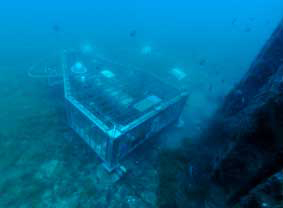
Currently undergoing the consultation process within the EU, this this joint communication presents a vision of the Union’s maritime security interests and threats, and proposes the areas in which cooperation between various maritime players can be enhanced beyond what is already good practice today. It encompasses all maritime functions, from coastguards to navies, port authorities and customs duty officers and would affect the EU waters as well as each ship sailing under an EU Member State flag and have a global reach. This document serve as a basis for the work with Member States towards a full-fledged EU maritime security strategy.
The purpose of the new strategy is to identify the maritime interests of the EU such as prevention of conflicts, protection of critical infrastructure, effective control of external borders, the protection of the global trade support chain and the prevention of illegal, unregulated and unreported fishing. It spells out the multitude of risks and threats the EU and its citizens may be confronted with: territorial maritime disputes, maritime piracy, terrorism against ships and ports or other critical infrastructure, organised sea-borne crime and trafficking up to potential impacts of natural disasters or extreme events.
An EU maritime security strategy would facilitate a strategic, cross-sectoral approach to maritime security, without seeking to create new structures, programmes or legislation, but instead striving to build upon and strengthen existing achievements, at the same time ensuring consistency with existing EU policies.
The purpose of this strategy would be achieved by pursuing the following four strategic objectives:
– make best use of existing capabilities at national and European level;
– promote effective and credible partnerships in the global maritime domain;
– promote cost efficiency;
– enhance solidarity among Member States.
Click here for more information
Opportunity for transnational access to FixO3 network observatories
This opportunity comes from the Europe-funded Fixed-point Open Ocean Observatory network (FixO³) project, coordinated by the UK’s National Oceanography Centre (NOC). As part of this initiative private companies and research institutions working on marine technology or wanting to conduct scientific research, have the opportunity to apply for access to one or more observatories and receive full scientific and technological support.
The FixO³ project started in September 2013 with a European Commission (EC) funded grant of €7m. It is a four-year project with 29 European partners from academia, research institutions and small and medium enterprises (SMEs). The project aims to integrate all infrastructures operated by European organizations and to enable continuity in ocean observations. It also aims to improve access for the wider community to these key installations and the data products and services.
Transnational access
The FixO3 project’s ‘Transnational Access (TNA)’ initiative is about supporting external scientific users with coordinated, free-of-charge access and includes 14 ocean observatories in the open ocean and one shallow water test site in the Western Mediterranean Sea available for access by successful applicants.
Observatory locations range from the polar regions of the Antarctic and Arctic, to the Atlantic Ocean and Mediterranean Sea with a choice of seafloor, mid-water and surface infrastructures with varying scientific focus due to each location’s characteristics.
These observatories were selected as they offer the broadest scientific and technological capabilities for multidisciplinary observations such as atmosphere-ocean interactions at the sea surface and processes in the water column and ocean floor. Gliders are also available for some of the sites. The observatories address a wide range of disciplines such as biology, biogeochemistry, chemistry, physics and geology.
Each of these open ocean observatories is in a key region which has been identified by the European Multidisciplinary Seafloor and Water Column Observatory (http://www.emso-eu.org/) as a critical area for environmental monitoring.
Call for proposals
The call for proposals will open in mid-June and close before the end of July. Applicants are encouraged to start working on their proposals as soon as possible as they need to contact the observatory manager of the preferred FixO³ location for a pre-feasibility evaluation of their project and a letter of support prior to submitting the proposal. Applicants also need to write a short research proposal explaining the reasons why they would like to use one of the observatories offered under TNA.
The proposals will be evaluated by a panel of experts, based on scientific merit, technical quality and the novelty of the proposed activities. The selection process will start as soon as the FixO3TNA Office closes the first call in July and successful applications will be decided by the end of the year.
User groups, particularly those working in countries where no similar research infrastructure exists or with no prior experience of accessing similar infrastructure, are encouraged to apply and will have extensive support during proposal preparation and subsequently if funded.
The TNA is a unique opportunity for scientists and engineers to access high-quality, interlinked instrumented infrastructures operating in open ocean observatories in order to carry out research and/or to test equipment.
For more information please visit http://www.fixo3.eu/tna/; email the FixO3 TNA office at fixo3.tna@plocan.eu or email the FixO3 Project Manager at luisa.cristini@noc.ac.uk.
Climate Change, Understanding the Challenge Summer School 2014
The BC3 Summer School is organized in collaboration with the University of the Basque Country and is a high quality and excellent summer course gathering leading experts in the field and students from top universities and research centres worldwide.
The BC3 Summer School will continue with the multidisciplinary approach. The structure of the school will follow the IPCC (Intergovernmental Panel on Climate Change) general meetings, with three main sessions that coincide with the subjects of the three IPCC Working Groups: climate science, adaptation and impact and mitigation of climate change. During 2013 the IPCC science report has been published and the remaining two will be out during 2014. We will have each day at least one IPCC scientist talking in each of these sections. Thus, we expect to have a scientist from (IPCC-WG1), Anil Markandya (BC3; IPCC-WG2) and Xavier Labandeira (Univ. Vigo; IPCC-WG3) who will give an overview on their field. Then, different speakers will try to cover all the current key issues in climate change such as: artic sea ice, ocean circulation, see level rise, impacts on water, food and health, mitigation options, climate policy and economic instruments.
The school is open to Master students, PhD students, postdoctoral fellows and other researchers as well as policy makers interested in acquiring a deep understanding of climate change and the policies designed to fight it.
PhD students and postdoctoral participants will have the opportunity to present their work in a specific poster session and get feedback from the faculty.
Jellyfish? Man or woman? Some facts about Portuguese Man of War Edit
Ever since the first death by a Portuguese Man of War has been reported in the Mediterranean in 2010 (in Sardinia) more and more people especially in the med got curious about this jellyfish. Ah no, first misconception, the Portuguese Man of War is not a jellyfish but rather a marine phylum, it differs from a jellyfish in so far as it is not actually a single multicellular organism but a colonial organism made up of many highly specialized minute individuals called zooids.
It lends its name from the 18th-century warship man-of-war, and the phylum’s supposed resemblance to the Portuguese version at full sail. In Australia it is known as bluebottle for its gas-filled bladder that is seen at the ocean service.
We call it “man” but the Portuguese man of war has no gender it is dioecious, its gametes are released into the sea and then fertilized externally, fertilised eggs then undergo gastrulation.
Is it lethal? Well there are few deaths attributed to the Portuguese man of war and only one in the Mediterranean. Potentially these deaths relate to a severe allergic reaction to the venom. However they do sting tremendously and cause severe pain.
If stung, do not treat like a jellyfish, that is pour vinegar on the sting as this makes it worse. Rather apply salt water to the affected area (not fresh water, which tends to make the affected area worse) and follow up with the application of hot water (45°C) to the affected area from 15 to 20 minutes, which eases the pain of a sting by denaturing the toxins.
Since the Portuguese man o’ war has no means of propulsion, it is moved by a combination of winds, currents, and tides. Although it can be found anywhere in the open ocean (especially warm water seas), it is most commonly found in the tropical and subtropical regions of the Pacific, Indian and Atlantic oceans. However we now see it more in the Mediterranean due to the changes in sea temperature.
References:
http://prezi.com/vn-z_r_ly2_f/phylum-cnidaria-physalia-physalis-portugese-mano-war/
Slaughter RJ, Beasley DM, Lambie BS, Schep LJ (2009). “New Zealand’s venomous creatures”. N. Z. Med. J. 122 (1290): 83–97.
Yoshimoto, C.M., and Yanagihara, A.A. Cnidarian (coelenterate) envenomations in Hawai’i improve following heat application. Transactions of the Royal Society for Tropical Medicine and Hygiene 96, 300–303, 2002.
2014 Jerico Summer School announcement
The topic of this summer school is “From data to decisions”. We aim to cover the entire marine and coastal information cycle from data gathering via data management, data dissemination, data analysis, data assimilation to data-based policy decisions for MSFD purposes. Please refer to the wiki for updates to this overall programme:
1 day: dissemination: EMODnet backbones: EurOBIS/ICES, EuroGOOS, MyOcean and SeaDataNet
1 day: data analysis: with DIVA (variational analysis) or DINEOF
1 day: data assimilation: introduction with OpenDA
1 day: making information: MSFD, web processing service, EMECO, data analysis tools communities
1 day: data management: interoperability standards (OGC, ISO, INSPIRE), versions, doi, catalogues
Field visit and demo Sand Engine coastal observatory: HF Radar, Argus camera, jetski with sonar.Field visit and demo Sand Engine coastal observatory: HF Radar, Argus camera, jetski with sonar.
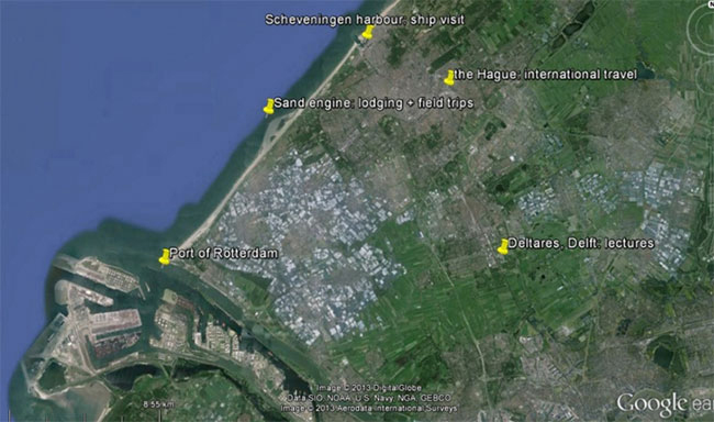
The target group is 30 early career scientists plus scientifically oriented early career marine spatial planners (MSP). Students are expected to arrange for their own funding for travel and lodging. We arranged for affordable lodging (300 € for 7 nights) in the beach resort near a coastal observatory.
The official form for admission has been finalized and is now available via the wiki site http://publicwiki.deltares.nl/display/OET/JERICO. It contains a bullet list with the required supplementary documents (CV, letter of recommendation, covering letter).
Deadline for registration: 7 April 09:00 CET (Monday)
Notification for admission: 23 April 23:59 CET (Wednesday).
Please mind timely visa procedures.
For more information please refer to: http://publicwiki.deltares.nl/display/OET/JERICO
Scholarships for postgraduate Course in Applied Oceanography – Malta
In October 2014, the Physical Oceanography Unit of the IOI-Malta Operational Centre at the University of Malta will be offering a new Master course in Applied Oceanography. This will be open to both local and foreign students with a post-graduate degree. An international faculty of experts will be participating in delivering the course. Scholarships to attend this course are also available for students with high academic records relevant to the course.
Application deadlines for scholarships:
- 31st March 2014 (Foreign applicants)
- 30th April 2014 (Local applicants)
The course builds on the core principles of oceanography in coastal and open sea domains, with a focus on operational oceanography and the versatile and broad spectrum of disciplines and offshoot applications related to it. The primary aim is to train students and professionals on state-of-the-art methodologies and tools to measure, understand and predict the marine environment, and derive sustained benefits from the sea. It is elaborated over a course programme spanning and merging the scientific, technical and applicative aspects of oceanography to offer students a wide-ranging integrated approach, linking science to management, putting technology at the service of users and stakeholders, and providing tools and training for more efficient service oriented applications.
The course modules:
- Scientific Baseline of Oceanography
- Practical Baseline of Oceanography
- Essentials of Operational Oceanography
- Data Resources in Oceanography
- Boot Camp – Field survey and hands-on marine data analysis
- Principles of Ocean Governance
- Applications and Services deriving from Operational Oceanography
Job Opportunities include:
- Marine impact assessment and specialized analysis of environmental risks
- Research fields in oceanography and the marine environment
- Management of coastal/marine resources
- Marine-related industries, services and economic activities
- Policy-making and governance
- Environmental monitoring
- Marine observations and forecasting
- Data mining, management, quality control and archival
For more information on the course please visit: http://www.um.edu.mt/ioi-moc/msc
For more information on the scholarships please go to:
http://www.um.edu.mt/ioi-moc/msc/applying_for_scholarships
Email: Please login or register to view contact information.
2014 Jerico Summer School announcement
The FP7 project JERICO will organise a 2nd summer school after the successful 2013 one held in Malta. The date has been set for the 14-20 June 2014 (Saturday – Friday) and the location will be around The Hague and Delft, in the Netherlands.
The preliminary title of this summer school is “From data to decisions”. We aim to cover the entire marine and coastal information cycle from data gathering via data management, data dissemination, data analysis, data assimilation to data-based policy decisions.
The target group is 30 early career scientists plus scientifically oriented early career marine spatial planners (MSP). Students are expected to arrange for their own funding for travel and lodging. The JERICO team is currently agreeing on selection criteria for participation, which will include a support letter from a senior scientist you work with, your CV and a letter explaining what you expect/want to learn from the JERICO community, and what specific expertise you can offer to the JERICO community.
For more information please refer to:
Microplastics Make Marine Worms Sick
Tiny bits of plastic trash could spell big trouble for marine life, starting with the worms, say a team of researchers from Plymouth University and the University of Exeter who report their evidence in a pair of studies in the Cell Press journal Current Biology
Those marine worms play a key ecological role as an important source of food for other animals. Work by Stephanie Wright from the University of Exeter found that if ocean sediments are heavily contaminated with microplastics, marine lugworms eat less and their energy levels suffer.
A separate report, from Mark Anthony Browne on work performed at Plymouth University, shows that ingesting microplastic can also reduce the health of lugworms by delivering harmful chemicals, including hydrocarbons, antimicrobials, and flame retardants, to them.
Read full article here:
http://www.sciencedaily.com/releases/2013/12/131202121447.htm
7th EuroGOOS Conference: Operational Oceanography for Sustainable Blue Growth
The EuroGOOS association together with the collaboration of the Instituto Hidrografico in Portugal will be organizing the EuroGOOS conference in Lisbon, Portugal between the 28th and 30th of October 2014. This conference is usually organized every 3 years. EuroGOOS association pushes the development of Operational Oceanography in Europe in the framework of UNESCO/IOC InternationalGOOS. The two and a half day conference will make debate between marine scientists and technologists, who develop and review Operational Oceanography, possible.
The 3 Key Priorities for 2014 will be:
- Identifying the new operational services and ways of interacting with users;
- Bringing to light all the difficulties of monitoring and forecasting the biogeochemical state of seas and oceans;
- Creating new strategies for key European initiatives.
During the conference there will be discussions regarding the satisfaction of the end users and the support given to blue growth, a presentation of the capabilities of Copernicus Marine Service: moving towards a European Centre of Monitoring and Forecasting as well as towards a European Ocean Observing System will be given. Finally the topic of Ocean Modeling will be tackled with regards to extending and improving predictability.
The conference will also include plenary, splinter, poster and round table sessions. At the end of the meeting there will be a summarization of the main outcome. Those interested are invited to submit the abstracts of their presentations and the full papers will be published in the EuroGOOS conference proceeding series. The second call for abstracts will be in January 2014.
For more information please use the details below.
Email:Please login or register to view contact information.
Website: www.eurogoos.eu
Towards a healthy Baltic Sea – HELCOM in a nutshell
Article Author: Kinga Polynczuk Photo by: Samuli Korpinen
Since its establishment nearly 40 years ago, HELCOM (Baltic Marine Environment Protection Commission) has been committed to protecting the marine environment of the Baltic Sea from all sources of pollution through intergovernmental cooperation. HELCOM is the governing body of the Convention on the Protection of the Marine Environment of the Baltic Sea Area, known as the Helsinki Convention. The Contracting Parties are Denmark, Estonia, the European Union, Finland, Germany, Latvia, Lithuania, Poland, Russia and Sweden.
HELCOM’s vision for the future is a healthy Baltic Sea environment with diverse biological components functioning in balance, resulting in a good ecological status and supporting a wide range of sustainable economic and social activities. To achieve this goal, HELCOM is active in a variety of fields that are central to cross-sectorial protection of the marine environment. HELCOM acts as a regional information hub, coordinating monitoring and compiling scientific results to support informed decision-making by the Contracting Parties.
All the HELCOM publications are available online.
The overarching Baltic Sea Action Plan
A central operational programme of HELCOM is the Baltic Sea Action Plan (BSAP), designed for restoring the good ecological status of the Baltic marine environment by 2021. The strategy, adopted by all the coastal states and the EU in 2007 at the HELCOM Ministerial Meeting in Krakow, is a crucial stepping stone for wider and more efficient actions to combat the continuing deterioration of the marine environment resulting from human activities. Moreover, the Plan provides a concrete basis for HELCOM work and stimulates even closer multilateral cooperation around the Baltic Sea region.
Countries have committed to the objectives set in the Action Plan, and the progress made – or lack thereof – is assessed every few years at Ministerial Meetings, the latest of which was held in Copenhagen on 3 October 2013 (Ministerial Declaration). To facilitate the evaluation of the progress on the Action Plan implementation, HELCOM produced and released a range of new assessments and reports, “Eutrophication status of the Baltic Sea 2007-2011.A concise thematic assessment” being one of them.
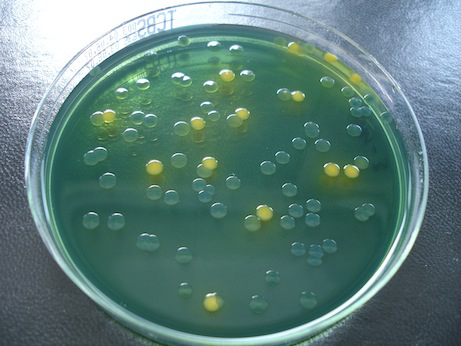
Tackling eutrophication by exceptional nutrient reduction scheme
Eutrophication is one of the main threats to the Baltic Sea ecosystem, and the latest eutrophication assessment results underscore the need for further HELCOM work, revealing how much is yet to be done to reach a good environmental status of the Baltic Sea. According to the assessment, despite the measures already taken to reduce external inputs of nitrogen and phosphorus, nearly the entire sea area is still affected by eutrophication with the exception of the Bothnian Bay.
The HELCOM nutrient reduction scheme, exceptional worldwide, was established with the 2007 Baltic Sea Action Plan to tackle the problem of eutrophication. The country-wise nutrient reduction targets of the scheme have been revised using improved data and models, and new figures were agreed on by the Ministerial Meeting 2013. Although substantial measures have already been taken to reduce nutrient pollution, it will take time before the effects of the measures can be seen at sea. As pointed out in the recently released climate change assessment, the Baltic Sea region is warming faster than the Earth as a whole, and this is expected to affect precipitation patterns in the region and hence also affect input of nutrients to the sea, possibly requiring even more stringent measures in the future.
More information about HELCOM, its activities and the Baltic Sea Action Plan can be found on the renewed website: www.helcom.fi.
The new US IOOS Data Quality Control manual
February 2012 marked the establishment of the Quality Assurance for Real Time Oceanographic Data (QARTOD) project. The objective of this project was to regulate and make sure that a systematic process was used when using procedures for quality assurance and control in the observation of oceanic data. NOAA’s National Data Buoy Centre collaborated in this project as well. Together they are designing manuals each providing a checklist of QC tests for the collection of real time information that includes steps for the control of sensors as wellas those for collected data that are imperative for accurate data collection. Each test is very user friendly and the manual provides QA best practices in the manual’s appendix. These publications are of great aid for those in the ocean observing community, who in return helped in writing the manuals.
The latest manual published, Temperature and Salinity, the fourth publication from the US IOOS QARTOD can be downloaded from http://www.ioos.gov/qartod/. Another manual about Water Level will be published soon after.
To see what has been published up till now and what will be published please go to the website: www.ioos.noaa.gov
References: www.facebook.com/usioosgo
Seafood pathogen spreads to East coast of USA and Europe
During the summer of 2012 two separate shellfish-associated outbreaks of illness in humans occurred in New York and Northwest Spain. Both outbreaks were caused by a bacterium called Vibrio parahaemolyticus, a bacterium common in marine and estuarine environments. Previously, Vibrio parahaemolyticus serotypes O4:K12 and O4:KUT (termed Pacific Northwest or ‘PNW’ strains) were considered unique to the Pacific Northwest region, but have subsequently been identified in the Atlantic, according to an article published in the Oct. 17 issue the New England Journal of Medicine.
The study, led by scientists from Cefas, the European Centre for Disease Prevention and Control (ECDC) and its American counterpart (CDC), and the USA’s Food and Drug Administration (FDA) demonstrated that the strains causing near simultaneous outbreaks on both sides of the Atlantic appear to be identical, a finding never seen before. Vibrio parahaemolyticusinfections are rare in Europe but the two 2012 outbreaks suggest the potential global movement of these bacteria, which could be significant from a public health perspective. The PNW Vibrio strains appear to be particularly virulent at much lower doses, compared to other pathogenic variants. These strains are genetically and biochemically distinct, with a unique “finger print”. Pathogenic strains normally carry one of two virulent genes (referred to as tdh+ and trh+) and very rarely carry both genes. The 2012 analysed strains contained various combinations of both of these genes – something never seen before in Europe. Current work involves the analysis of isolated strains from European water and shellfish samples (see inset) to determine if these pathogens have persisted into 2013.
JERICO TNA sampling polar organic chemicals in marine water with organic –diffusive gradient in thin-film (o-DGT)
Chang’er Chen, Lancaster Environment Centre, Lancaster University, UK.
This experiment under JERICO TNA started on 11th September, 2013 with the ferrybox together with the ‘Chem-Mariner’ unit in the ferry of Color Fantasy travels between Oslo (Norway) and Kiel (Germany) and with the fix station in Cuxhaven in Germany. The experiment is planned to end in the middle of October, 2013.
The experiment is supported/collaborated with Kai Sorensen from NIVA for the Ferrybox and Daniel Proefrock/Wilhelm Petersen from HZG. The purpose of the research is to test the novel passive water sampler – diffusive gradient in thin-film for organics (o-DGT) for in situ measurement of polar organic chemicals in marine environment and investigate the contaminants distribution in the area covered by the color line (Oslo to Kiel) (Figure 1) and in the fix station at Cuxhaven (Figure 2). Another passive sampler – ceramic dosimeter was also co-deployed in order to compare.
The samplers will be retrieved by the colleagues from NIVA and HZG, respectively, after about every week following the deployment. After retrieving all the samplers after 4 weeks, the samplers will be extracted and subsequently analyzed for polar organic chemicals, mainly antibiotics.
The Jerico presentation at the MonGOOS 2013 annual meeting
See Attachments
JERICO (5.1 MiB)JERICO Workshop WP10
Date: 16-18 October 2013
Location: Observatoire Océanologique de Villefranche/Mer
Organisers: P.Farcy (IFREMER Brest France), G.Nolan (Marine Institute Galway Ireland), L.Coppola (CNRS LOV France)
In the framework of JERICO, a workshop will be organised on the main results of WP10 to date.
WP10 objectives are to examine the extent to which existing technologies can be improved and/or adapted to the benefit of coastal operational oceanography and to document and test emerging technologies that will underpin future operational oceanographic systems in Europe’s coastal seas. The work package is sub-divided into tasks including:
- New tools and strategies for monitoring key biological compartments and processes
- Development of new physico-chemical sensors.
- Use of emerging profiling technologies for coastal seas.
- Increased use of ships of opportunity in making coastal oceanographic measurements. Best practices in coastal observatory implementation.
Download the programme of this workshop below.
JERICO-WP10-Worskhop-2013 (111.5 KiB)GESEBB glider Mission of the First TNA call of JERICO
July 4th, 2013: JERICO TNA GESEBB glider Mission started in front of Cape Matxitxako, in the southeastern Bay of Biscay.
July 5th, 2013: Mission temporary suspended due to a leak occurred inside the digifin that run inside the cables of the antennas; glider was safely recovered near the deployment position.
July 23rd,2013: Re-start of the GESSEB glider mission.
The GESEBB glider mission (http://www.jerico-fp7.eu/) of the first TNA call of Jerico re-started on 23 July, 2013 The deep glider mission will cover the southeastern Bay of Biscay (from 43N to 45ºN and from 2.5ºW to 4.5ºW), during 2 months (until end of September 2013). During approximately 12 days, the glider will first perform two exploratory transects, covering a distance of 300 km approximately from the sea surface to a maximum depth of 1000 m. After that and depending on the observations, the rest of the campaign (48 days) will be redefined.
CAMPE is a Slocum-1000 type glider; it is part of the fleet operated by the INSU-CNRS (La Seyne-sur-Mer (France); http://www.dt.insu.cnrs.fr/gliders/gliders.php). It is equipped with a CTD (conductivity, temperature and pressure), dissolved oxygen, and fluorescence-turbidity sensors. Data measured will be transmitted via Iridium in order to check the overall status of the instruments (sensors, battery…) and the navigation behaviour, and to send the scientific measurements. Real time data transmission will be done at every surfacing event, at least every 4 hours. The glider track and its near real time position can be checked in the EGO-network webpage http://glider83a.dt.insu.cnrs.fr/.
In addition, in the EGO-network the measurements and technical information of the glider are continuously updated (http://www.ego-network.org).
The objective of the mission is sampling the characteristics of a mesoscale eddy that appears in the southeastern Bay of Biscay, during spring and summer. The origin of this structure is associated with the strength and extension of a winter warm flow on the cantabrian slope. Since this eddy is retained in the study area during months, it is expected that during July-August 2013 it will be close to the position observed in the previous figures. The following map shows the location of this structure on 8 July 2008. The purple arrows represent transects first proposed for the mission.
Since a previous monitoring of this structure doesn’t ensure the presence of this type of anticyclonic eddy in the area, and as stated before, the mission will start with 2 exploratory transects. The campaign has begun in the Matxitxako offshore buoy (WP0: 43.6ºN 2.69ºW). This buoy belonging to Meteorology and Emergencies Directorate of the Basque Government (http://www.euskalmet.euskadi.net/) is equipped with a chain of CTD and a downward looking ADCP (interesting for data inter-comparison). Finally, in parallel to the glider mission 2 drifting buoys will be deployed in the centre of the eddy. These drifters will have a holey sock drogue centred at 50 m depth. The position will be transferred by an ARGOS localisation system. These drifters will be deployed by means of one vessel of the Spanish Maritime Safety Agency (SASEMAR: http://www.salvamentomaritimo.es/).
The experiment will permit to know in detail the vertical structure of the eddy and its evolution during the two months of the campaign. If the stationary eddy is not sampled, both because it has not been developed or because we are not able to locate it correctly from remote sensing maps, the campaign will permit to sample in detail the vertical structure of the water column (stratification, thermocline…) over the shelf-slope area in a period which is especially interesting regarding the biological cycle of some of the key species for the fishery activity.
By Ainhoa Caballero(1), Anna Rubio(1), Julien Mader(1), Carlos Hernandez(1), Laurent Beguery(2) and Pierre Testor(3).
-
Marine Research Division, AZTI-Tecnalia, Pasaia, Spain.
-
INSU-CNRS, La Seyne-sur-Mer, France.
-
LOCEAN-IPSL, Paris, France.
Deep Oceans getting warmer
NBC Science News have recently published a news article based on information from Discovery Communications LLC (owners of The Discovery Channel) about the overall warming of the oceans which is happening at an alarming rate.
Recently the “global warming” phenomenon has started to be ignored by the general public, given that the prophesised catastrophes have not happened, but this is mostly due to the fact that the seas have been absorbing the extra warmth of the earth’s crust, although this will stop happening at a point in time.
A joint research paper by the National Center for Atmospheric Research in USA and the European Center for Medium Range Weather Forecasts based in the UK has brought together diverse data sets of monitoring data captured from sensors in fixed or drifting locations, and also probes put on elephant seals. This study clearly shows that the deeper parts of the oceans are not as cold as they have been, and this causes different weather conditions including winds and phenomenas like El Nino in 1998. (seen in this image, courtesy NASA)
Copyright and Links:
- Full NBC article: http://www.nbcnews.com/science/deep-oceans-warming-alarming-rate-6C10606562
- Discovery Communications: http://corporate.discovery.com/
- Geophysical Research Letters Journal: http://onlinelibrary.wiley.com/journal/10.1002/(ISSN)1944-8007
- National Centre for Atmospheric Research: http://ncar.ucar.edu/
- European Centre for Medium Range Weather Forecasts: http://www.ecmwf.int/
- NASA: http://www.nasa.gov
Follow the Glider
Follow the Glider is a web tool aimed at students and developed by CEFAS, IMEDEA (CSIC-UIB) and SOCIB (Balearic Coastal Monitoring and Forecasting System) as part of the European FP7 – JERICO project. It is based on the glider-monitoring tool available at www.socib.es.
The aim is to help students from a variety of different grade levels to find out what underwater gliders are and gain awareness of their importance for coastal research. We also strive to enable students to monitor the gliders that SOCIB is currently using in the Balearic coastal area.
To visit the site either go to www.followtheglider.com or click the image below.
Presentations from the Jerico mid term review
Name | Size |
---|---|
JERICO MID TERM REVIEW WP3 PetersenN | 10.9 MiB |
WP11 JERICO MID TERM REVIEW | 674.0 KiB |
WP6 MTR-Paris June2013 | 11.8 MiB |
JERICO MID TERM REVIEW General Presentation | 1.7 MiB |
WP8 MTR-Paris June2013 UPD | 1.7 MiB |
WP5 MTR-Paris June2013 | 928.0 KiB |
WP2 JERICO MID TERM REVIEW | 3.6 MiB |
WP7 MTR 18 Juin 2013 | 2.0 MiB |
WP4 JERICO MID TERM REVIEW | 3.8 MiB |
WP9 Présentation MTR V1 | 4.8 MiB |
WP1 Présentation MidTerm Review | 1.1 MiB |
WP10-MTR | 40.2 MiB |
WP Financial Issue | 1.9 MiB |
European Marine Board Position Paper 18 on Marine Protected Areas
A newly launched Marine Board Position Paper (number 18) presents key scientific priorities for Marine Protected Areas (MPA) management and calls for the rapid implementation of MPA networks in Europe.
Coinciding with the 2013 European Maritime Day stakeholder conference held in Malta, the paper explains that the establishment of MPAs in Europe is slower on the uptake than the equivalent land based protected areas. Moreover this is unco-ordinated and therefore happens sporadically and in pockets. Networks of such MPAs are needed since long term monitoring programmes will provide key information and data for marine ecosystems.
As human activity in the seas continues to rise, and the exploitation of the oceans continue, the different countries must rise to the challenge together. Integrated ocean observation will be a tool for scientific assessment and also for achieving compliance in MPAs.
The full text of the paper is available for download at http://www.marineboard.eu/publications
JERICO Biofouling Monitor Program
ISMAR-CNR (Institute of Marine Sciences – Italian National Research Council) developed a special sampling system (Biofouling Monitoring Box – BMB) to be deployed in 12 selected locations in Europe (amongst all JERICO partners) both in coastal and open waters (see Figure 1).
The BMB (see Figure 2) is a monitoring device allowing to study the complexity of biofouling community. It was designed to simulate a wide range of sensors and sensor housing/containers, considering different substrates (metal, glass, plastic), spatial and structural heterogeneity typical of marine sensors immersed in coastal and open waters.
The main aims of this study will be:
- characterization of the biofouling community in the different geographic locations;
- screening of biofouling on different kind of sensors and identification of critical materials and areas of the instruments as regards the settlement of organisms
- deep understanding of biofouling as a technological problem peculiar of each tested material and each selected site, in order to identify the most effective and appropriate antifouling method to protect sensors and their housings from biofouling in each geographical location.
White paper on dissolved oxygen measurements: scientific needs and sensors accuracy
The objective here is to review the practical accuracy and the precision of the existing oxygen sensors used in oceanography. The idea is to review all oxygen sensors mounted on fixed and lagrangian platforms (mooring, CTD profiler, glider, ARGO floats) used on coastal observatories. This report synthetizes the past experiences and recommendations for a better use of oxygen sensors in order to improve the quality of the oxygen data for scientific exploitations.
Richness of Mid-Atlantic ridge
Shallow waters close to the coasts are fertile ground for plankton and biological nutrients, allowing for marine life to thrive more. By contrast, in the deeper parts of the ocean, where the sun penetrates less, there is less growth potential. However in the middle of the Atlantic there is a ridge where water is shallower and therefore a potential ‘hotspot’ of biodiversity in marine life. The Plymouth Marine Laboratory has worked in the ECOMAR project with a strong scientific team hailing from 16 research institutes in 8 countries and come up with results to dispel this.
In fact plankton productivity in the mid-Atlantic ridge is no more and no less than in the deeper seas around it. This was an unexpected outcome and it will help to understand and guide better the issues relating to management of fishing and protection of this area.
Further information on the ECOMAR project and its findings can be found at:http://www.oceanlab.abdn.ac.uk/ecomar/
Also of interest is this paper: http://dx.doi.org/10.1371/journal.pone.0061550
The official website of the Plymouth Marine Laboratory is at http://www.pml.ac.uk/
40th CIESM Congress – Marseille
The Mediterranean Science Commission formed by over 2,000 marine scientists, based for the large part in research institutes on the shores of the Mediterranean and Black Seas, come together for the 40th time in a Congress in Marseilles between the 28th October and 1st November 2013.
The Commission, with headquarters in Monaco, has grown from the eight founding countries of its origin to 22 Member States today. These support a network of several thousand marine researchers, applying the latest scientific tools to better understand, monitor and protect a fast-changing, highly impacted Mediterranean Sea.
The Congress will be split according to the 6 Committees of the Commission that will discuss areas related to:
- Marine Geosciences
- Physics & Climate of the Ocean
- Marine Biogeochemistry
- Marine Microbiology & Biotechnology
- Living Resources & Marine Ecosystems
- Coastal Systems
JERICO TNA Reference Temperature Calibration (RTC) experiment at the “Centro di Taratura Oceanografica” (CTO) of the OGS in Trieste
February 28th to March 1st, 2013: JERICO TNA “Reference Temperature Calibration (RTC) experiment”
The fourth JERICO TNA experiment took place between the 28th of February and the 1st of March 2013 at the OGS-Oceanographic Calibration Centre (OGS-CTO), the facility for oceanographic testing and calibration of the Department of Oceanography of the OGS (Istituto Nazionale di Oceanografia e di Geofisica Sperimentale), located in Trieste, Italy. The experiment proposal was submitted by HCMR at the First TNA call of JERICO.
The purpose of the experiment was to acquire expertise, receive guidance, and gain “handson” experience in applying the procedures and Best Practice conventions for the calibration of oceanographic temperature sensors using primary reference standards. The long-term goal is for HCMR to be able to perform such calibrations on its own premises. This is essential in order to ensure the quality of the data collected by the POSEIDON network (http://poseidon.hcmr.gr) and field surveys performed by HCMR.
During the last decade HCMR set up the integrated project POSEIDON, a real-time monitoring and forecasting system for the marine environmental conditions in the Aegean Sea. The monitoring network consists of 11 Seawatch oceanographic buoys, equipped with several sensors deployed at multiple depths, and 9 Smart-wave buoys with the capability of online data transmission to the operational centre of HCMR every 3h through the Inmarsat- C satellite or a GSM mobile telephone communication system. The enhanced forecasting component of the system consists of an atmospheric model, an offshore wave model, a general circulation ocean model, a surface pollutant dispersion model and a shallow water wave model.
HCMR has established an in-house calibration laboratory for the evaluation and calibration of its oceanographic sensors and instruments. For the calibration of the temperature sensors, two standard platinum thermometer(s) manufactured by Seabird Electronics, Inc. and a large temperature-controlled bath are employed. However, for proper calibration, the reference standard platinum thermometer(s) should be maintained within specifications by linearization, slope and offset adjustments using primary temperature standards (ITS-90 fixed points). The calibration of oceanographic temperature sensors using primary temperature standards requires expertise, and is a delicate and labour-intensive process, often associated with heavy costs for the operators. The HCMR calibration lab does not currently employ this calibration procedure.
The OGS-Oceanographic Calibration Centre (OGS-CTO) is the facility for oceanographic testing and calibration of the Department of Oceanography of the OGS (Istituto Nazionale di Oceanografia e di Geofisica Sperimentale), located in Trieste, Italy. It provides the scientific and technical infrastructure necessary for high-quality observations of the marine environment using procedures that repeatedly meet recognized international standards of excellence. A critical element of the services offered is the ability to calibrate and maintain sea-going instrumentation efficiently. The facility is run applying relevant international guidelines and protocols as much as practically possible in order to assure conformity or, at least, compatibility, with the regulatory standards governing this kind of activity worldwide.
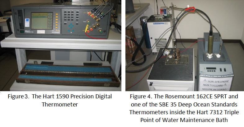
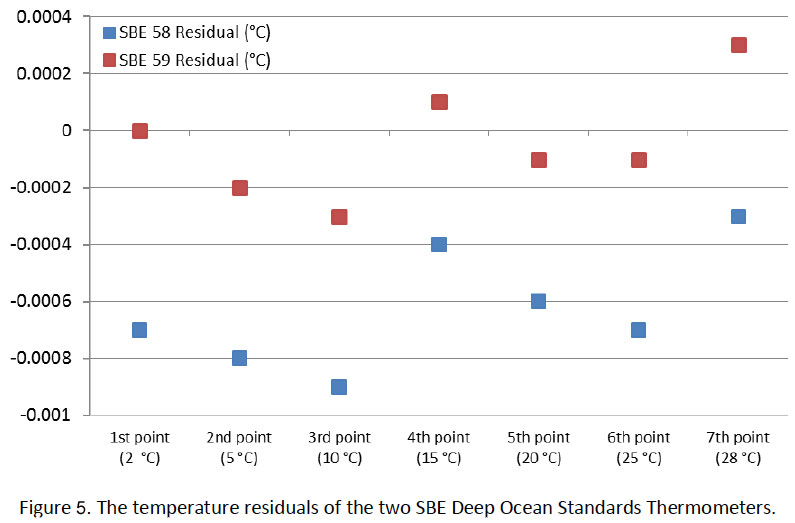
At present, the OGS-CTO provides high-calibre temperature and conductivity calibrations, able to meet the demanding oceanographic measurement specifications for these parameters. It is also capable of performing functional tests, evaluations and validations of instrumentation used for measuring other commonly monitored parameters like turbidity, pH, etc.
The sensors under calibration were two SBE35 Deep Ocean Standards Thermometers (serial numbers 58 and 59) manufactured by Seabird Electronics, Inc. that were purchased by HCMR in 2007. One of them, the one bearing serial number (s/n) 59, had never been used in the field while the other has been employed in HCMR’s evaluation/calibration experiments.
For the linearization procedure, the two sensors were placed in a Hart 7052 Seawater Calibration Bath together with a Metal-sheath SPRT Rosemount model 162 CE for taking reference temperature readings . Seven calibration set-points (28 °C to 2 °C) were chosen, and at each set-point, the bath temperature was logged for 10 minutes. The averaged data of the sensors at the different set-points and the corresponding temperature residuals with respect to the relevant reference temperatures are presented in Figure 5.
The data showed that neither of the two sensors required any changes in their linearization coefficients at the present time.
Subsequently, the slope and offset terms of the two sensors were evaluated one at a time at the Triple Point of Water (TPW) and the Melting Point of Gallium (MPGa) using appropriate, certified ITS-90 fixed point cells.
The results indicated that the slope and the offset of one of the the units, specifically, s/n 58 had slightly changed since its last calibration (Table 1), and the experimental data was used to recompute a new slope and offset.
The performances of this unit with its “as received” and new slope and offset settings have been compared using the data from the linearization testing in Figure 7.
Both of the calibrated SBE 35 units will be used as reference sensors for temperature in the calibration laboratory of the HCMR at its facilities in Thalassokosmos in Crete (Greece).
by Manolis Ntoumas (1), Rajesh Nair(2) , Nevio Medeot(2) , Fotis Pantazoglou(1) ,George Petihakis (1)
- Hellenic Center for Marine Research, ,HCMR,Heraklion, Crete, Greece.
- Istituto Nazionale di Oceanografia e di Geofisica Sperimentale,OGS,Trieste,Italy
Open source for BFM model
Bologna University (UNIBO), the National Institute of Oceanography and Experimental Geophysics (OGS) and the Euro-Mediterranean Centre on Climatic Change (CMCC) joined forces to develop, use and disseminate an open source marine biogeochemical numerical model fully usable in coupled mode with ocean general circulation models.
The model is the BFM (Biogeochemical Flux Model). In order to develop and promote its use by the largest possible audience, the three institutions formed a consortium aimed to improve, manage and distribute the model.
Jointly with the official opening of the BFM web site, the consortium invite the marine science community to attend a “BFM official release meeting” that will be held on March 19 2013 at the CMCC premises in Bologna.
The aim of the meeting is to illustrate the model characteristics, provide highlights about the underlying theory and assumptions adopted to describe and simulate the marine biogeochemical cycling, the technicalities of the computer code and explore the possibilities for increasing the users audience and the potential Consortium Members.
We encourage the interested community to participate.
Attached you find the meeting announcement, Agenda and also some logistic information.
If you are willing to participate, please inform Marco.Zavatarelli@unibo.it to facilitate organisation.
Name | Size |
---|---|
Logistics information | 729.4 KiB |
Agenda BFM event V2 | 609.0 KiB |
Announcement of Event | 355.7 KiB |
Rising acid levels may make sea sediments more toxic
by Cefas, UK
A recent report by Cefas scientists found that ocean acidification, caused by climate change, could result in sediments contaminated with metals becoming more toxic and harming the animals that graze on that sediment.
The study looked at crustaceans that feed on the surface of sediments from dredged ports and estuaries.
“The combined effect on these animals, of coping with adapting to climate change as well as increased toxin levels, could prove to be fatal,” said Dave Sheahan, a senior Cefas researcher on the study.
Cefas already monitors dredged sediments from industrialised estuaries for poisonous metals. Such areas are regularly dredged to maintain harbour entrances, and the excess material is tested for toxicity.
In the laboratory, burrowing crustaceans that normally graze on the surface of sediment were placed in a tank with dredged material from one of these sites. The creatures were then exposed to current sea conditions as well as acid levels predicted for the next 50 and 100 years. The animals that survived ten days in these tanks were then tested to see if they incurred DNA damage.
The animals experienced significant DNA damage, which rose with acidification levels, suggesting that when acidification is combined with metals in sediments it can be more harmful. The study also showed, however, that as the toxicity of ingested metals rises, animals are sometimes able to adapt their behaviour to cope with such changes.
Dr Silvana Birchenough, senior benthic ecologist and co-author of the study, described how “initially you can see the distinct burrows they made, but after treatment there was less activity: some species just sat on top without moving much. This showed us how some organisms may be able to move more or less to regulate for these changes. So there could be a trade-off in behaviour.”
The scientists may now find that certain species’ are less tolerant, or even some genotypes within species are better able to tolerate changes. So, over time, species that cope less well may face stiffer competition from groups of animals that are more adaptable.
Cefas will continue to work in this area, focusing on commercially important crustaceans like lobsters and crabs. They will be assessed to see if those creatures are also exposed to contaminated sediments.
Birchenough continued: “There’s a commercial importance on where we think the major exposure routes are. In our study we focused on two aspects: whether contaminated sediments and changes in ocean acidification will affect animals in the marine environment, and whether the tests we do will help us to make a judgement about sediments that we currently deem okay.”
Currently, if toxicity in dredged sediments falls below a predetermined threshold they are considered safe to deposit in the sea. However, rising ocean acid levels may put more stress on animals, on top of the metal toxicity, meaning that current threshold values would need to be changed to make sure all marine animals, including crustaceans, are protected.
Fact File
- Laboratory tests on the amphipod, Corophium volutator, were conducted to determine whether it would respond to the combined effects of increasing CO2levels and metals.
- Amphipods were exposed to two test sediments – one with relatively high metals concentrations and control sediment with lower contamination – under conditions that mimic current and projected ocean acidification conditions (390-1140 atm p CO2).
- The data demonstrated the clear potential for near-future acidification to increase the susceptibility of benthic ecosystems to contaminants.
- Paper: Roberts, D A, Birchenough, S N R, Lewis, C, Sanders, M B, Bolam, T and Sheahan, D (2013), Ocean acidification increases the toxicity of contaminated sediments. Global Change Biology, 19: 340-351 (http://onlinelibrary.wiley.com/doi/10.1111/gcb.12048/abstract).
Links
- Cefas’ Marine Climate Change Centre (MC3): http://www.cefas.defra.gov.uk/our-science/marine-climate-change-centre-(mc3).aspx
- Ocean acidification experimental facility: http://www.cefas.defra.gov.uk/our-science/marine-climate-change-centre-(mc3)/climate-change-impacts/ocean-acidification-experimental-facility.aspx
- Dredged marine sediments: http://www.cefas.defra.gov.uk/our-science/assessing-human-impacts/dredged-marine-sediments.aspx
Bio-geochemical sensors calibration and intercalibration exercise at POSEIDON calibration Laboratory of HCMR in Crete
November 26th, 2012: JERICO TNA “Calibration and inter-calibration exercise of biogeochemical sensors
The third JERICO TNA experiment (www.jericofp7. eu) started on Monday November 26th, 2012, with the setup of the instrumentation in the POSEIDON Calibration Laboratory of the Hellenic Center for Marine Research in Heraklion (Crete, Greece).
The experiment was part of a research proposed by CNR to the First TNA call of JERICO.
The main purpose of the experiment was to perform a calibration and an inter-calibration activity of bio-geochemical sensors to be operationally and routinely deployed on offshore marine observatories making part on a continuous basis of the marine monitoring network of the Mediterranean Sea.
The main relapse of this activity has been consisted in an important enhancement of the accuracy of the insitu observations on a long term basis of dissolved oxygen, chlorophyll-a and turbidity in the Ligurian basin (Figure 1) collected by a multiparametric probe installed on the W1-M3A off-shore observing system (Figure 2, 3).
The W1-M3A off-shore observing system is moored in the Ligurian-Provencal basin that, for its role in the climate and in the circulation of the Mediterranean region, has been object of intense scientific investigation since the sixties. During winter, processes of dense water formation often occur; strong airsea interaction processes greatly affect both atmospheric and marine circulation, determining a strong variability in the upper ocean thermocline; its productivity is very high and its ecosystem very rich and complex. The Ligurian Sea is characterised by a permanent basin-wide cyclonic circulation involving both surface and intermediate waters. More specifically, the waters flowing northwards on both sides of Corsica, theWestern Corsica Current (WCC) and the Tyrrhenian Current (TC), join along the eastern periphery of the basin and form the Ligurian-Provencal Current (LPC), which flows westward along the coast of Provence, completing the cyclonic loop.
It is important to characterize such water masses not only in terms of their physical properties (temperature and salinity) but also for their bio-geochemical properties. However, long term in-situ monitoring of bio-geo-chemical properties of the ocean is challenging, not only due to marine environmental condition that often are consistent with remote sites, corrosion issues and biologically active basins, but also due to the instruments accuracy and precision needed to obtain useful data for processes analysis as well as for assimilation into models. Indeed, the complexity of the ocean seawater comprehensive of several chemical compounds makes difficult to use measurement techniques very common in laboratory.
Nonetheless, the growing interest in the knowledge of ocean interiortogether with the increasing sophistication of autonomous analyzers promote the investigation of processes such as oxygen consumption, primary productivity and ocean acidity that have not been possible to be autonomously measured in the past.
Apart from their undoubted scientific relevance (for process analysis as well as for modeling requirements) some biogeochemical variables can be nowadays measured through non-intrusive and automatic, partially miniaturized, low-power, in-situ sensors. The variability of these processes due to geographical position, seasonal behaviour and concentrations, that sometimes are very low, requires a close attention to the maintenance procedures of the used instrumentation, especially in terms of calibration.
The performed experiment allowed to obtain an extremely accurate laboratory calibration and a test at sea for oxygen and fluorescence sensors. The calibration for the oxygen probes has been carried out in a tank (Figure 4) furnished by an immersion circulator and two aerators. Two SBE43 oxygen sensors were tested together (Figure 5) and Winkler chemical titration served as the reference standard for evaluating performance characteristics.
Five calibration points (at 14°C, 17.7 °C, and 20.2 °C) had been chosen and three samples for each point have been used for the Winkler analysis. During the one day cruise onboard the R/V Philia three water samples were acquired for the evaluation of both oxygen and chl-a parameters. The results showed an underestimation of oxygen probes with respect to the Winkler samples with an average difference of about 0.43 ml/l for the laboratory test and 0.49 ml/l for the samples taken at sea (Figure 6).
The chl-a calibration were performed by means of two reference concentrations of chlorella culture and eight concentration points of uranine solution in laboratory and with water samples at sea. The results showed a good agreement between tests in laboratory and in field and allowed to calculate a new scale factor for the analyzed sensors (Figure 7) that best fit with the in-situ species present in the Mediterranean waters.
The SBE16plus multiparametric CTD with the freshly calibrated sensors will be installed on the W1-M3A observatory in early spring 2013. This will allow to validate the work done in the laboratory. Near real-time data will be shown in the website of the observatory.
- by Roberto Bozzano(1), George Petihakis(2), Sara Pensieri(1), Tatiana Tsagaraki(2), Manolis Ntoumas(2), Dimitris Podaras(2)
- National Research Council of Italy, Genoa, Italy.
- Hellenic Center for Marine Research, Heraklion, Crete, Greece.
Surf’s up! Wave glider trials in the North Sea
by Cefas, UK
Scientists at Cefas are trialling a clever device that looks like a surf board but packs a wide range of sophisticated instruments to record a variety of marine conditions.
The autonomous wave glider, hired from US firm Liquid Robotics, was deployed off Lowestoft on 30 January. This marks the first time such a device has been tested in the southern North Sea, where tides and currents are strong and shipping is busy.
The 2m-long wave glider is self-propelled by wave action and has the capacity to travel thousands of miles. It is steered remotely from the operations base and has a built-in automatic identification system, which means that it can send alerts with advice to actively avoid shipping.
The suite of systems onboard the device is powered by batteries recharged by solar panels.
Alongside the standard fitments – of weather station, wave height and temperature sensors – the Cefas scientists have added instruments to measure oxygen concentration and saturation, turbidity (water cloudiness), the chlorophyll fluorescence of phytoplankton and salinity. These observations are being recorded by a specially integrated Cefas data logger and data are transmitted to shore via satellite telecommunications in near “real-time”.
During the Cefas trial, which runs to March, the glider will transit north to Cefas’ own Dowsing SmartBuoy site, about 25 miles off the Norfolk and Lincolnshire coasts. There it will make a comparison of the sensors on the wave glider with those on the SmartBuoy. After a few days of monitoring activity, the glider will set off for another SmartBuoy site further south at West Gabbard, 30 miles from the Suffolk and Essex coasts. It will then repeat the same monitoring pattern as at the Dowsing site.
The wave glider travels at around 1.5 knots and will need to cope with strong tides so the 120-mile journey between the two SmartBuoy sites may take several days. Once its work at the Dowsing site is completed, it will turn north and transit back to Lowestoft for recovery (see map).
If the Cefas trial is successful there will be long-term benefits in using wave gliders. Not only will there be validation of a range of environmental characteristics, but there opens up the possibility of more collaborative work with neighbouring European states. Shared marine boundaries with neighbouring states have been areas of contention in the past, so a glider could be programmed to sample transboundary waters across the North Sea for bilateral research studies. This could save money and provide improved scientific understanding of the marine environment.
The Impact of Hydro Energy Devices on the surrounding Wildlife
…a Study by UK Scientists
Hydro energy is a form of renewable energy that can be generated using turbines. FLOWBEC is a National Oceanography Centre project whose aim is to monitor the effects of such devises on the surrounding wildlife. This is done at UK test sites, one of which is the tidal energy test area of the European Marine Energy Centre (EMEC) in Orkney. Together with an experienced team, researchers from the Universities of Bath and Aberdeen have created two sonar systems on a seabed frame placed within 25 meters of the OpenHydro structure. It observes fish and diving seabirds that pass through and feed from the sea. These sensors, which are now being mounted autonomously, can collect data,that allows imaging of a full ‘acoustic curtain’ in a highly challenging environment. Concurrently EMEC is also working on a project called ReDapt, which is paying for a cabled monitoring pod, including an active sonar system. The knowledge provided from these will directly benefit the industry.
The NOC are also monitoring on and above the sea surface using marine radar, which has been tracking the movement of birds, and marine mammals in the surrounding areas. James Waggitt PhD an expert on birds from the University of Aberdeen has also been taking part in this monitoring and giving his input on the matter. The researchers will identify the different species and their behaviour including how renewable energy structures affect these species. Through this they hope to understand how various types of marine wildlife will be affected and how they might interact with this technology. The sonar systems used to monitor the EMEC tidal energy test side were set up in June and the first results were presented at the European Conference in Underwater Acoustics in July. These were very highly appreciated by the audience.
The results of the project will be shared and made available to environmental scientists at the end of the project. When all analysis is finalized, the data will clearly indicate to which extent the devices used impact the animals’ behaviours.
References:
Links Between Kuwait and CEFAS, Strengthened
An agreement was signed by the Centre for Environment, Fisheries and Aquaculture Science (Cefas) and the Kuwait Environment Public Authority (KEPA) to start performing specialist environmental evaluation of Kuwait Waters. The contract was signed in London in April. This agreement stemmed from a long standing relationship with Kuwait, which dates back to the 1980s, as well as a good track record of delivering to clients in the areas of the Middle East. The agreement requests Cefas to assess and evaluate the environmental situation in Kuwait’s marine and costal areas, since they’ve been impacted by residual waste from industry and sewage.
Dr. Mike Waldock, Cefas’ Chief Executive, is very pleased with this relationship agreement since he esteems KEPA very much. He also believes that due to Cefas expertise, previous assessment and work in the field, these are in fact the perfect candidates for such a project. In fact, Cefas is more than happy to offer its knowledge, expertise and resources so that Kuwait can diminish the aftermath of local pollution on its people and environment. One must realize that most of Kuwait’s urban population resides along the southern coastline of Kuwait Bay, hence, this contamination is impacting the residents at first hand. Furthermore, one must also remember that such contamination in these same waters has happened in the past already.
Ms. Katherine Kennedy, Coastal and Marine Infrastructure Director and Project leader, has said that the greatest challenge for them is going to be to locate the “footprint of the impact”. She also added that seasonal differences and sediment or water transport will be key factors to enable this identification. However, Cefas has all the required resources to make this work possible. Finally, Ms. Katherine Kennedy said that by working with Kuwait scientist, they hope to enrich their knowledge base as well as equip KEPA with the right resources and information to approach this problem in the best and most feasible manner possible, should such environmental issues arise once more in the future.
For more information about Cefas and its activities please consult their website: http://www.cefas.defra.gov.uk/
MyOcean 4U newsletter
MyOcean, the Ocean Monitoring and Forecasting system of the GMES Marine Service, has just launched a new edition of its newsletter with informative articles and updates on marine environmental monitoring.
Professionals in the industry will enjoy reading about user workshops, past and upcoming events, online training and also access videos and documents related to all of the above.
The full newsletter can be accessed here:
Symposium on The Future of Operational Oceanography 2013
‘The Future of Operational Oceanography 2013’ symposium will take place in Hamburg, Germany at the Congress Centre (CCH) from 8-10 October. The meeting will seek to broaden and galvanize the dialogue on new observational and modelling techniques and the subsequent benefits for a range of marine industries. There will be a wide cross-section of topics in which speakers are invited to submit talks and posters.
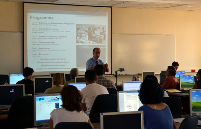
For further information go to the official website for all information, from the breakdown of topics covered to how to submit an abstract.
EEA and EuroGOOS sign partnership agreement
The European Environment Agency (EEA) and the European Global Ocean Observation System (EuroGOOS) signed a partnership agreement on April 10th 2013. This agreement focuses on the issues related to marine in situ data.
This means that they will work together to create a standard way of accessing data that comes from Regional Ocean Observing System (ROOS), a series of national institutions within the EU Member States, and that is currently made available through data portals.
Successful JERICO Summer School in Malta
35 participants attended the first JERICO Summer school organised by the Physical Oceanography Unit of the IOI-Malta Operational Centre at the University of Malta between the 8th and 13th July 2013. The young researchers came from all over Europe, including participants from the southern Mediterranean countries and the Black Sea, and hailed from a variety of disciplines.
The intensive programme on operational oceanography in the 21st century with a focus on the coastal seas featured high level lectures and practical sessions on all aspects revolving around the real-time acquisition and the continuous and sustainable delivery of high quality environmental data and information products related to the marine environment of European coastal seas. Experts discussed data acquisition technology, coastal observatories, data management, numerical modelling techniques, and the delivery of downstrean services. The participants were able to work hands on using software tools and applications; they also had a taste of putting things into practice with a visit to the CALYPSO HF radar installation in Malta.
Prof Aldo Drago from the IOI-Malta Institute together with Dr Jo Foden of CEFAS UK spearheaded this effort, but they were aided by the excellent lecturing team that came from Italy, Ireland, Netherlands, UK, France, Cyprus and of course the great technical and logistics team in Malta headed by Mr. Adam Gauci.
Feedback from all participants – lecturers and students alike – was excellent and this bodes well for the future capacity building endeavours, especially the Master Course in Applied Oceanography (http://www.capemalta.net/msc/applied_oceanography) to be offered by the University of Malta as from next October.
The school has nurtured the sharing of experiences and best practices between the school participants who have vouched to remain in contact after the course in favour of collaborative joint efforts and contributions to the future of operational oceanography.
The school was funded by the FP7 JERICO project and sponsored by the International Ocean Institute and the MyOcean project
D6.3 Milestone20 JericoMaltaSummerSchool Final (3.1 MiB)
M.Sc. in Applied Oceanography – Malta
October 2013 sees the launch of a new challenging M.Sc. course in Applied Oceanography being offered by the Physical Oceanography Unit of the IOI-Malta Operational Centre at the University of Malta.
Prof Aldo Drago – the brains behind this initiative – explained that such a course will provide a new channel for professionals that want to rise to the current challenges being posed in the areas of sustainable development, marine environmental policies, coastal planning and more.
The programme is split into seven distinct study units bringing together legal, socio-economic, scientific and environmental areas together in a coherent way as to give students a holistic approach to the area of applied oceanography. Emphasis will be made on environmental monitoring and surveillance, assessment and mitigation of risks, marine science-based policy development and strategic planning, climate change, sustainable resource exploitation, ocean governance, marine industries and service provision.
This course is ideal for students with a first degree in science, engineering, architecture or computing and also for mid-career professionals already working in this area and wanting to add a new suite of capabilities to their portfolio.
Further information can be obtained from: http://www.capemalta.net/msc/applied_oceanography
The Ecosystem approach and fisheries
The project ‘Ecosystem approach to fisheries’ (2007-2012) developed and tested methods to support the implementation of an ecosystem approach to fisheries, thus contributing to the evidence base that supports the co-ordination and integration of fisheries and environmental management.
The main objectives were to develop and test linked state and pressure indicators focused on the state of seabed habitats, biodiversity and fish communities (food webs). These were identified in an initial assessment as the system components that were most likely to be impacted unsustainably by fishing.
New models were developed, and existing models modified, to predict
- how the intensity and distribution of fishing activity affected biomass and production of seabed habitats,
- how the structure of fish communities and food webs changed with fishing mortality and
- how the biomass and reproductive potential of sensitive fish species changed with fishing mortality.
New methods for describing the intensity and distribution of fishing activity were also developed, based on the analysis of satellite vessel monitoring system data. A model of fishing vessel displacement in response to area closure was developed to assess the effect of closed areas on the distribution of fishing activity and the consequences for seabed habitat.
The project findings suggested that future work should focus on further defining, developing and testing harmonised assessment and management methods to help meet fisheries and environmental objectives and targets in a transparent, consistent and cost-effective way.
References:
http://randd.defra.gov.uk/Document.aspx?Document=10372_M1001FinalReportEvid-4March2012final.pdf
Jerico Summer School – July 2013, Malta
Don’t miss the opportunity to be part of the first JERICO Summer School to be held between 8th to 13th July in the beautiful island of Malta. Organised by the Physical Oceanography Unit of the IOI-Malta Operational Centre at the University of Malta in collaboration with CEFAS (UK), this event is free of charge and open to young researchers and PhD students with a background in oceanography wishing to expand their knowledge and share experiences. The selected participants are expected to cover their travel, accommodation and subsistence costs, but a number of sponsorships are offered to the right applicants.
Focusing on operational oceanography in coastal domains, attendants to this school will have the opportunity to learn about coastal observatories, data management, numerical modeling techniques and applications. The programme includes hands on sessions. A visit to the HF radar site will be organised.
More information on the school can be obtained from www.capemalta.net/jerico/maltaschool.
This summer school is another important effort by the Physical Oceanography institute in Malta to raise the bar in excellence within research areas in data and information products and services related to the marine environment of European coastal and regional seas. It will also serve as precursor to a Masters Course in Applied Oceanography that the institute is launching next October at the University of Malta.
Secure your place now by sending in the application below.
Important data:
Dates: 8-13 July 2013
Price: free of charge
Location: University of Malta
Deadline for applications: 15 April 2013
Malta Summer School Update
The Physical Oceanography Unit of the IOI-Malta Operational Centre at the University of Malta is making the final preparations to hold an international summer course on applied oceanography in the week 8th to 12th July 2013. The planning and coordination of the course is done by Prof. Aldo Drago jointly with the Centre for Environment, Fisheries and Aquaculture Science (CEFAS), and is funded by the FP7 JERICO project with additional support by MyOcean and the International Ocean Institute.
The JERICO Summer School is a quality professional course with 13 high profile foreign lecturers delivering applied and hands-on expertise in operational oceanography with a focus on coastal domains. There was a high demand for the course and a record number of 83 applicants worldwide applied. After a lengthy selection process 35 students have been now confirmed to attend.
Operational oceanography in the coastal seas is the focus of this summer school.
It will deal with technical and theoretical aspects related to metocean observations, operational monitoring platforms, numerical modelling and forecasting, data quality control and management, data assimilation and assessments, data archiving and dissemination. Other aspects include downstream services, applications and links to a wide range of users. The school will provide participants with an overview of coastal observatories and European operational oceanography, now and in the future. Students will be introduced to state-of-the-art methods and tools of operational oceanography across inter-related disciplines from physics to ecology, and over wide geographic scales.
They will experience how this links to data acquisition and forecasting systems, and to managing sustainable development for scientific and socio-economic purposes.
Further information on the JERICO Malta Summer School can be accessed fromwww.capemalta.net/jerico/summerschool
This summer school is a precursor to a Masters Course in Applied Oceanography that the PO-Unit of the University of Malta is launching next October.
European Maritime Day 2013
The 6th edition of the European Maritime Day Conference was held successfully in Valletta, Malta, on May 21 & 22, 2013. It has attracted the attention of the European and the Mediterranean Maritime community with 847 participants who attended the 27 sessions of the Conference. It was organised by the DG for Maritime Affairs and Fisheries of the European Commission in partnership with the Maltese Ministry for the Economy, Investment and Small Business, and the Maltese Ministry for Tourism.
The seas and oceans, and the opportunities they offer, were the focus of the event. There were high-level political debates as well as more practical exchanges between maritime stakeholders. Thoughts, ideas and new concepts have been devised during the Conference.
The main theme of the European Maritime Day 2013 Conference was coastal development and sustainable maritime tourism in the wider context of Blue Growth. It was an occasion to reflect, at high level, on how to make Blue Growth happen through sustainable tourism, connectivity and coastal management. A special focus was made on the Mediterranean Region.
In parallel to the political discussions there were also public events happening throughout the islands of Malta and Gozo with a range of educational and entertaining activities including guided tours of a research vessel, swimming and sea angling competitions, sailing and traditional boat rides and much more.
Further information can be found on the official website: http://www.emd2013.gov.mt/
Operational oceanographic products for Irish marine users.
The Marine Institute (MI) in Ireland has developed a capability in operational oceanography since 2003. This has involved increasing the number of places (stations) where we collect oceanographic data on buoys, coastal piers and ships, developing ocean nowcast and forecast models and using satellite images of ocean colour and temperature to observe changes in the surface of the ocean. With this combination of in-situ observations, model forecasts and satellite images we can look at the past, current and future state of the ocean around Ireland by analysing information on ocean temperature, salinity, currents, waves and several biogeochemical variables including chlorophyll, oxygen and turbidity.
But why do we want to know these things in the first place?
Many marine industries rely on the marine environment to generate employment and income. These include having a basic knowledge of the sea conditions (wave heights, sea state, current strength) for ship routing and marine operations, tracking and successfully targeting marine resources (commercial fish, aggregate extraction, ocean energy) and harvesting resources from the sea (aquaculture). Marine leisure users also make use of “oceanographic products” to plan activities in the sea including marine weather forecasting, sea temperatures, wave and tidal conditions. Finally we need to understand the ocean if we are to maintain our seas at Good Environmental Status and if we are to consider the impacts of climate change on Ireland and its people.
For a snapshot of the products that are routinely produced and made available to marine users, see (http://www.marine.ie/home/services/operational/oceanography/ ). For more information please contact glenn.nolan@marine.ie
Deepwater Horizon, Two Years On
by Jo Foden, Cefas, UK
What are the effects of the Deepwater Horizon oil spill, two years on? For the families of the 11 people who were killed, of course, their tragedy means life will never be the same. What have been the environmental and economic effects of the oil spill?
It’s been bad news for the deep-water coral communities 1.2 km beneath the Gulf’s surface. Corals were found with brown flocculent material and showed signs of tissue damage (Science Daily). It is unusual for such deep-water communities to be affected but this spill occurred at depth.
It’s also been bad news for some fish: a small proportion still show signs of diseases related to petroleum and other pollutants. Those illnesses don’t pose an increased health threat to humans, scientists say, but the problems could be devastating to prized species such as grouper and red snapper. This, then, affects people who make their living catching them.
Whilst the Deepwater Horizon oil spill has undoubtedly caused problems, the one-off event looks modest by comparison to annual pollution from agricultural fertilisers. The chemical pollution derived mostly from fertilisers that run-off into the mouth of the Mississippi Delta into the Gulf of Mexico has created a dead-zone. Exceeding 21,000 km2, it is one of the largest dead zones to be found.
There were initial estimates that 22,000 jobs could be lost (Science Daily) but by February 2012 Louisiana’s unemployment rate recovered, to 7%: similar to the pre-spill rate (The Times-Picayune). So the economic impact has actually turned out to be far less than imagined. The scale of the long-term effects of the Deepwater Horizon oil spill on society and nature has yet to play out but there are plenty of economists and scientists working hard to document every change, so that we can learn lessons and put in safeguards that help us to minimise damaging effects from future incidents.
References:
Deepwater Horizon: fish still getting sick: http://www.3news.co.nz/Deepwater-Horizon-fish-still-getting-sick/tabid/1160/articleID/251122/Default.aspx#ixzz1wSlS3QEX
Louisiana’s economic recovery from BP oil spill has been quicker than expected: http://www.nola.com/news/gulf-oil-spill/index.ssf/2012/04/louisianas_economic_recovery_f.html
JERICO TNA Dissolved Oxygen measurements in the Corsica Channel
The second JERICO TNA experiment (www.jerico-fp7.eu) started on Tuesday November 20th, 2012, with the implementation of automatic Dissolved Oxygen (DO) measurements in the Corsica Channel, Ligurian Sea, Western Mediterranean. The experiment is planned to last for twelve months under the aegis of JERICO TNA and then continue for at least other six months as a collaboration of the Institute of Marine Sciences of the National Research Council of Italy (ISMAR CNR), the Observatoire Oceanographique de Villefranche/Mer of the French National Center for Scientific Research (CNRS/OBS-VLFR) and the Mediterranean Institute of Oceanography (MIO).
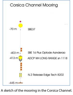
The experiment is part of a research proposed by CNRS/OBS-VLFR (P.I. Dr Laurent Coppola) to the First TNA call of JERICO. The purpose of the research is integrating the dissolved oxygen concentration in the long term time series data in the Ligurian basin to track the water mass variability, the impact of the water mass change on the oxygen content and to estimate the time lag between the eastern and the western part of the Ligurian Sea. The Levantine Intermediate Water (LIW) is the warmest and saltiest water resulting from the dense water formation processes occurring in the Mediterranean Sea. This water mass is formed in the Levantine basin and circulates from the Eastern basin to the Western basin through the Sicilian Strait. In the Northwestern basin, the Corsica Channel is a strategic site where a branch of the LIW is passing through before reaching the DYFAMED site (cyclonic circulation) and the area of dense water formation.
From previous time series data, a time lag has been observed in terms of T-S change in the LIW level. To solve this issue, regular and long term oxygen measurements might give a good opportunity to understand and to estimate accurately this time lag. This also gives the possibility to quantify the variability versus anomalies of the LIW property due to the climate change already observed in the Mediterranean Sea. The DYFAMED site (DYF, 2350 m depth), in the western part, and the CORSICA Channel (CC, 445 m depth), in the eastern part, are permanently monitored since 1988 and 1985 respectively to observe the water masses evolution and more specifically the shift of the LIW properties due to the climate change.
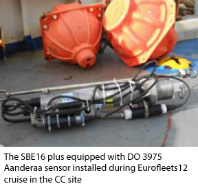
These observations are done through fixed moorings regularly maintained to record temperature, salinity and currents data. Since 2005 and 2009, the CC and DYF moorings are equipped with precise Seabird SBE37 sensors (0.001°C). Both moorings are maintained every year through annual/semiannual scientific cruises in order to collect T-S data, to clean and to calibrate the sensors and to repair the mooring line.
In summer 2012, the DYFAMED mooring located in the Ligurian Sea between Nice and Calvi has been equipped with two DO sensors (optode 4330F) at 400 m and 2000 m depth (MOOSE-GE cruise). The objective of the TNA activity was to complete the oxygen observation in the Ligurian Sea by implementing a DO sensor on the CC mooring at the core of the LIW water mass (400 m depth). This was done during a maintenance cruise (EUROFLEETS12), performed in November 2012 with the research vessel URANIA of CNR, installing an optical dissolved oxygen sensor (OPTODE 3975 Aanderaa) on the underwater station at 400 m depth.
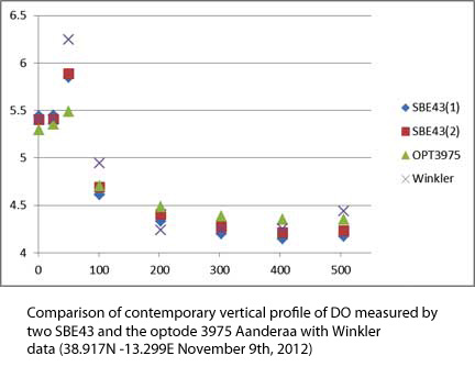
In summer 2013 the underwater station will be maintained again and a second sensor (OPTODE 4330 Aanderaa) will be installed at the same position for simultaneous measurements and comparison.
The Oxygen optode is designed to measure absolute oxygen concentration and % saturation. The optode sensor fits to the long term monitoring, as the data drift is very low and the data accuracy higher than other chemical sensor. The optode 3975 Aanderaa is installed on a SBE16 plus probe equipped with alkaline battery and will record the dissolved oxygen concentration every 30 min. This sensor has been calibrated during the cruise with Winkler titration. The DO sensor will be deployed for 2 periods of 6 months to be consistent with the DYF site (where data are collected every 12 months), and the second period will run together the optode 4330 Aanderaa. The optode 4330 has a time response faster than optode 3975 (less than 25s) with a better accuracy and precision (<8 μmol/l and <1 μmol/l, respectively).
Data will be recovered at each mooring maintenance, when dissolved oxygen concentrations will be also measured by Winkler titration in order to calibrate the automatic DO measurements. This operation is essential in order to check the quality of the DO data acquired by the sensor. After validation, DO data will be analysed along with other parameters measured in the site after each period.
During the cruise, additional measurements were carried out, which will be available for completing the study. Those are physical (CTD stations, vessel mounted ADCP, lowered ADCP profiles) and chemical (dissolved oxygen, dissolved inorganic nutrients) measurements.
References
Millot, C. and Taupier-Letage, I., 2005. Circulation in the Mediterranean Sea. The Handbook ofEnvironmental Chemistry, K, 29 – 66, doi:10.1007/b107143
CC: http://www.jerico-fp7.eu/images/tna/fixed-platforms/fixed_platforms_mplc_cnr.pdf
DYF: http://www.eurosites.info/dyfamed.php
by Katrin Schroeder(1), Laurent Coppola(2), Mireno Borghini(1), Dominique Lefevre(3), Stefania Sparnocchia(1)
(1)ISMAR CNR, (2)Observatoire Oceanographique de Villefranche/Mer, (3)Mediterranean Institute of Oceanography
International Conference on Marine Data and Information Systems
The International Conference on Marine Data and Information Systems of 2013 (IMDIS 2013) will be held in Lucca, Italy on the 23rd till the 25th of September 2013. It aims at providing a general idea of the progresses that have been made in the last years when it comes to the efficient infrastructures for the management of large and various data sets. The sessions will focus on infrastructures, technologies and services for different users: environmental authorities, research, schools, and universities amongst others. The sessions’ topics will be as following:
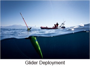
• Session 1 Marine information and data management
• Session 2 Marine environmental data bases
• Session 3 Data Services in ocean science
• Session 4 Services for Users and Education
The Conference is organized by ENEA (Italian National agency for new technologies, Energy and sustainable economic development), together with SeaDataNet, IFREMER and IOC/IODE. Due to other events in Lucca in that period, early reservations are advisable (preferably before April 2013).
For those interested in contributing information, the deadline for the submission of posters and papers is the 30th of April 2013. On the other hand for registration or further information access the official website; http://imdis2013.seadatanet.org/ or send an email on imdis2013@enea.it
References:
http://imdis2013.seadatanet.org/
http://www.pegasoproject.eu/
Jerico TNA First Glider Mission
- October 23rd, 2012: JERICO TNA first glider mission started in the Balearic Sea.
- October 30rd, 2012: Mission temporary suspended due to battery problems; glider safely recovered 45 miles East of Menorca. The mission will re-start as soon as possible.
- January 31st, 2013: Mission re-started. SOCIB’s Seaglider sdeep03 is now heading to Oristano (Sardinia, Italy).
The first experiment under JERICO (http://www.jerico-fp7.eu/) TNA started on Tuesday October 23rd, 2012, with a deep glider mission from Minorca to Sardinia in the Western Mediterranean Sea. The mission is planned to end on December 10th, 2012.
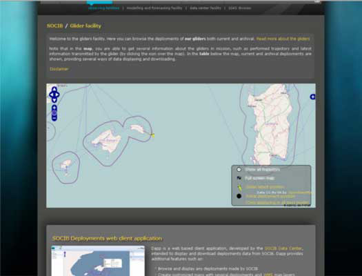
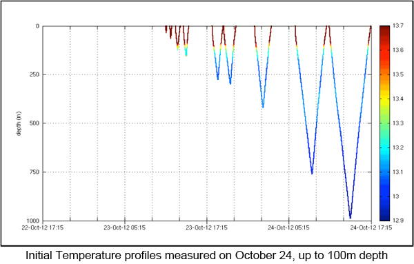
The glider is part of the fleet operated by the Balearic Islands Coastal Observing and Forecasting System (SOCIB) and CSIC-IMEDEA (Spain). The glider will follow a route from the East of Minorca to Sardinia along the latitude 39º 49.457’ N and will return to Menorca and Mallorca./p>
During approximately 49 days, the glider will cover a distance of about 380 Km in both directions, acquiring profiles of oceanographic data from the surface to about 1000 m. The glider is equipped with CTD (conductivity, temperature and pressure), oxygen, fluorescence and turbidity sensors.
Data measured will be transmitted through Iridium to verify sensors, sampling and navigation behaviour of the glider. Real time data transmission will be done at least every day (approximately 1 dive transmitted every 4 dives performed) to minimize communication costs and surface time (increasing platform safety). All data will be downloaded by cable once mission ends (delay mode).
The glider track can be followed and is continuously updated using SOCIB Data Centre glider tools (http://www.socib.es/?seccion=observingFacilities&facility=glider and http://apps.socib.es/dapp/).
In accordance with the European glider workshop (JERICO/GROOM/EGO) hosted in Mallorca 22-23 May 2012, the real-time tracking data from gliders is available in a standard format, following international conventions (NetCDF) at the SOCIB Thredds discovery catalog (http://thredds.socib.es/thredds/catalog.html). Also the real time mission data is automatically uploaded to the EGO network (Everyone’s Gliding Observatory) for international data share and public access. The scientific data transmitted can be visualized at the EGO web page http://www.ego-network.org/dokuwiki/doku.php?gId=2045.
The mission is part of a research proposed by CNR IAMC in Oristano (P.I. Mr Alberto Ribotti) to the First TNA call of JERICO.
The central part of the Algero-Provencal sub-basin, where the glider mission is going on, is a buffer area between the northern Provencal sub-basin and the southern Algerian one, and is mainly characterized by the presence and action of the Balearic Front (interactions between more recent MAW and MW).
The purpose of the research is contributing to understand exchanges through the two sub-basins and the complex interactions through eddies. The area of work covers a transect between Balearic Islands and Oristano (Sardinia) that the Group in Oristano, in collaboration with the Institute of Marine Sciences of CNR in La Spezia, is annually repeating with CTD and current-meter casts for the last ten years during oceanographic cruises to study the inter-annual variability of physical and biochemical properties of water masses and understand the circulation, the exchanges through the sub-basins and the transport of salt and heat in the western Mediterranean.
In particular, the proposed research wants to identify the physical properties of the surface and intermediate water masses between Baleares and Sardinia with the aim of:
i) study the variability of the physical properties of surface and intermediate water masses between the Algerian and the Provencal sub-basins;
ii) evaluate the transport of water, salt and heat through the area and verify if the interannual variability of the surface and intermediate water masses is due to climatic changes;
iii) validate the operational hydrodynamic numerical model of the western Mediterranean (http://www.seaforecast.cnr.it/en/fl/wmed.php) through the use of in-situ and satellite data.
by Simó Cusí(1), Alberto Ribotti(2), Antonio Olita(2), Miguel Martínez Ledesma(3), Simón Ruiz(3), Joaquin Tintore(1,3), Stefania Sparnocchia(4)
(1)SOCIB; (2)IAMC CNR; (3)IMEDEA CSIC – UIB; (4)ISMAR CNR;
Android Mobile App for Sea Pollution
A new app for Android phones and tablets is opening up the notification of oil spills and sea pollution to the wider general public. The ‘ARGO Sentinel’ app allows users to notify an incident, follow what is happening and see other volunteers. It also links directly into Twitter and Facebook for updates thus unleashing the power of social networking into the arena of environmental monitoring.
The app has been designed by the National Institute for Research (CNR) in Pisa, Italy, and is funded thanks to an EU project. The alerts generated by it are sent to the closest monitoring outpost. Alarms can be classified as Urgent if immediate response is required, and thanks to the GPS tracking facility embedded in most smartphones and tablets today, the app will send the exact co-ordinates of where the issue is.
The app can be found and downloaded from GooglePlay. iPhone and iPad versions are in the pipeline and should be out soon.
MEDESS-4MS: A Mediterranean project tackling oil spill emergencies in the Mediterranean Sea
Although the Mediterranean Sea makes up less than 1% of the global marine surface, it sees 20% of the global tank ship maritime traffic. This traffic inevitably means numerous cases of oil pollution at sea, sometimes severe, not to mention pipeline or oil terminal accidents (EEA, 2006). The well-documented events of Prestige in 2002 and BP Deepwater Horizon in 2010 have widely and conclusively demonstrated that an efficient forecasting system is necessary in order to manage similar emergency situations.
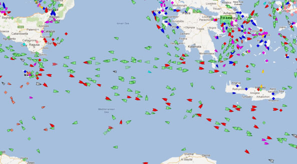
The Mediterranean project MEDESS-4MS (Mediterranean Decision Support System for Marine Safety; www.medess4ms.eu) is co-financed by the European Regional Development Fund (ERDF) through the MED Programme for the period 2012-2015. In this project, the Department of Merchant Shipping (DMS) of Cyprus coordinates the activities of 20 partners from 7 Mediterranean countries plus REMPEC, among which the Italian Coast Guard (ITCG), the National Research Council (CNR) of Italy, and the International Ocean Institute – Malta Operational Center (IOI-MOC) at the University of Malta.
The main service delivered by MEDESS-4MS will be an integrated real time operational oil spill forecasting service for the Mediterranean for the national response agencies REMPEC and EMSA. The multi-model oil spill forecasting system is composed of environmental information from the GMES Marine Service and the national ocean forecasting systems interfaced with oil slick data from existing monitoring platforms from EMSA CSN, as well with AIS data. It will use real-time information about oil slick positioning and interface it with oil spill models which are capable of forecasting the movement of the pollution, thus providing tailored products to oil spill crisis management users. This will contribute substantially to maritime risks prevention and maritime safety.
The service will be accessible through a User Interface which will be made up of a web portal on which the MEDESS-4MS services will be made available. The system will be capable of being accessed by different user categories and will thus implement authentication services, profiling, management of customized contents and centralized administration.
Users will have the possibility of choosing the MEDESS-4MS oil spill model that best satisfies their local or sub-regional needs, and of selecting the necessary forcing data from the output of local, sub-regional and regional ocean and meteorological forecasting systems.
MEDESS-4MS Service Scenarios
The MEDESS-4MS services will be delivered through 3 service scenarios (SS), in order to assist operational response agencies:
SS1- Real time interactive oil spill predictions by the end-user request. An automatic system that will run after an oil spill alert from satellite data. This scenario will be used by selected authorized users (i.e. official agencies of Member States).
SS2-Delayed mode simulations by end-user request. In this solution, intended for the use of REMPEC and generic users, the UI provides the means to access the monitoring component, environmental data and model outputs and to receive integrated remote/in-situ data. The user will query the NDR Service to consult historical data for study or statistical purposes, and possibly query the NDR to back-trace data with the aim of identifying possible polluting ships.
SS3-Decision support system (DSS) to manage emergency operations. The services will consist of a DSS that will be an operational tool proposing a set of possible scenarios to the users, developed according to the foreseeable meteo-marine conditions and the possible on-site interventions. The DSS will then be used for oil spill crisis management and will be built upon a set of simulation functionality, launched by the UI to support the work of operational decision makers. This last SS also includes the work dedicated specifically to supporting REMPEC.
Partners have established the Emergency Response Office (ERO) to serve as the coordinating body for the MOON ERO experts who provide oil spill monitoring and forecasting bulletins, including meteo-oceanographic forecasts, to REMPEC to support it in emergencies operations management. The ERO system will be developed further in MEDESS4-MS and the ERO bulletin maker user-interface will be created to allow the system to automatically produce the ERO bulletin based on the input of the ERO experts.
References and links
EEA (European Environment Agency): Priority issues in the Mediterranean environment, EEA Report no. 4, 88 pp., 2006.
MEDESS-4MS site: http://www.medess4ms.eu